Glendene, New Zealand facts for kids
Quick facts for kids Glendene |
|
|---|---|
 |
|
| Basic information | |
| Local authority | Auckland |
| Electoral ward |
|
| Local board |
|
| Land area | 251 ha (0.97 sq mi)* |
| Coordinates | 36°53′22″S 174°39′13″E / 36.88944°S 174.65361°E |
| Population | 8130 (June 2023) |
| Postcode(s) | 0602 |
|
|
||
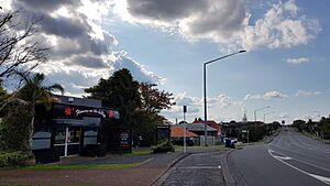
Glendene is a suburb located in West Auckland, New Zealand. It is managed by the Auckland Council.
Glendene is mostly a place where people live, with homes making up most of the area. The north-eastern part has some light industries, like small factories or workshops.
Contents
The Story of Glendene
Glendene got its name from a farm owned by Percy Jones. This farm was later divided into smaller pieces of land for building houses.
Long ago, in the late 1800s and early 1900s, the western side of the Whau River was busy. Many places there made things from clay, like pottery. These included yards run by families like Malam, Laurie, Black & Scott, and Hepburn. Most of the houses in Glendene were built in the 1960s and 1970s.
In April 2014, Glendene became part of a new voting area called the Kelston electorate. This means people in Glendene vote for a representative in the New Zealand Parliament as part of the Kelston area.
The Glendene Community Hub opened in March 2015. It was created because studies showed that the area needed more community activities and support.
Who Lives in Glendene?
Glendene covers about 2.51 square kilometers. As of June 2023, about 8130 people live here.
The population of Glendene has been growing. In the 2023 New Zealand census, 7,719 people lived here. This was an increase of 156 people since the 2018 census. It was also 798 more people than in the 2013 census.
There are slightly more males than females living in Glendene. The average age of people in Glendene is 35.5 years old. About 19.4% of the people are under 15 years old. Also, 21.1% are aged 15 to 29.
Different Backgrounds in Glendene
People in Glendene come from many different backgrounds. About 37.9% are European (also called Pākehā). Around 15.0% are Māori, and 28.2% are Pasifika. A significant number, 33.1%, are Asian. There are also people from the Middle East, Latin America, and Africa.
Most people in Glendene speak English (92.7%). Other languages are also common. For example, 3.6% speak the Māori language, and 8.6% speak Samoan. Many other languages are spoken too.
Beliefs and Work in Glendene
Many people in Glendene follow a religion. About 39.6% are Christian. Other religions include Hindu (8.7%) and Islam (5.1%). Some people also follow Māori religious beliefs or Buddhism. About 34.2% of people said they had no religion.
When it comes to education, 22.3% of adults have a university degree or higher. Many people (47.4%) have a certificate or diploma from after high school. About 53.2% of adults work full-time.
Schools in Glendene
Glendene has its own primary school for younger students.
Glendene School
Glendene School opened in 1965. It teaches children from Year 1 to Year 6. Boys and girls both attend this school. As of February 2024. , the school has 120 students.
Nearby High Schools
For older students, there are several high schools close to Glendene. These include Henderson High School, Kelston Boys' High School, and Kelston Girls' College. There are also private schools like Liston College and St Dominic's College.
 | Kyle Baker |
 | Joseph Yoakum |
 | Laura Wheeler Waring |
 | Henry Ossawa Tanner |

