
Goieşti facts for kids
Quick facts for kids
Goiești
|
|
|---|---|
 |
|

Goiești
Location in Romania
|
|
| Country | |
| County | |
| Historical Region | Oltenia |
| Area | |
| • Total | 78.49 km2 (30.31 sq mi) |
| Elevation | 126 m (413 ft) |
| Population
(2011)
|
|
| • Total | 3,113 |
| • Density | 39.661/km2 (102.722/sq mi) |
| Time zone | UTC+02:00 (EET) |
| • Summer (DST) | UTC+03:00 (EEST) |
| Geocode | 676992 |
Goiești is a special type of local area called a commune in Romania. It is located in Dolj County, which is part of the larger Oltenia region in the southwestern part of the country.
Contents
What is a Commune?
A commune is like a small local government area in Romania. It usually includes a main village and several smaller villages nearby. Think of it as a group of villages that work together and share services.
Goiești's Location
Goiești is found in Dolj County, which is in the southwestern part of Romania. This county is known for its flat lands and rivers. The commune is also part of the Oltenia historical region. This region has a long history and unique traditions.
Where is Goiești on the Map?
Goiești is located at about 44.48 degrees North and 23.75 degrees East. This means it's in the northern hemisphere, not too far from the center of Romania. Its elevation is around 126 meters (about 413 feet) above sea level.
People and Leadership
In 2011, about 3,113 people lived in Goiești. This number helps us understand how many people call this commune home.
Who is the Mayor?
The leader of a commune is called a mayor. The mayor helps manage the commune and makes decisions for the people living there. As of 2004, the mayor of Goiești was Atanasie Adam.
Time Zone
Goiești follows Eastern European Time (EET). This means it is two hours ahead of Coordinated Universal Time (UTC+02:00). During the summer, they switch to Eastern European Summer Time (EEST), which is three hours ahead of UTC (UTC+03:00). This is similar to how many countries use daylight saving time.
Images for kids
-
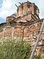
A church in Gruița, part of Goiești commune.
