
Green Bay, New Zealand facts for kids
Quick facts for kids
Green Bay
|
|
|---|---|
|
Suburb
|
|

Barron Green and Green Bay village
|
|

Green Bay
Location in New Zealand
|
|
| Country | New Zealand |
| Local authority | Auckland |
| Electoral ward | Whau ward |
| Local board | Whau Local Board |
| Area | |
| • Land | 229 ha (566 acre) |
| Population
(June 2023)
|
|
| • Total | 4,900 |
|
|
||
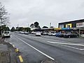
Green Bay is a lovely suburb located in West Auckland, New Zealand. It's looked after by the Auckland Council. The main road that goes through Green Bay is Godley Road, which is also called Urban Route 15. This road continues all the way to Titirangi and Laingholm.
Green Bay beach is a special part of the Karaka Park coastal walk. Long ago, before Europeans arrived, this beach was the southern end of a very important path called Te Toanga Waka. This path helped connect the Waitematā and Manukau harbours. At the west end of the beach, there used to be a large Māori pā (a fortified village) at Motukaraka, which is now Karaka Park. The area was first called Karaka Bay, but its name was changed to Green Bay to avoid confusion with other bays that also had the name Karaka.
New Zealand’s biggest wild bird hospital and rescue centre, BirdCare Aotearoa, is based in Green Bay. This amazing centre helps more than 6,000 sick or injured birds every year.
Contents
Discovering Green Bay's Population
Green Bay covers an area of about 2.29 square kilometres. As of June 2023, around 4900 people live here. This means there are about 2140 people living in each square kilometre.
How Green Bay's Population Has Grown
The number of people living in Green Bay has slowly increased over the years.
| Historical population | ||
|---|---|---|
| Year | Pop. | ±% p.a. |
| 2006 | 4,350 | — |
| 2013 | 4,596 | +0.79% |
| 2018 | 4,788 | +0.82% |
In the 2018 New Zealand census, Green Bay had 4,788 residents. This was an increase of 192 people since the 2013 census. It was also 438 more people than in the 2006 census.
Who Lives in Green Bay?
In 2018, there were 1,833 homes in Green Bay. There were more females (2,535) than males (2,253). About 879 people, or 18.4% of the population, were under 15 years old. This shows that Green Bay is home to many families and young people.
Green Bay is a diverse place with people from many backgrounds. About 74.9% of residents were European or Pākehā. Around 8.1% were Māori, and 7.5% were Pacific peoples. About 19.0% of residents were Asian, and 2.8% belonged to other ethnic groups. Many people in Green Bay were born overseas, making up 31.9% of the population. This is higher than the national average of 27.1%.
People in Green Bay have different beliefs. About 47.0% said they had no religion. Around 37.8% were Christian. Other religions like Hindu (4.1%), Muslim (2.0%), and Buddhist (0.7%) were also present.
Many adults in Green Bay have completed higher education. About 25.2% of people aged 15 or older had a bachelor's degree or higher. Most adults were employed, with 45.9% working full-time and 12.6% working part-time.
Learning in Green Bay
Green Bay has excellent schools for students of different ages. Both schools are located next to each other on Godley Road.
Green Bay High School
Green Bay High School is a secondary school for students in years 9 to 13. It opened in 1973. The school has a roll of 1,329 students. It is a coeducational school, meaning both boys and girls attend.
Green Bay Primary School
Green Bay Primary School is a full primary school. It teaches students from years 1 to 8. The school opened in 1960. It originally taught years 1 to 6, but an intermediate department was added in 1997. The school has a roll of 641 students. It is also a coeducational school.
Images for kids
-
Green Bay shops

