Gurneyville, Ohio facts for kids
Quick facts for kids
Gurneyville, Ohio
|
|
|---|---|

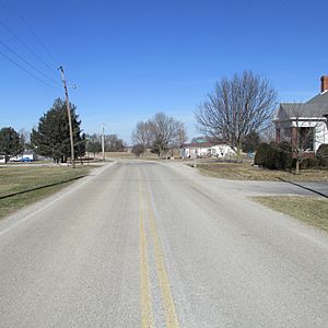
Looking northwest at the intersection of Gurneyville Road and West Mt. Pleasant/New Oglesbee roads in Gurneyville
|
|
| Country | United States |
| State | Ohio |
| County | Clinton |
| Elevation | 1,056 ft (322 m) |
| Time zone | UTC-5 (Eastern (EST)) |
| • Summer (DST) | UTC-4 (EDT) |
| Area code(s) | 937, 326 |
| GNIS feature ID | 1064777 |
Gurneyville (sometimes spelled Guerneyville) is a small community located in Clinton County, Ohio, in the United States. It is an "unincorporated community," which means it doesn't have its own separate local government like a city or town. Instead, it's part of the larger county area.
Gurneyville's History
Gurneyville was officially planned out and marked on maps in 1847. This process is called "platting." The community was named after Joseph John Gurney. He was an important local member of the Quakers, a religious group known for their peaceful beliefs.
Later, in 1875, a post office opened in Gurneyville. This allowed people in the community to send and receive mail. The post office served the area for about 30 years, closing its doors in 1905.
Famous People from Gurneyville
One notable person connected to Gurneyville is Francis A. Wallar. He was a recipient of the Medal of Honor. The Medal of Honor is the highest military award given by the United States government for bravery in combat.
 | Toni Morrison |
 | Barack Obama |
 | Martin Luther King Jr. |
 | Ralph Bunche |


