Güssing District facts for kids
Quick facts for kids
Güssing District
Bezirk Güssing
|
|
|---|---|
 |
|
| Country | Austria |
| State | Burgenland |
| Number of municipalities | 28 |
| Area | |
| • Total | 486.71 km2 (187.92 sq mi) |
| Population
(2012)
|
|
| • Total | 26,636 |
| • Density | 54.7266/km2 (141.741/sq mi) |
| Time zone | UTC+01:00 (CET) |
| • Summer (DST) | UTC+02:00 (CEST) |
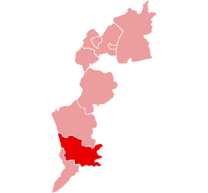
Güssing is a district located in Burgenland, a state in Austria. A district is like a region or an area that has its own local government. The main town, or administrative center, of this district is also called Güssing.
Before 1921, the Güssing district was part of Hungary. After that year, it became part of Austria.
About Güssing District
The Güssing district covers an area of about 486.71 square kilometers. This is roughly the size of 48,671 football fields. In 2012, about 26,636 people lived in the district.
The district is located in the southeastern part of Burgenland. It is known for its beautiful countryside. The area has many small hills and forests.
Towns and Villages
The Güssing district is made up of 28 different towns and villages. These are called municipalities. Each municipality has its own local government. They work together to manage the district.
Here are the municipalities in the district, with their populations from 2012:
- Bildein (361 people)
- Bocksdorf (800 people)
- Burgauberg-Neudauberg (1,375 people)
- Eberau (1,004 people)
- Gerersdorf-Sulz (1,044 people)
- Großmürbisch (262 people)
- Güssing (3,798 people)
- Güttenbach (938 people)
- Hackerberg (363 people)
- Heiligenbrunn (837 people)
- Heugraben (222 people)
- Inzenhof (328 people)
- Kleinmürbisch (250 people)
- Kukmirn (2,011 people)
- Moschendorf (407 people)
- Neuberg im Burgenland (1,020 people)
- Neustift bei Güssing (507 people)
- Olbendorf (1,408 people)
- Ollersdorf im Burgenland (975 people)
- Rauchwart (458 people)
- Rohr im Burgenland (382 people)
- Sankt Michael im Burgenland (1,018 people)
- Stegersbach (2,558 people)
- Stinatz (1,412 people)
- Strem (928 people)
- Tobaj (1,393 people)
- Tschanigraben (72 people)
- Wörterberg (505 people)
See also
 In Spanish: Distrito de Güssing para niños

