Hāʻena, Kauai County, Hawaii facts for kids
Quick facts for kids
Hāʻena, Hawaii
|
|
|---|---|
| Country | United States |
| State | Hawaii |
| County | Kauai |
| Area | |
| • Total | 1.453 sq mi (3.76 km2) |
| • Land | 1.453 sq mi (3.76 km2) |
| • Water | 0 sq mi (0 km2) |
| Elevation | 23 ft (7 m) |
| Population
(2020)
|
|
| • Total | 550 |
| • Density | 379/sq mi (146.2/km2) |
| Time zone | UTC-10 (Hawaii-Aleutian) |
| Area code(s) | 808 |
| GNIS feature ID | 365072 |
Hāʻena is a small, special community located on the beautiful island of Kauai in Hawaii, United States. It's not a big city, but a quiet place where people live. In 2020, about 550 people called Hāʻena home. You can find this community on the north side of the island, right along Hawaii Route 560.
What is Hāʻena?
Hāʻena is known as an "unincorporated community" and a "census-designated place." This means it's a group of homes and businesses that isn't officially a town or city with its own local government. Instead, it's part of the larger Kauai County. A "census-designated place" is simply an area that the government counts for population statistics.
Where is Hāʻena Located?
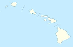
Hāʻena is nestled on the northern coast of Kauai, which is one of the main islands of Hawaii. It's located at specific coordinates: 22.2213479 degrees North and 159.5612936 degrees West. This helps pinpoint its exact spot on a map.
The community covers a small area, about 1.453 square miles (or 3.76 square kilometers). All of this area is land, meaning there are no large bodies of water like lakes or big rivers within its boundaries.
 | Ernest Everett Just |
 | Mary Jackson |
 | Emmett Chappelle |
 | Marie Maynard Daly |


