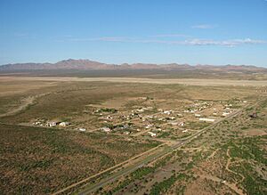
Hachita, New Mexico facts for kids
Quick facts for kids
Hachita, New Mexico
|
|
|---|---|

Hachita
|
|
| Country | United States |
| State | New Mexico |
| County | Grant |
| Area | |
| • Total | 0.44 sq mi (1.15 km2) |
| • Land | 0.44 sq mi (1.15 km2) |
| • Water | 0.00 sq mi (0.00 km2) |
| Elevation | 4,511 ft (1,375 m) |
| Population
(2020)
|
|
| • Total | 52 |
| • Density | 117.38/sq mi (45.30/km2) |
| Time zone | UTC-7 (Mountain (MST)) |
| • Summer (DST) | UTC-6 (MDT) |
| ZIP code |
88040
|
| Area code(s) | 575 |
| GNIS feature ID | 2584106 |
Hachita is a small community in Grant County, New Mexico, United States. It is known as a "census-designated place." This means it's an area that the government defines for counting people, even if it's not a formally organized town.
In 2020, only 52 people lived in Hachita. The community has its own post office, and its ZIP code is 88040. Several important roads, like New Mexico State Road 9, New Mexico State Road 81, and New Mexico State Road 146, pass through Hachita. A few miles to the west, you can find the ghost town of Old Hachita.
Contents
About Hachita
Hachita is located in the southwestern part of New Mexico. It sits in a desert area. The community is quite small and quiet. It serves as a local point for people living in the surrounding rural areas.
What is a Census-Designated Place?
A census-designated place, or CDP, is a special type of area. It is defined by the United States Census Bureau. CDPs are like towns or villages, but they don't have their own local government. They are created just for gathering population data. This helps us understand how many people live in different parts of the country.
Roads and Location
Hachita is connected by several state roads. These roads help people travel to and from the community. They link Hachita to other towns and cities in New Mexico. The area around Hachita is mostly open land.
Population and History
The number of people living in Hachita has changed over time. The United States Census counts everyone in the country every ten years. This helps us see how communities grow or shrink.
Population Count
| Historical population | |||
|---|---|---|---|
| Census | Pop. | %± | |
| 2020 | 52 | — | |
| U.S. Decennial Census | |||
The most recent count in 2020 showed 52 people living in Hachita. In 2010, the population was 49. This means the number of residents has stayed quite small.
Old Hachita: A Ghost Town
A few miles west of the current Hachita is a place called Old Hachita. This is a "ghost town." A ghost town is a place where most or all of the people have left. Often, these towns were once busy, perhaps because of mining or railroads. When the main activity ended, people moved away. Old Hachita is a reminder of the past.
See also
 In Spanish: Hachita (Nuevo México) para niños
 | John T. Biggers |
 | Thomas Blackshear |
 | Mark Bradford |
 | Beverly Buchanan |


