Grant County, New Mexico facts for kids
Quick facts for kids
Grant County
|
|
|---|---|
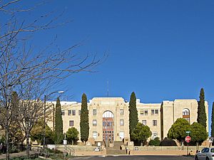
Grant County Courthouse in Silver City
|
|
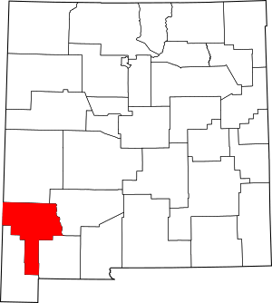
Location within the U.S. state of New Mexico
|
|
 New Mexico's location within the U.S. |
|
| Country | |
| State | |
| Founded | 1868 |
| Named for | Ulysses S. Grant |
| Seat | Silver City |
| Largest town | Silver City |
| Area | |
| • Total | 3,968 sq mi (10,280 km2) |
| • Land | 3,962 sq mi (10,260 km2) |
| • Water | 5.9 sq mi (15 km2) 0.1%% |
| Population
(2020)
|
|
| • Total | 28,185 |
| • Estimate
(2021)
|
27,889 |
| • Density | 7.1031/sq mi (2.7425/km2) |
| Time zone | UTC−7 (Mountain) |
| • Summer (DST) | UTC−6 (MDT) |
| Congressional district | 2nd |
Grant County is a special area in the state of New Mexico, USA. It's like a big district with its own local government. In 2020, about 28,185 people lived here. The main town and government center is Silver City. Grant County was created in 1868 and got its name from Ulysses S. Grant, who was the 18th President of the United States.
Contents
Geography of Grant County
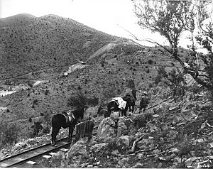
Grant County is quite large! It covers a total area of about 3,968 square miles. Most of this area, about 3,962 square miles, is land. The rest, a small part of 5.9 square miles, is water.
Neighboring Areas
Grant County shares its borders with several other counties:
- To the north: Catron County
- To the east: Sierra County
- To the southeast: Luna County
- To the south: Hidalgo County
- To the west: Greenlee County, Arizona (which is in a different state!)
Protected Nature Areas
A big part of the Gila National Forest is located within Grant County. This is a special area protected for its natural beauty and wildlife.
People of Grant County
| Historical population | |||
|---|---|---|---|
| Census | Pop. | %± | |
| 1870 | 1,143 | — | |
| 1880 | 4,539 | 297.1% | |
| 1890 | 9,657 | 112.8% | |
| 1900 | 12,883 | 33.4% | |
| 1910 | 14,813 | 15.0% | |
| 1920 | 21,939 | 48.1% | |
| 1930 | 19,050 | −13.2% | |
| 1940 | 20,050 | 5.2% | |
| 1950 | 21,649 | 8.0% | |
| 1960 | 18,700 | −13.6% | |
| 1970 | 22,030 | 17.8% | |
| 1980 | 26,204 | 18.9% | |
| 1990 | 27,676 | 5.6% | |
| 2000 | 31,002 | 12.0% | |
| 2010 | 29,514 | −4.8% | |
| 2020 | 28,185 | −4.5% | |
| 2021 (est.) | 27,889 | −5.5% | |
| U.S. Decennial Census 1790-1960 1900-1990 1990-2000 2010-2016 |
|||
The population of Grant County has changed over many years. In 2010, there were about 29,514 people living here. By 2020, the population was 28,185. This means there are about 7 people living in each square mile.
Many different groups of people live in Grant County, making it a diverse place. In 2010, about 48.3% of the people were of Hispanic or Latino background. People also reported having English, German, or Irish family roots.
Towns and Villages
Grant County has several communities, from small villages to larger towns.
City
Towns
- Hurley
- Silver City (This is the main town where the county government is located.)
Village
Other Communities
There are also many smaller communities, some of which are called "census-designated places" because they are recognized for population counting.
- Arenas Valley
- Buckhorn
- Casas Adobes
- Cliff
- Cobre
- Faywood
- Gila
- Gila Hot Springs
- Hachita
- Hanover
- Lake Roberts
- Lake Roberts Heights
- Little Walnut Village
- Mimbres
- North Hurley
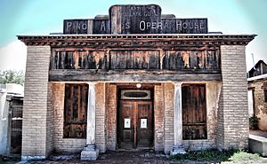
- Pinos Altos
- Redrock
- Rosedale
- San Lorenzo
- Trout Valley
- Tyrone
- White Signal
There are also other small, unincorporated communities that are not officially cities, towns, or villages:
- Carpenter
- Dwyer
- Fort Bayard
- Mangas Springs
- Mimbres Valley
- Mule Creek
- Riverside
- Separ
- Sherman
See also
 In Spanish: Condado de Grant (Nuevo México) para niños
 | Janet Taylor Pickett |
 | Synthia Saint James |
 | Howardena Pindell |
 | Faith Ringgold |

