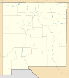
Redrock, New Mexico facts for kids
Quick facts for kids
Redrock, New Mexico
|
|
|---|---|
| Country | United States |
| State | New Mexico |
| County | Grant |
| Area | |
| • Total | 0.60 sq mi (1.55 km2) |
| • Land | 0.60 sq mi (1.55 km2) |
| • Water | 0.00 sq mi (0.00 km2) |
| Elevation | 4,029 ft (1,228 m) |
| Population
(2020)
|
|
| • Total | 3 |
| • Density | 5.00/sq mi (1.93/km2) |
| Time zone | UTC-7 (Mountain (MST)) |
| • Summer (DST) | UTC-6 (MDT) |
| ZIP codes |
88055
|
| Area code(s) | 575 |
| GNIS feature ID | 2806705 |
Redrock is a very small place in Grant County, New Mexico, United States. It's called an "unincorporated community" because it doesn't have its own local government like a city or town. It's also a "census-designated place," which means the government counts the people living there for official records. Redrock is located right by the Gila River and New Mexico State Road 464. It's about 27 miles (44 km) west-southwest of Silver City.
People Living in Redrock
When we talk about "demographics," we're looking at information about the people who live in a place. This includes things like how many people there are.
| Historical population | |||
|---|---|---|---|
| Census | Pop. | %± | |
| 2020 | 3 | — | |
| U.S. Decennial Census | |||
According to the 2020 United States Census, only 3 people lived in Redrock. This makes it one of the smallest communities in New Mexico!
Redrock's Weather
Redrock has a type of weather called a cool semi-arid climate. This means it's generally dry, but not as dry as a desert. The summers in Redrock are usually hot, while the winters are mild, meaning they aren't too cold.
| Climate data for Redrock, New Mexico (1991–2020 normals, extremes 1958–present) | |||||||||||||
|---|---|---|---|---|---|---|---|---|---|---|---|---|---|
| Month | Jan | Feb | Mar | Apr | May | Jun | Jul | Aug | Sep | Oct | Nov | Dec | Year |
| Record high °F (°C) | 79 (26) |
82 (28) |
89 (32) |
95 (35) |
103 (39) |
110 (43) |
109 (43) |
106 (41) |
103 (39) |
96 (36) |
86 (30) |
76 (24) |
110 (43) |
| Mean maximum °F (°C) | 68.5 (20.3) |
73.8 (23.2) |
81.1 (27.3) |
87.1 (30.6) |
95.1 (35.1) |
102.2 (39.0) |
102.0 (38.9) |
98.4 (36.9) |
95.2 (35.1) |
88.6 (31.4) |
78.7 (25.9) |
69.3 (20.7) |
103.8 (39.9) |
| Mean daily maximum °F (°C) | 59.7 (15.4) |
64.3 (17.9) |
71.1 (21.7) |
78.6 (25.9) |
86.5 (30.3) |
95.6 (35.3) |
95.0 (35.0) |
92.6 (33.7) |
88.2 (31.2) |
79.3 (26.3) |
68.1 (20.1) |
58.9 (14.9) |
78.2 (25.7) |
| Daily mean °F (°C) | 42.1 (5.6) |
46.0 (7.8) |
51.6 (10.9) |
57.4 (14.1) |
65.1 (18.4) |
74.4 (23.6) |
79.0 (26.1) |
77.8 (25.4) |
71.8 (22.1) |
60.7 (15.9) |
49.5 (9.7) |
41.9 (5.5) |
59.8 (15.4) |
| Mean daily minimum °F (°C) | 24.5 (−4.2) |
27.8 (−2.3) |
32.1 (0.1) |
36.3 (2.4) |
43.8 (6.6) |
53.2 (11.8) |
63.1 (17.3) |
62.9 (17.2) |
55.4 (13.0) |
42.1 (5.6) |
30.9 (−0.6) |
24.9 (−3.9) |
41.4 (5.2) |
| Mean minimum °F (°C) | 13.2 (−10.4) |
16.8 (−8.4) |
21.0 (−6.1) |
26.4 (−3.1) |
33.1 (0.6) |
42.4 (5.8) |
53.6 (12.0) |
55.0 (12.8) |
44.4 (6.9) |
28.3 (−2.1) |
18.1 (−7.7) |
13.3 (−10.4) |
10.5 (−11.9) |
| Record low °F (°C) | 0 (−18) |
−1 (−18) |
10 (−12) |
20 (−7) |
24 (−4) |
— | 44 (7) |
45 (7) |
31 (−1) |
13 (−11) |
8 (−13) |
−3 (−19) |
−3 (−19) |
| Average precipitation inches (mm) | 0.99 (25) |
0.81 (21) |
0.57 (14) |
0.21 (5.3) |
0.42 (11) |
0.43 (11) |
2.61 (66) |
2.08 (53) |
1.68 (43) |
0.97 (25) |
0.68 (17) |
1.09 (28) |
12.54 (319) |
| Average snowfall inches (cm) | 0.5 (1.3) |
0.0 (0.0) |
0.0 (0.0) |
0.0 (0.0) |
0.0 (0.0) |
0.0 (0.0) |
0.0 (0.0) |
0.0 (0.0) |
0.0 (0.0) |
0.0 (0.0) |
0.0 (0.0) |
0.5 (1.3) |
1.0 (2.5) |
| Average precipitation days (≥ 0.01 inch) | 5.2 | 5.3 | 3.4 | 1.7 | 2.5 | 3.5 | 10.8 | 10.4 | 7.1 | 4.2 | 3.4 | 5.3 | 62.8 |
| Average snowy days (≥ 0.1 in) | 0.3 | 0.0 | 0.0 | 0.0 | 0.0 | 0.0 | 0.0 | 0.0 | 0.0 | 0.0 | 0.0 | 0.3 | 0.6 |
| Source: NOAA | |||||||||||||
 | James Van Der Zee |
 | Alma Thomas |
 | Ellis Wilson |
 | Margaret Taylor-Burroughs |


