Silver City, New Mexico facts for kids
Quick facts for kids
Silver City, New Mexico
|
||
|---|---|---|
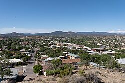
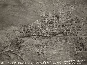
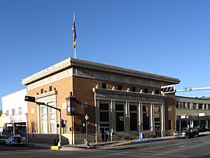
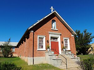
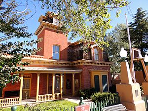
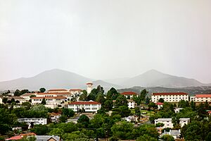
Downtown and the surrounding area as viewed from La Capilla Heritage Park
|
||
|
||
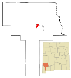
Location in the State of New Mexico
|
||
| Country | ||
| State | ||
| County | Grant | |
| Incorporated | January 14, 1876 | |
| Government | ||
| • Type | Council-Manager | |
| Area | ||
| • Total | 10.14 sq mi (26.26 km2) | |
| • Land | 10.12 sq mi (26.21 km2) | |
| • Water | 0.02 sq mi (0.05 km2) | |
| Elevation | 5,919 ft (1,804 m) | |
| Population
(2020)
|
||
| • Total | 9,704 | |
| • Density | 957.0/sq mi (369.54/km2) | |
| Time zone | UTC−07:00 (MST) | |
| • Summer (DST) | UTC−06:00 (MDT) | |
| ZIP Codes |
88061-88062
|
|
| Area code(s) | 575 | |
| FIPS code | 35-73260 | |
| GNIS feature ID | 2413285 | |
Silver City is a town in Grant County, New Mexico, United States. It is the main town of the county and home to Western New Mexico University. In 2020, about 9,704 people lived there.
Contents
History of Silver City
Long ago, the area where Silver City now stands was an Apache campsite. When the Spanish arrived, they found a lot of copper here. After the American Civil War, a small settlement grew. It was called "La Ciénega de San Vicente."
In 1870, silver was discovered nearby. This led to the founding of Silver City. Captain John M. Bullard helped plan the town. Many people came, and a busy tent city quickly appeared.
In the 1870s, the town had some wild times. Sheriff Harvey Whitehill was elected in 1874. He was known for keeping order. In 1875, Whitehill arrested Billy the Kid twice for theft. Billy the Kid's mother is buried in the town cemetery.
The communities of Silver City and Pinos Altos grew because of mining. Miners found copper, gold, and silver. A Santa Fe Railroad line reached Silver City in 1886.
In 1893, a school called New Mexico Normal School was started. It later became Western New Mexico University in 1963. Today, the university offers many degrees. Its sports teams are called the Mustangs.
The town was first built with streets running north to south. But there was no good plan for heavy rain. Businesses had high sidewalks to deal with floods. However, too much grazing and cutting down trees nearby made floods worse. On July 21, 1895, a huge flood swept through downtown. It created a large ditch where Main Street used to be. Businesses then started using their back doors on Bullard Street as their new main entrances.
Ancient people called the Mimbres Mogollon Indians lived in this area from about A.D. 200 to A.D. 1150. Other groups, like the Salado, also lived here. Many old sites with Mimbres pottery are found around Silver City. People have been collecting this pottery for a long time. Sadly, some sites have been damaged over the years.
The Apaches also lived in this area starting in the late 1500s or early 1600s.
Geography and Climate
Silver City is in the middle of Grant County. It sits at the base of the Pinos Altos Range, which is part of the Mogollon Mountains. The town is about 3 miles (5 km) east of the Continental Divide. It is in a valley next to San Vicente Arroyo.
U.S. Route 180 goes through the northern part of town. New Mexico State Road 90 (Hudson Street) goes southwest. State Road 15 goes north to the Gila Cliff Dwellings National Monument.
Silver City has a total area of about 10.14 square miles (26.26 square kilometers). Only a tiny part of this is water.
The climate in Silver City is special. It has hot summers and cool winters. This type of climate is rare in New Mexico. Silver City gets moderate rain in fall and winter. Spring is dry, and summer brings rains from the North American Monsoon.
The coldest temperature ever recorded was -13°F (-25°C) on January 11, 1962. The hottest was 105°F (41°C) on July 5, 1901.
| Climate data for Silver City, New Mexico, 1991–2021. (Elevation 5,919 feet or 1,800 metres) | |||||||||||||
|---|---|---|---|---|---|---|---|---|---|---|---|---|---|
| Month | Jan | Feb | Mar | Apr | May | Jun | Jul | Aug | Sep | Oct | Nov | Dec | Year |
| Mean daily maximum °F (°C) | 49.1 (9.5) |
52.9 (11.6) |
60.5 (15.8) |
68.6 (20.3) |
76.4 (24.7) |
85.9 (29.9) |
84.0 (28.9) |
81.6 (27.6) |
77.2 (25.1) |
68.5 (20.3) |
58.1 (14.5) |
48.6 (9.2) |
67.6 (19.8) |
| Daily mean °F (°C) | 36.6 (2.6) |
40.0 (4.4) |
47.0 (8.3) |
55.0 (12.8) |
63.7 (17.6) |
73.7 (23.2) |
73.0 (22.8) |
70.7 (21.5) |
66.1 (18.9) |
56.6 (13.7) |
45.9 (7.7) |
36.6 (2.6) |
55.4 (13.0) |
| Mean daily minimum °F (°C) | 27.3 (−2.6) |
30.0 (−1.1) |
34.8 (1.6) |
41.8 (5.4) |
50.1 (10.1) |
60.1 (15.6) |
62.0 (16.7) |
59.8 (15.4) |
55.1 (12.8) |
45.8 (7.7) |
35.8 (2.1) |
28.1 (−2.2) |
44.2 (6.8) |
| Average precipitation inches (mm) | 1.38 (35) |
1.38 (35) |
0.91 (23) |
0.47 (12) |
0.43 (11) |
0.71 (18) |
2.87 (73) |
2.52 (64) |
1.69 (43) |
1.22 (31) |
1.14 (29) |
1.57 (40) |
16.29 (414) |
| Average snowfall inches (cm) | 2.68 (6.8) |
1.65 (4.2) |
0.47 (1.2) |
0 (0) |
0 (0) |
0 (0) |
0 (0) |
0 (0) |
0 (0) |
0.04 (0.10) |
2.76 (7.0) |
2.95 (7.5) |
10.55 (26.8) |
| Average precipitation days | 4 | 4 | 3 | 2 | 2 | 2 | 9 | 9 | 5 | 4 | 3 | 4 | 51 |
| Source: Climate Data
Note: Climatic data will vary slightly depending upon the period of time chosen to calculate average figures. |
|||||||||||||
People of Silver City
| Historical population | |||
|---|---|---|---|
| Census | Pop. | %± | |
| 1880 | 1,800 | — | |
| 1890 | 2,102 | 16.8% | |
| 1900 | 2,735 | 30.1% | |
| 1910 | 3,217 | 17.6% | |
| 1920 | 2,662 | −17.3% | |
| 1930 | 3,519 | 32.2% | |
| 1940 | 5,044 | 43.3% | |
| 1950 | 7,022 | 39.2% | |
| 1960 | 6,972 | −0.7% | |
| 1970 | 8,557 | 22.7% | |
| 1980 | 9,887 | 15.5% | |
| 1990 | 10,683 | 8.1% | |
| 2000 | 10,545 | −1.3% | |
| 2010 | 10,315 | −2.2% | |
| 2020 | 9,704 | −5.9% | |
| U.S. Decennial Census | |||
In 2000, there were 10,545 people living in Silver City. About 30% of households had children under 18. The average age of people in town was 37 years old.
Economy and Jobs
Silver City started as a mining town. Mining operations, now run by Freeport-McMoRan, are still important to the local economy. In 2006, the Chino and Tyrone mines produced a lot of copper.
Besides mining, tourism, retirement, and trade are also big parts of Silver City's economy. Many people visit the area, and some choose to retire here.
Arts and Fun Things to Do
Silver City is a hub for artists and musicians. It has a lively downtown arts district. The Silco Theater, built in 1923, was reopened in 2016 as a community movie house.
The Mimbres Region Arts Council (MRAC) is a top arts group in New Mexico. They host the Silver City Blues Festival in May. They also put on Pickamania, a music festival, in September. MRAC's Youth Mural Program helps kids create public murals.
Other fun events include the Red Paint Pow Wow, the Chicano Music Festival, and the Silver City Clay Festival. There's also Chocolate Fantasia, the Gila River Festival, and the Silver City Fiber Arts Festival.
Schools and Learning
Public Schools
Public schools are part of the Silver Consolidated School District. This district serves Silver City and nearby towns like Cliff and Pinos Altos. There are five elementary schools, one middle school, and two high schools.
Elementary Schools
- G.W. Stout Elementary
- Harrison H. Schmitt Elementary
- Jose Barrios, Jr. Elementary
- Sixth Street Elementary
Middle Schools
- La Plata Middle School
- Aldo Leopold Charter School (also a high school)
High Schools
- Opportunity High School
- Silver High School
- Aldo Leopold Charter School (also a middle school)
Private Schools
- Calvary Christian Academy
- Guadalupe Montessori School
Colleges
- Western New Mexico University
Getting Around
Airports
- Grant County Airport: This airport is about 10 miles (16 km) southeast of Silver City.
- Whiskey Creek Airport: This airport is about 4 miles (7 km) east of downtown Silver City.
Major Roads
- U.S. Route 180
- New Mexico State Road 90
Media and News
Newspapers
- Silver City Daily Press and Independent
Radio
- 89.1 FM KURU, Gila / Mimbres Community Radio
- 88.1 FM KOOT, owned by Community Access Television of Silver
Television
- Community Access Television of Silver (CATS) - local cable channels 17, 18, and 19
Places to Visit
The Gila Cliff Dwellings National Monument is about 44 miles (71 km) north of Silver City. Here, you can see ancient homes built inside cliffs by the Mogollon culture between 1275 and 1300 AD. The area also has places for camping, hiking, and fishing.
The Catwalk is a cool trail with a metal walkway. It hangs 25 feet (7.6 m) above Whitewater Canyon. It follows old water pipes built by miners in 1893. You can walk the trail, have a picnic, and enjoy the river. It's about 70 miles (110 km) north of Silver City.
There are several lakes nearby for fishing. Lake Roberts is about 27 miles (43 km) north of Silver City. Other lakes include Bill Evans Lake and Bear Canyon Dam. You can fish for trout, catfish, and bass. Rivers like the Gila River are also close by.
The Kneeling Nun is a natural rock formation. It looks like a person kneeling. It's about 20 miles (32 km) east of Silver City.
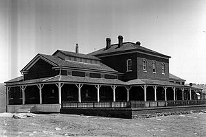
Nearby is Fort Bayard Historic District, about eight miles (13 km) east of Silver City. Fort Bayard was built in 1866 for soldiers. Later, it became a hospital. Today, it has a museum run by the Fort Bayard Historic Preservation Society. They offer tours of the old buildings and grounds.
Famous People from Silver City
Many interesting people have lived in or visited Silver City:
- Billy the Kid, a famous outlaw, lived here for a time.
- Jeff Bingaman, a U.S. Senator, grew up in Silver City.
- Kit Carson, a well-known western scout.
- Cochise and Geronimo, famous Apache leaders, were active in the surrounding area.
- Nichelle Nichols, the actress who played Uhura on Star Trek, passed away in Silver City.
- Harrison Schmitt, an American geologist and NASA astronaut.
See also
 In Spanish: Silver City (Nuevo México) para niños
 | Shirley Ann Jackson |
 | Garett Morgan |
 | J. Ernest Wilkins Jr. |
 | Elijah McCoy |


