Mogollon Mountains facts for kids

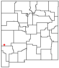
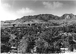
The Mogollon Mountains, also known as the Mogollon Range, are a group of tall mountains in southwestern New Mexico. They are located in Grant County and Catron County. Most of these mountains are protected inside the Gila National Forest.
Contents
Exploring the Mogollon Mountains
Where Are the Mogollon Mountains?
The Mogollon Mountains are found in New Mexico. They are west of the Gila River and east of the San Francisco River. You can find them between the towns of Reserve and Silver City.
The mountains stretch about 30 miles (48 km) from north to south. They help divide the San Francisco and Gila Rivers. The highest part of the mountains is about 15 miles (24 km) east of U.S. Route 180. This road runs alongside a part of the San Francisco River.
Most of the Mogollon Mountains are part of the Gila Wilderness. This special area is within the Gila National Forest, keeping it safe and natural.
Tallest Peaks in the Range
The highest point in the Mogollon Mountains is a peak called Whitewater Baldy. It stands at 10,895 feet (3,321 meters) tall. This makes it the highest point in all of southwestern New Mexico.
The range also has five other peaks that are over 10,000 feet (3,048 meters) high. One of the most famous is Mogollon Baldy, which is 10,778 feet (3,285 meters) tall.
How the Mountains Were Formed
The Mogollon Mountains were created a very long time ago. This happened between 40 and 25 million years ago. They were formed as part of a large area of volcanoes called the Datil-Mogollon Volcanic Plateau.
Even today, you can find hot springs in the area. These hot springs are a reminder of the volcanic activity that shaped these mountains so many years ago.
A Look at History
Who Are the Mountains Named After?
The Mogollon Mountains get their name from Juan Ignacio Flores Mogollón. He was a governor of a Spanish colony called Nuevo Leon from 1712 to 1715. This was during the time of the Viceroyalty of New Spain.
Early People and Mining
Long ago, the Mimbres Culture lived in these mountains. They were here from about 300 BCE to 1300 CE. Later, different groups of the Apache people lived here, including the Chiricahua and Mimbres bands. It is believed that the famous Apache leader Geronimo was born in this area around 1829.
Mining for valuable minerals started in the mountains in the 1890s. This activity continued for several decades.
Mogollon Mountains vs. Mogollon Rim
It is important not to confuse the Mogollon Mountains with the Mogollon Rim. The Mogollon Rim is a very large cliff or escarpment in Arizona. It is about 100 miles (160 km) to the northwest of the Mogollon Mountains. They are two different geological features.
See also
 In Spanish: Sierra de Mogollón (Nuevo México) para niños
 | Precious Adams |
 | Lauren Anderson |
 | Janet Collins |


