Hanwell Park facts for kids
Hanwell Park was a large farming estate in west London. It was put together by Charles Gostlin in the 1700s. He bought land from nearby owners to create this big estate. When Gostlin passed away in 1766, he left the estate to his cousin's sons, William and Henry Berners. The estate was eventually divided and sold off by 1886. This happened after Sir Montagu Sharpe sold the part he had inherited.
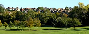
A golf club called Brent Valley was later created from a part of the estate known as The Grove. This smaller estate was about 29 acres and was formed when Hanwell Park was first broken up in 1837. It became fully owned land in 1860.
Near Hanwell Park is a place called Cuckoo Hill. This spot was once the site of a fierce battle in the 500s. It was fought between the Romano-British people (who had lived under Roman rule) and the Saxons (Germanic tribes who came to Britain). This battle was known as Blood(y) Croft. Some people think the name Hanwell comes from this event. Haenwael means a "slaughter on high ground." In 1886, graves of seven Saxon leaders were found here, along with broken spearheads. Later, around 1905, new homes were built on this land. This happened after the London United Tramways Company was allowed to run trams through the area in 1901, leading to more building.
Hanwell Park House
Hanwell Park also had a beautiful house built in the 1800s. It was designed in a style called neoclassical. This means it looked like ancient Greek or Roman buildings. John Henry Brady wrote in his 1838 guide that the estate was an "attractive seat." Others said that even though the house wasn't huge, it had very large grounds around it.
Sir Archibald Macdonald, who was once a very important judge, owned the house. Sadly, the house was torn down around 1928. This was part of a time when many large English country houses were being demolished.
Maps of the Area
Maps help us see how Hanwell Park and the surrounding area changed over time.
Hanwell in 1894

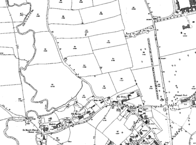
This map from 1894 shows the Brent Valley and Cuckoo Hill. You can see "The Grove" at the bottom center. This is the land that later became the golf course. To its left, you can spot other important buildings like "The Spring" and St. Mary's Church, Hanwell. The River Brent flows along the left side of the map. On the right side, you can find "Hanwell Park" itself. Above it is the large Central London District School.
Hanwell in 1934

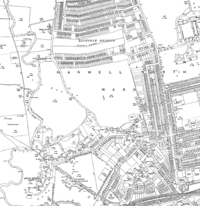
By 1934, things had changed quite a bit. "The Grove" had become the clubhouse for the golf course. A new road called Grove Avenue was built to the east. You can also see Hanwell railway station at the bottom of the map. This station is on the Great Western Railway line.
 | Delilah Pierce |
 | Gordon Parks |
 | Augusta Savage |
 | Charles Ethan Porter |


