Harmonsburg, Pennsylvania facts for kids
Quick facts for kids
Harmonsburg, Pennsylvania
|
|
|---|---|

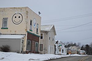
Plum Street
|
|

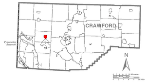
Location of Harmonsburg in Crawford County
|
|

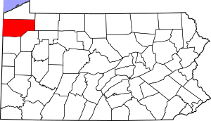
Location of Crawford County in Pennsylvania
|
|
| Country | United States |
| State | Pennsylvania |
| County | Crawford County |
| Township | Summit |
| Area | |
| • Total | 1.38 sq mi (3.57 km2) |
| • Land | 1.38 sq mi (3.57 km2) |
| • Water | 0.00 sq mi (0.00 km2) |
| Elevation | 1,120 ft (340 m) |
| Population
(2020)
|
|
| • Total | 309 |
| • Density | 224.40/sq mi (86.67/km2) |
| Time zone | UTC-4 (EST) |
| • Summer (DST) | UTC-5 (EDT) |
| ZIP code |
16422
|
| Area code(s) | 814 |
Harmonsburg is a small community in Crawford County, Pennsylvania. It is called a census-designated place (CDP) because the U.S. Census Bureau tracks its population. In 2020, about 309 people lived there.
Contents
Harmonsburg's Early Days
Harmonsburg was started in 1816 by a man named Henry Bright. He was a German farmer and blacksmith. Bright bought the land in 1802. For many years, the community was even called "Brightstown" after him. Henry Bright lived in Harmonsburg until he passed away in 1838. The very first house built here was a tavern. It was built by Joseph McMurtry.
Harmonsburg stayed a small village. At its largest, it had about 160 people. There was an early mill for grinding grain and cutting wood about half a mile south. A cheese factory was also located nearby to the east.
Where is Harmonsburg Located?
Harmonsburg is in the western part of Crawford County, Pennsylvania. It is just east of the center of Summit Township. The community is less than 2 miles (3.2 km) north of Conneaut Lake.
Travel and Surroundings
Pennsylvania Route 18 goes right through Harmonsburg. This road leads 7 miles (11 km) north to Conneautville. It also goes 5 miles (8 km) south to the town of Conneaut Lake.
Harmonsburg is surrounded by many farms and fields. The land is very flat, which is great for farming. It also has access to water from Conneaut Inlet and Conneaut Creek. Many different kinds of trees grow here naturally. These include hemlock, sugar maple, pine, oak, sycamore, and beech.
Area Size
According to the United States Census Bureau, Harmonsburg covers a total area of about 1.38 square miles (3.6 square kilometers). All of this area is land.
Who Lives in Harmonsburg?
| Historical population | |||
|---|---|---|---|
| Census | Pop. | %± | |
| 2020 | 309 | — | |
| U.S. Decennial Census | |||
In 2000, there were 356 people living in Harmonsburg. There were 140 households and 107 families. The population density was about 259.9 people per square mile (100.3 people per square kilometer).
Community Makeup
Most of the people in Harmonsburg are White (99.44%). A small number (0.56%) are Native American.
Many households (34.3%) had children under 18 living with them. Most households (62.9%) were married couples. About 9.3% of households had a female head with no husband present.
Age Groups
The population of Harmonsburg is spread out by age:
- 26.4% were under 18 years old.
- 6.7% were from 18 to 24 years old.
- 29.5% were from 25 to 44 years old.
- 22.2% were from 45 to 64 years old.
- 15.2% were 65 years or older.
The average age in Harmonsburg was 39 years. For every 100 females, there were about 108 males.
See also
 In Spanish: Harmonsburg para niños
 | Claudette Colvin |
 | Myrlie Evers-Williams |
 | Alberta Odell Jones |

