Crawford County, Pennsylvania facts for kids
Quick facts for kids
Crawford County
|
|||
|---|---|---|---|
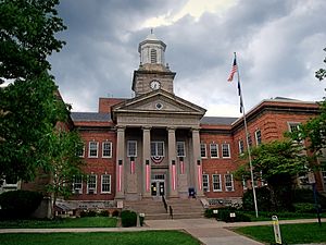
The Crawford County Courthouse in Meadville
|
|||
|
|||
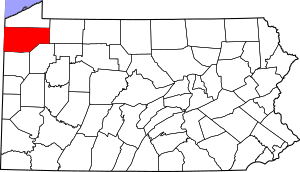
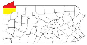
Location within the U.S. state of Pennsylvania
|
|||
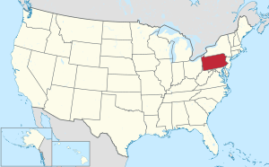 Pennsylvania's location within the U.S. |
|||
| Country | |||
| State | |||
| Founded | March 12, 1800 | ||
| Named for | William Crawford | ||
| Seat | Meadville | ||
| Largest city | Meadville | ||
| Area | |||
| • Total | 1,038 sq mi (2,690 km2) | ||
| • Land | 1,012 sq mi (2,620 km2) | ||
| • Water | 25 sq mi (60 km2) 2.4%% | ||
| Population
(2020)
|
|||
| • Total | 83,938 | ||
| • Density | 80.87/sq mi (31.222/km2) | ||
| Time zone | UTC−5 (Eastern) | ||
| • Summer (DST) | UTC−4 (EDT) | ||
| Congressional district | 16th | ||
|
Pennsylvania Historical Marker
|
|||
| Designated: | May 12, 1982 | ||
Crawford County is a special area in Pennsylvania. It is called a county. In 2020, about 83,938 people lived here. The main town, or county seat, is Meadville.
Crawford County was created a long time ago, on March 12, 1800. It was formed from a part of Allegheny County. The county is named after Colonel William Crawford. He was an important soldier. This county is in the northwest part of Pennsylvania.
Crawford County is part of a larger area called the Meadville, PA Micropolitan Statistical Area. It also belongs to the Erie-Meadville, PA Combined Statistical Area.
Contents
Geography of Crawford County
Crawford County covers a total area of about 1,038 square miles. Most of this area, 1,012 square miles, is land. The rest, about 25 square miles, is water. This means about 2.4% of the county is water.
The county has a warm-summer humid continental climate. This means it has warm summers and cold winters. In Meadville, the average temperature in January is about 24.9°F. In July, it's around 69.5°F. Titusville has similar temperatures.
Neighboring Counties
Crawford County shares its borders with several other counties:
- Erie County (to the north)
- Warren County (to the east)
- Venango County (to the southeast)
- Mercer County (to the south)
- Trumbull County, Ohio (to the southwest)
- Ashtabula County, Ohio (to the west)
Protected Natural Areas
Crawford County has important natural spaces.
- The Erie National Wildlife Refuge is a special area for wildlife.
- Pymatuning State Park is also here. It is located on the Pymatuning Reservoir.
Main Roads
Many important roads run through Crawford County. These roads help people travel and transport goods.
 I-79
I-79 US 6
US 6 US 19
US 19 US 322
 PA 8
PA 8
 PA 8 Truck
 PA 18
PA 18 PA 27
PA 27
 PA 27 Truck
 PA 77
PA 77 PA 86
PA 86 PA 89
PA 89 PA 98
PA 98 PA 99
PA 99 PA 102
 PA 173
 PA 198
 PA 285
 PA 408
 PA 428
People of Crawford County (Demographics)
| Historical population | |||
|---|---|---|---|
| Census | Pop. | %± | |
| 1800 | 2,346 | — | |
| 1810 | 6,178 | 163.3% | |
| 1820 | 9,397 | 52.1% | |
| 1830 | 16,030 | 70.6% | |
| 1840 | 31,724 | 97.9% | |
| 1850 | 37,849 | 19.3% | |
| 1860 | 48,755 | 28.8% | |
| 1870 | 63,832 | 30.9% | |
| 1880 | 68,607 | 7.5% | |
| 1890 | 65,324 | −4.8% | |
| 1900 | 63,643 | −2.6% | |
| 1910 | 61,565 | −3.3% | |
| 1920 | 60,667 | −1.5% | |
| 1930 | 62,980 | 3.8% | |
| 1940 | 71,644 | 13.8% | |
| 1950 | 78,948 | 10.2% | |
| 1960 | 77,956 | −1.3% | |
| 1970 | 81,342 | 4.3% | |
| 1980 | 88,869 | 9.3% | |
| 1990 | 86,169 | −3.0% | |
| 2000 | 90,367 | 4.9% | |
| 2010 | 88,765 | −1.8% | |
| 2020 | 83,938 | −5.4% | |
In 2000, there were about 90,366 people living in Crawford County. Most people, about 97%, were White. About 1.59% were Black or African American. Other groups made up smaller parts of the population.
The average family size was about three people. Many households had children under 18 living with them. The median age in the county was 38 years old. This means half the people were younger than 38, and half were older.
2020 Census Information
Here is a look at the different groups of people living in Crawford County in 2020:
| Race | Num. | Perc. |
|---|---|---|
| White (NH) | 77,347 | 92.14% |
| Black or African American (NH) | 1,496 | 1.8% |
| Native American (NH) | 109 | 0.13% |
| Asian (NH) | 365 | 0.43% |
| Pacific Islander (NH) | 26 | 0.03% |
| Other/Mixed (NH) | 3,354 | 4% |
| Hispanic or Latino | 1,241 | 1.48% |
Important Areas for Population
The United States Office of Management and Budget has a special way to group areas. Crawford County is called the Meadville, PA Micropolitan Statistical Area (μSA). This means it's a smaller city area with its surrounding communities. In 2010, it was the 5th largest micropolitan area in Pennsylvania.
Crawford County is also part of the Erie-Meadville, PA Combined Statistical Area (CSA). This larger area includes both Crawford County and Erie County. It helps show how different areas are connected.
Education in Crawford County
Crawford County offers many choices for learning.
Colleges and Universities
- Allegheny College is a four-year college located in Meadville.
- The University of Pittsburgh at Titusville is a branch campus of the University of Pittsburgh. It is located in Titusville.
Other Colleges
- Precision Manufacturing Institute (PMI)
- Laurel Technical Institute (LTI)
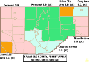
Public School Districts
Kids in Crawford County go to schools in different districts. These districts manage the public schools.
- Conneaut School District
- Corry Area School District
- Crawford Central School District
- Jamestown Area School District
- Penncrest School District
- Titusville Area School District
- Union City Area School District
Communities in Crawford County
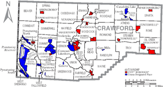
In Pennsylvania, there are different types of towns and areas. These include cities, boroughs, and townships. Crawford County has examples of all of these.
Cities
- Meadville (This is the county seat, the main town for county government.)
- Titusville
Boroughs
Boroughs are smaller towns.
Townships
Townships are areas of land that include smaller communities or rural areas.
- Athens
- Beaver
- Bloomfield
- Cambridge
- Conneaut
- Cussewago
- East Fairfield
- East Fallowfield
- East Mead
- Fairfield
- Greenwood
- Hayfield
- North Shenango
- Oil Creek
- Pine
- Randolph
- Richmond
- Rockdale
- Rome
- Sadsbury
- South Shenango
- Sparta
- Spring
- Steuben
- Summerhill
- Summit
- Troy
- Union
- Venango
- Vernon
- Wayne
- West Fallowfield
- West Mead
- West Shenango
- Woodcock
Census-Designated Places (CDPs)
These are areas that the U.S. Census Bureau names for collecting information. They are not official towns or cities.
Other Communities
These are smaller communities that are not officially incorporated.
- Buells Corners
- Custards
- Frenchtown
- Rundell
Largest Communities by Population
This table shows the largest communities in Crawford County based on the 2010 census. † county seat
| Rank | City/Town/etc. | Municipal type | Population (2010 Census) |
|---|---|---|---|
| 1 | † Meadville | City | 13,388 |
| 2 | Titusville | City | 5,601 |
| 3 | Cambridge Springs | Borough | 2,595 |
| 4 | Conneaut Lakeshore | CDP | 2,395 |
| 5 | Pymatuning Central | CDP | 2,269 |
| 6 | Cochranton | Borough | 1,136 |
| 7 | Linesville | Borough | 1,040 |
| 8 | Saegertown | Borough | 997 |
| 9 | Conneautville | Borough | 774 |
| 10 | Fredericksburg | CDP | 733 |
| 11 | Conneaut Lake | Borough | 653 |
| 12 | Hydetown | Borough | 526 |
| 13 | Canadohta Lake | CDP | 516 |
| 14 | Pymatuning South | CDP | 479 |
| 15 | Springboro | Borough | 477 |
| 16 | Harmonsburg | CDP | 401 |
| 17 | Blooming Valley | Borough | 337 |
| 18 | Townville | Borough | 323 |
| 19 | Pymatuning North | CDP | 311 |
| T-20 | Spartansburg | Borough | 305 |
| T-20 | Kerrtown | CDP | 305 |
| 21 | Venango | Borough | 239 |
| 22 | Centerville | Borough | 218 |
| 23 | Hartstown | CDP | 201 |
| 24 | Woodcock | Borough | 157 |
| 25 | Guys Mills | CDP | 124 |
| 26 | Geneva | CDP | 109 |
| 27 | Lincolnville | CDP | 96 |
| 28 | Atlantic | CDP | 77 |
| 29 | Riceville | CDP | 68 |
| 30 | Adamsville | CDP | 67 |
Famous People from Crawford County
- John Brown was a famous person who worked to end slavery. He lived in Crawford County for 11 years, longer than anywhere else. He was the first postmaster of Randolph Township from 1828 to 1836. He even had a secret room in his barn to help people escape slavery. Today, you can visit the John Brown Farm, Tannery & Museum.
- Robert F. Kent (1911–1982) was born in Meadville. He represented Crawford County in the Pennsylvania House of Representatives. He also served as the Pennsylvania Treasurer, managing the state's money.
See also
 In Spanish: Condado de Crawford (Pensilvania) para niños
 | Stephanie Wilson |
 | Charles Bolden |
 | Ronald McNair |
 | Frederick D. Gregory |


