Centerville, Crawford County, Pennsylvania facts for kids
Quick facts for kids
Centerville, Pennsylvania
|
|
|---|---|
|
Borough
|
|

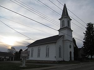
Centerville United Methodist Church
|
|

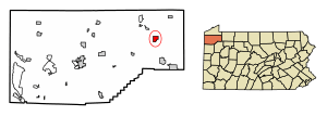
Location of Centerville in Crawford County, Pennsylvania.
|
|
| Country | United States |
| State | Pennsylvania |
| County | Crawford County |
| Founded | 1812 |
| Area | |
| • Total | 1.75 sq mi (4.52 km2) |
| • Land | 1.75 sq mi (4.52 km2) |
| • Water | 0.00 sq mi (0.00 km2) |
| Elevation
(where Oil Creek flows out of the borough)
|
1,260 ft (380 m) |
| Highest elevation
(PA 8 at the northern borough line)
|
1,510 ft (460 m) |
| Lowest elevation
(Oil Creek)
|
1,248 ft (380 m) |
| Population
(2020)
|
|
| • Total | 176 |
| • Estimate
(2022)
|
174 |
| • Density | 102.01/sq mi (39.38/km2) |
| Time zone | UTC-4 (EST) |
| • Summer (DST) | UTC-5 (EDT) |
| Area code(s) | 814 |
| FIPS code | 42-12184 |
| GNIS feature ID | 1215132 |
Centerville is a small town, known as a borough, located in Crawford County, Pennsylvania, USA. It was founded in 1812. According to the 2020 census, about 176 people live there.
Contents
Where is Centerville Located?
Centerville is in the eastern part of Crawford County. It shares its borders with different townships. To the north, east, and south, it's next to Rome Township. To the southwest, you'll find Steuben Township, and to the west is Athens Township.
How Big is Centerville?
The United States Census Bureau says that Centerville covers about 4.6 square kilometers (or 1.75 square miles). All of this area is land, with no large bodies of water inside the borough limits.
Natural Features of Centerville
Centerville is located in an interesting area that was once shaped by glaciers. These huge sheets of ice moved across the land long ago. The town is also home to Oil Creek, a stream that flows south through the western side of the town. Another stream, East Branch Oil Creek, joins the main creek nearby. The lowest point in Centerville is where Oil Creek leaves the borough, at about 1,260 feet above sea level. The highest point is at the northern border, reaching about 1,510 feet.
Main Roads in Centerville
Pennsylvania Route 8 is an important road that goes right through Centerville. If you head north on this road, you'll reach Union City in about 12 miles. If you go south, you'll get to Titusville in about 9 miles.
Who Lives in Centerville?
| Historical population | |||
|---|---|---|---|
| Census | Pop. | %± | |
| 1870 | 322 | — | |
| 1880 | 307 | −4.7% | |
| 1890 | 274 | −10.7% | |
| 1900 | 260 | −5.1% | |
| 1910 | 264 | 1.5% | |
| 1920 | 218 | −17.4% | |
| 1930 | 229 | 5.0% | |
| 1940 | 273 | 19.2% | |
| 1950 | 245 | −10.3% | |
| 1960 | 238 | −2.9% | |
| 1970 | 246 | 3.4% | |
| 1980 | 245 | −0.4% | |
| 1990 | 249 | 1.6% | |
| 2000 | 247 | −0.8% | |
| 2010 | 218 | −11.7% | |
| 2020 | 176 | −19.3% | |
| 2022 (est.) | 174 | −20.2% | |
| Sources: | |||
Let's look at the people who live in Centerville, based on information from the year 2000.
Population and Homes
In 2000, there were 247 people living in Centerville. These people lived in 99 different homes, and 67 of these were families. On average, about 2.49 people lived in each home.
Most of the people living in Centerville were White. A very small number were Asian or from two or more racial backgrounds.
Age Groups
The population in Centerville includes people of all ages. About 21.9% of the people were under 18 years old. About 7.7% were young adults between 18 and 24. The largest group, about 29.1%, were adults aged 25 to 44. People aged 45 to 64 made up about 24.7% of the population. Finally, about 16.6% of the people were 65 years old or older. The average age in Centerville was 41 years.
Income in Centerville
In 2000, the average income for a household in Centerville was $29,318 per year. For families, the average income was $32,778. The average income per person in the borough was $12,860.
See also
 In Spanish: Centerville (condado de Crawford, Pensilvania) para niños
 | Jewel Prestage |
 | Ella Baker |
 | Fannie Lou Hamer |


