Union City, Pennsylvania facts for kids
Quick facts for kids
Union City, Pennsylvania
|
|
|---|---|
|
Borough
|
|

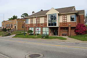
Union City Public Library and South Main Arms
|
|
| Motto(s):
"Our Hometown"
|
|

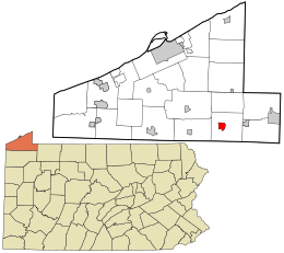
Location in Erie County and the U.S. state of Pennsylvania.
|
|
| Country | United States |
| State | Pennsylvania |
| County | Erie |
| Area | |
| • Total | 1.85 sq mi (4.81 km2) |
| • Land | 1.83 sq mi (4.74 km2) |
| • Water | 0.03 sq mi (0.07 km2) |
| Elevation
(center of downtown)
|
1,265 ft (386 m) |
| Highest elevation
(north boundary of borough)
|
1,430 ft (440 m) |
| Lowest elevation | 1,238 ft (377 m) |
| Population
(2020)
|
|
| • Total | 2,927 |
| • Density | 1,599.45/sq mi (617.53/km2) |
| Time zone | UTC-4 (EST) |
| • Summer (DST) | UTC-5 (EDT) |
| ZIP Code |
16438
|
| Area code(s) | 814 |
Union City is a small town, called a borough, in Erie County, Pennsylvania, United States. It is about 22 miles (35 km) southeast of the city of Erie. In the 1900s, Union City was known for its factories. These included large chair factories, mills for wood and grain, a powdered milk plant, and other furniture factories. In 2020, about 2,934 people lived there. Union City is part of the larger Erie area.
Contents
History of Union City
Union City has a rich history that dates back to the early 1800s. The Union City Historic District was added to the National Register of Historic Places in 1990. This means it's an important area with historical buildings.
Early Settlement: Miles Mills
The area was first settled in 1800 and was known as Miles Mills. A man named William Miles, who fought in the American Revolution, built a dam on the South Branch of French Creek. He also built a gristmill (for grinding grain) and a sawmill (for cutting wood). For many years, Miles Mills was just a few small mills along this creek.
The Railroad and Oil Boom
Things changed a lot in 1855 when people expected the railroad to arrive. New town lots were planned north and east of the creek. The Philadelphia and Erie Railroad reached the town in 1858. This was just before Edwin L. Drake found oil in Titusville nearby.
The railroad made Miles Mills a key spot for the oil business. By 1860, the town had three oil refineries and a barrel-making industry. This was in addition to its sawmills. The town's citizens were very excited by this growth. In 1865, they officially became a borough and named it Union Mills.
From Oil to Wood Products
After 1862, much of the oil shipping moved to another town called Corry. This caused the oil refinery business in Union Mills to slow down. However, the barrel-making industry stayed strong. This led to a focus on wood products, which is still important to the town today.
By 1870, the town's population grew to 1,500 people. The sawmills, which had closed during the oil boom, reopened. Many companies made wood products, including barrels. One company, Wood and Johnson's factory, started in 1870. It employed 70 workers and was known as the largest maker of oil barrels in the country. In 1871, the town changed its name to Union City.
Growth and Challenges
The next ten years saw steady changes. In 1879, a big fire destroyed most of the businesses on Main Street. But the town quickly rebuilt, often with stronger brick buildings. The town hall, a beautiful brick building, was built in 1884.
In 1882, the Union City Chair Co. moved to town. This was a big step. It marked the start of Union City becoming an important center for making furniture in Pennsylvania. Many new homes were built in the 1880s, especially for the managers of the new furniture factories. These homes were often built on higher ground away from the creek.
Overcoming Disasters
Union City continued to grow in the 1890s, even with two major problems. In 1892, heavy rain caused the South Branch of French Creek to flood the town center. Several businesses were destroyed. This flood led to improvements in the town. A new concrete bridge was built in 1896. Main Street was paved in 1899, and sewers were installed.
The town's strong wood products industry helped it get through a tough economic time in 1892. Local companies did well despite the national problems. For example, Blanchard and Hansen, which made caskets and furniture, added a third floor to its factory. By 1897, new homes were being built again.
Modern Era
By the early 1900s, the "Mill and Mansion" era, where large homes were built near factories, started to end. While some new houses were still built, they were smaller. The wood products industry remained important, but many new companies were not located on Main Street. The Union City Chair Co. is one of the few companies that can trace its history back to the 1800s.
Geography of Union City
Union City is located in the southeastern part of Erie County. It is surrounded by Union Township.
Roads and Transportation
Two main roads, U.S. Route 6 and Pennsylvania Route 8, go through the center of town. They are known as Main Street. US 6 goes east to Corry (about 11 miles or 18 km away). It also goes southwest towards Meadville (about 30 miles or 48 km away).
PA 8 goes north to Wattsburg (about 8 miles or 13 km away) and then to Erie (about 27 miles or 43 km away). To the south, PA 8 leads to Titusville (about 22 miles or 35 km away). Another road, Pennsylvania Route 97, heads west out of town to Waterford (about 8 miles or 13 km away).
Waterways
Union City covers about 1.85 square miles (4.8 square kilometers). A small part of this area, about 0.03 square miles (0.07 square kilometers), is water. The South Branch of French Creek flows through the middle of the town. This creek is a branch of the Allegheny River. Bentley Run, which helps fill the Union City Reservoir, also joins French Creek in Union City.
Population and People
| Historical population | |||
|---|---|---|---|
| Census | Pop. | %± | |
| 1870 | 1,500 | — | |
| 1880 | 2,171 | 44.7% | |
| 1890 | 2,261 | 4.1% | |
| 1900 | 3,104 | 37.3% | |
| 1910 | 3,684 | 18.7% | |
| 1920 | 3,850 | 4.5% | |
| 1930 | 3,788 | −1.6% | |
| 1940 | 3,843 | 1.5% | |
| 1950 | 3,911 | 1.8% | |
| 1960 | 3,819 | −2.4% | |
| 1970 | 3,638 | −4.7% | |
| 1980 | 3,623 | −0.4% | |
| 1990 | 3,537 | −2.4% | |
| 2000 | 3,463 | −2.1% | |
| 2010 | 3,320 | −4.1% | |
| 2020 | 2,934 | −11.6% | |
| 2021 (est.) | 2,909 | −12.4% | |
| U.S. Decennial Census | |||
According to the census in 2000, there were 3,463 people living in Union City. These people lived in 1,326 households, and 900 of these were families. The town had about 1,848.6 people per square mile.
Most of the people in Union City were White (about 97.92%). A small number were African American, Native American, or Asian. About 0.84% of the population were Hispanic or Latino.
About 37.9% of households had children under 18 living with them. About 48.0% were married couples. The average household had 2.61 people. The average family had 3.16 people.
The population was spread out by age. About 30.1% were under 18 years old. About 9.3% were between 18 and 24. And 12.4% were 65 years or older. The average age in Union City was 32 years.
The median income for a household was $27,216. For families, it was $34,352. About 20.9% of the people in Union City lived in families who didn't earn much money. This included 26.4% of those under 18.
Education in Union City
Most kids in Union City go to schools in the Union City Area School District. This school district also includes children from Crawford County. There is one elementary school. The middle school and high school are in the same building. The school colors are green and white, and their mascot is a Bear. The school buildings were greatly updated in 2020.
Museum
The Union City Historical Society Museum is a three-story building on Main Street. This museum has a large collection of old items. These items date from the 1780s to today. Many things on the third floor were made by people who lived in the town.
See also
 In Spanish: Union City (Pensilvania) para niños
 | William M. Jackson |
 | Juan E. Gilbert |
 | Neil deGrasse Tyson |


