Bentley Run facts for kids
Quick facts for kids Bentley Run |
|
|---|---|
|
Location of the mouth of Bentley Run
|
|
| Other name(s) | Tributary to South Branch French Creek |
| Country | United States |
| State | Pennsylvania |
| County | Erie |
| Physical characteristics | |
| Main source | divide between Alder Run, Bentley Run and Pine Run just upstream of Union City Reservoir, about 1.0 mile northeast of Union City, Pennsylvania 1,520 ft (460 m) 41°55′51″N 079°47′39″W / 41.93083°N 79.79417°W |
| River mouth | South Branch French Creek Union City, Pennsylvania 1,266 ft (386 m) 41°53′50″N 079°50′12″W / 41.89722°N 79.83667°W |
| Length | 1.2 mi (1.9 km) |
| Basin features | |
| Progression | southwest |
| River system | Allegheny River |
| Basin size | 4.1 square miles (11 km2) |
| Tributaries |
|
| Waterbodies | Union City Reservoir |
| Bridges | Hoyt Road, US 6, Bridge Street, Willow Street |
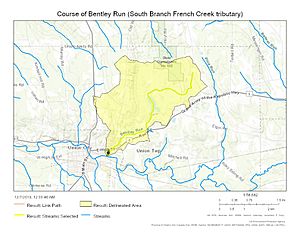
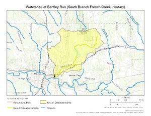
Bentley Run is a small stream, about 1.2 miles (1.9 kilometers) long, located in Erie County, Pennsylvania. It's like a smaller helper stream that flows into a bigger one called South Branch French Creek. Think of it as a "second-order tributary," meaning it flows into a stream that then flows into an even larger river system, the Allegheny River.
Where Bentley Run Starts and Flows
Bentley Run begins in Union Township, which is in the southern part of Erie County, Pennsylvania. From there, it flows towards the southwest. Its journey ends when it joins the South Branch French Creek in Union City, Pennsylvania.
Understanding the Bentley Run Watershed
A watershed is like a giant bowl where all the rain and melted snow drain into a single stream or river. The Bentley Run watershed covers about 4.1 square miles (10.6 square kilometers). This area is part of a geological region called the Erie Drift Plain. On average, this watershed receives about 46.4 inches (118 centimeters) of rain and snow each year.
 | Emma Amos |
 | Edward Mitchell Bannister |
 | Larry D. Alexander |
 | Ernie Barnes |


