
Interstate 79 facts for kids
Quick facts for kids
|
|
|---|---|
| Lua error in Module:Infobox_road/map at line 15: attempt to index field 'wikibase' (a nil value). | |
| Route information | |
| Length | 343.24 mi (552.39 km) |
| Major junctions | |
| South end | |
| North end | |
| Highway system | |
| Main route of the Interstate Highway System Main • Auxiliary • Business |
|

Interstate 79 (also known as I-79) is an important highway that is part of the Interstate Highway System in the United States. It stretches for about 343 miles (552 kilometers). This highway starts in Charleston, West Virginia, and goes north all the way to Erie, Pennsylvania.
I-79 is a main road for traveling through western Pennsylvania and West Virginia. It also serves as a key connection to places like Buffalo, New York, and the border with Canada. For much of its path, especially from Sutton northward, Interstate 79 generally runs alongside U.S. Route 19. In many areas, I-79 has taken the place of U.S. Route 19 as the main road, except for the section between Washington and Cranberry Township, Pennsylvania.
Highway Names and History
Interstate 79 has special names in different states. In West Virginia, it is known as the Jennings Randolph Expressway. Jennings Randolph was a well-known politician who served in the U.S. Congress for many years. In the northern parts of West Virginia, I-79 is also called part of the "High Tech Corridor," which connects areas with technology businesses.
Through most of Pennsylvania, the highway is called the Raymond P. Shafer Highway. Raymond P. Shafer was a former governor of Pennsylvania. These names honor important people who contributed to the states.
Connecting Roads: Auxiliary Routes
Highways sometimes have smaller roads that branch off them. These are called "auxiliary routes." They help connect the main highway to cities or other major roads. Interstate 79 has a few of these important connecting roads:
- Interstate 279 (I-279) starts from Interstate 79 in the northern suburbs of Pittsburgh. It heads southeast and connects to Interstate 376 in downtown Pittsburgh.
- Interstate 579 (I-579) begins from Interstate 279 in Pittsburgh's North Side. It travels south towards the Liberty Bridge and the Boulevard of the Allies, which is just east of downtown Pittsburgh.
Images for kids
-
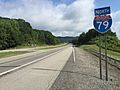
View north along I-79 north of US 19/WV 15 in Flatwoods, West Virginia
-

Aerial view of I-79 and surrounding terrain as it approaches Weston, West Virginia, from the south
-
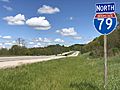
I-79 northbound past Exit 7 in Whiteley Township, Pennsylvania
-
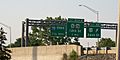
Exit signs for US 20, PA 5, PA 290 and the terminus for I-79 in Erie, Pennsylvania
-
Neville Island Bridge in Pennsylvania carrying I-79
-
Ghost ramps around milemarker 100 near Moraine State Park
-
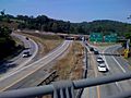
I-79 merges with I-70 through Washington, Pennsylvania
_just_north_of_Exit_67_(U.S._Route_19,_West_Virginia_State_Route_15,_Flatwoods)_in_Flatwoods,_Braxton_County,_West_Virginia.jpg)


