
Trumbull County, Ohio facts for kids
Quick facts for kids
Trumbull County
|
|||
|---|---|---|---|

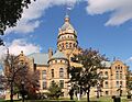
Trumbull County Courthouse
|
|||
|
|||

Location within the U.S. state of Ohio
|
|||
 Ohio's location within the U.S. |
|||
| Country | |||
| State | |||
| Founded | July 10, 1800 | ||
| Named for | Jonathan Trumbull | ||
| Seat | Warren | ||
| Largest city | Warren | ||
| Area | |||
| • Total | 637 sq mi (1,650 km2) | ||
| • Land | 618 sq mi (1,600 km2) | ||
| • Water | 18 sq mi (50 km2) 2.9%% | ||
| Population
(2020)
|
|||
| • Total | 201,977 | ||
| • Estimate
(2021)
|
201,335 |
||
| • Density | 317.08/sq mi (122.42/km2) | ||
| Time zone | UTC−5 (Eastern) | ||
| • Summer (DST) | UTC−4 (EDT) | ||
| Congressional district | 14th | ||


Trumbull County is a county located in the northeastern part of Ohio, a U.S. state. In 2020, about 201,977 people lived here. The main city and county seat is Warren. Warren grew into an important industrial area because it is located along the Mahoning River. Trumbull County is part of the larger Youngstown–Warren, OH area, which is a group of cities and towns that are connected.
Contents
History of Trumbull County
Early European Claims and Land Ownership
Long ago, the land that is now Trumbull County was first claimed by French explorers. They called it part of Canada. French fur traders often met with Native Americans in this area.
Later, France lost a big war called the Seven Years' War to Great Britain. In 1763, France had to give up its lands east of the Mississippi River. Great Britain then called this area the Province of Quebec.
After the United States won its American Revolutionary War, Great Britain gave this land to the new country. The U.S. government then convinced Connecticut to give up its claim to this area. This land became known as the Connecticut Western Reserve within the Northwest Territory. In 1795, Connecticut sold this land to a company called the Connecticut Land Company.
When Trumbull County was first created, it was much larger. It covered the entire Connecticut Western Reserve. As more people moved in, the area was divided into smaller counties. The city of Warren was founded as the main city of the Western Reserve.
Native American Presence
While no official Native American villages have been found in Trumbull County, many old tools and items are still discovered there. Early settlers believed they saw signs of ancient villages in places like Kinsman and Hartford. They also noted strange stone structures in the Black Ash Swamp, which is now the Grand River Preserve.
Around the time modern settlers arrived, different Native American groups still visited camps near Newton Falls and the Champion-Warren border. Some Native individuals mentioned in early histories include Cadashaway, Paqua, and Kiogg. A pile of memorial stones, thought to be from Native Americans, was once on the west bank of the Mahoning River. It was later removed for building projects.
Before the 1600s, this area was between the lands of the Erie people to the east and the Whittlesey Culture to the west. We don't know exactly where one group's land ended and the other's began. After the Beaver Wars, many different tribes used this area. These included the Lenape, Wyandot, Ottawa, Shawnee, and Seneca people. They shared the valley's animals, food, and plants. They also collected salt from the marshes.
Native Americans used this land as a shared hunting ground. However, they had to give up ownership of the region after the Northwest Indian War. Even so, early settlers said Native Americans still visited the area until about 1811.
Naming of the County
Trumbull County is named after Jonathan Trumbull. He was the Governor of Connecticut and once owned land in this region. Early towns were built along the Mahoning River and other waterways. These rivers helped with transportation and provided power for the industries that grew there later.
Geography of Trumbull County
Trumbull County covers about 637 square miles. Out of this, about 618 square miles are land, and 18 square miles (2.9%) are water. The county is shaped like a square, with each side being about 25 miles long. It is the only county in Ohio that is perfectly square.
Neighboring Counties
Trumbull County shares its borders with several other counties:
- Ashtabula County (to the north)
- Crawford County, Pennsylvania (to the northeast)
- Mercer County, Pennsylvania (to the east)
- Mahoning County (to the south)
- Portage County (to the southwest)
- Geauga County (to the northwest)
Main Roads and Highways
Many important roads run through Trumbull County, connecting its communities and making travel easier.
 US 62
US 62 US 422
 I-80
I-80 SR 5
SR 5 SR 7
SR 7 SR 11
SR 11 SR 45
SR 45 SR 46
SR 46 SR 82
SR 82 SR 87
SR 87 SR 88
SR 88 SR 169
 SR 193
 SR 303
 SR 304
 SR 305
 SR 534
 SR 609
 SR 616
 SR 711
Population and People
| Historical population | |||
|---|---|---|---|
| Census | Pop. | %± | |
| 1800 | 1,302 | — | |
| 1810 | 8,671 | 566.0% | |
| 1820 | 15,546 | 79.3% | |
| 1830 | 26,153 | 68.2% | |
| 1840 | 38,107 | 45.7% | |
| 1850 | 30,490 | −20.0% | |
| 1860 | 30,656 | 0.5% | |
| 1870 | 38,659 | 26.1% | |
| 1880 | 44,880 | 16.1% | |
| 1890 | 42,373 | −5.6% | |
| 1900 | 46,591 | 10.0% | |
| 1910 | 52,766 | 13.3% | |
| 1920 | 83,920 | 59.0% | |
| 1930 | 123,063 | 46.6% | |
| 1940 | 132,315 | 7.5% | |
| 1950 | 158,915 | 20.1% | |
| 1960 | 208,526 | 31.2% | |
| 1970 | 232,579 | 11.5% | |
| 1980 | 241,863 | 4.0% | |
| 1990 | 227,813 | −5.8% | |
| 2000 | 225,116 | −1.2% | |
| 2010 | 210,312 | −6.6% | |
| 2020 | 201,977 | −4.0% | |
| 2021 (est.) | 201,335 | −4.3% | |
| U.S. Decennial Census 1790-1960 1900-1990 1990-2000 2010-2020 |
|||
How Many People Live Here?
In 2010, a census counted 210,312 people living in Trumbull County. There were 86,011 households, which are groups of people living together. About 56,874 of these were families. On average, about 340 people lived in each square mile.
Who Lives in Trumbull County?
Most people in the county are white (89.0%). About 8.3% are black or African American. Other groups include Asian (0.5%), American Indian (0.2%), and people from other backgrounds. About 1.8% of people identified as being from two or more races. About 1.3% of the population was of Hispanic or Latino origin.
Many families in Trumbull County have different backgrounds. The most common ancestries are:
Families and Income
About 28.8% of households had children under 18 living with them. Many households (47.4%) were married couples. The average household had 2.40 people, and the average family had 2.95 people. The average age of people in the county was 42.8 years old.
In 2010, the average income for a household was $42,296. For families, the average income was $52,731. About 15.4% of all people, and 11.5% of families, lived below the poverty line. This included 24.9% of children under 18 and 8.1% of people aged 65 or older.
Education and Learning
Trumbull County offers different ways for people to continue their education:
- Kent State University Trumbull is a local campus of Kent State University. It offers different two-year degrees (associate degrees) and some four-year degrees (bachelor's degrees).
- Trumbull County Career and Technical Center is a special school that teaches job skills. It helps both high school students and adults learn new trades and get ready for careers.
Communities in Trumbull County

Cities in Trumbull County
Villages in Trumbull County
- Lordstown
- McDonald
- Newton Falls
- Orangeville
- West Farmington
- Yankee Lake
Townships in Trumbull County
Townships are smaller areas of land that often include rural areas or small communities.
- Bazetta
- Bloomfield
- Braceville
- Bristol
- Brookfield
- Champion
- Farmington
- Fowler
- Greene
- Gustavus
- Hartford
- Howland
- Hubbard
- Johnston
- Kinsman
- Liberty
- Mecca
- Mesopotamia
- Newton
- Southington
- Vernon
- Vienna
- Warren
- Weathersfield
Census-Designated Places (CDPs)
CDPs are areas that look like towns but are not officially incorporated as cities or villages.
Unincorporated Communities
These are small communities that are not part of any city, village, or CDP.
Ghost Towns
These are places that used to be communities but are now abandoned or have very few people living there.
- Antietam (in Hartford)
- Bentley (in Brookfield)
- Brockway (in Hartford)
- Chestnut Ridge (in Hubbard)
- Dewey (in Kinsman)
- Doughton (in Hubbard)
- Germantown (in Hubbard)
- Kingsbury (in Mecca)
- Longsville (in Hubbard)
- Mosier (in Liberty)
- Oil Diggings (in Mecca)
- Old Burg Hill (in Hartford)
- Penza (Liberty/ Hubbard border)
- Superior (in Vernon)
- Walnut Hill (in Brookfield)
- Wassie (Bristolville/ Champion border)
- York (in Gustavus)
- Ohltown (in Weathersfield)
A military training area called the Camp Ravenna Joint Military Training Center is partly located in Braceville Township. It is also known as the Ravenna Arsenal.
Images for kids
-
Trumbull County Courthouse
See also
 In Spanish: Condado de Trumbull para niños
