Havasupai Trail facts for kids
The Havasupai Trail is a famous path that leads to the small village of Supai, Arizona and the amazing Havasu Falls. It's the main way to get there, but there are a few other trails like Topocoba and Moqui. These other trails are not kept up and can be quite difficult or even dangerous. You need special permission to use them.
The Havasupai Trail Journey
The adventure begins at a place called Hualapai Hilltop. This is where BIA Road 18 ends. At the hilltop, you'll find a big parking lot, a place for helicopters, and clean restrooms. You can travel the trail by walking, riding a horse, or using a mule service. The Havasupai people offer this mule service. You can even pay for mules to carry your bags, making your hike easier!
The trail starts by going down the side of the canyon in zig-zag turns for about three-quarters of a mile. This part is the toughest, especially when you're hiking back up! The trail is about 8 miles (13 km) long to Supai village. To reach the campgrounds, you'll walk an extra 2 miles (3.2 km). The trail drops about 2,000 feet (610 meters) in total.
After the zig-zag turns, you'll reach a flat area. There's a small rest spot made of rocks and cement here. From this spot, the trail goes down into a dry streambed. It's important to be careful in dry streambeds in the desert because flash floods can happen quickly if it rains far away.
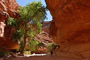
The trail follows this streambed for about 5 miles (8 km). There are a few paths in this small canyon, but they all lead to the same place. They never stray more than 30 feet (9 meters) from each other. As you continue, the canyon starts to open up into a bigger one. You'll notice a lot more plants growing here. Follow the trail to the left into the new canyon.
Reaching Supai Village
Next, the trail will take you right next to a stream. You'll soon come to a bridge. Cross this bridge, and you'll be entering the village of Supai! Make sure to stay on the trail and respect any fences you see. The land behind them is private property.
The trail goes into the main part of the village. You'll first see a small shop that sells drinks, ice cream, candy, and snacks. Straight ahead, there's often a rodeo corral where bulls are kept. The trail then leads to the town square, where all the public buildings are located. After that, the trail continues through the village along the canyon wall to your right. It makes a clear right turn and goes into an area with more plants. After leaving this green area, the trail follows the canyon to the left.
The trail will circle a small canyon. This is where Navajo Falls used to be before a big flood in 2008 changed the area. Now, there are two new unnamed waterfalls here. The trail then starts to head down towards the creek, crossing it twice over two small bridges.
After crossing the bridges, the trail leads to the top of Havasu Falls. It then moves towards the canyon wall on the left. On the right side of the trail, there's a cliff next to Havasu Falls. This is a great spot to take pictures of the beautiful waterfalls! There's a handrail on the right to help keep you safe.
The Campgrounds and Mooney Falls
The trail then goes down and enters the campgrounds. The campgrounds are about half a mile (nearly a kilometer) long. They have many campsites for groups or single campers. In the middle of the campgrounds, there's a small spring that offers fresh water. The Havasupai Tribe suggests treating this water, for example, by boiling or filtering it.
The campground also has many composting toilets and picnic tables. The Tribe asks all visitors to please pack out all their trash. Campfires are not allowed. The trail continues through the campgrounds and finally ends at Mooney Falls.
 | Charles R. Drew |
 | Benjamin Banneker |
 | Jane C. Wright |
 | Roger Arliner Young |


