Warner, Wisconsin facts for kids
Quick facts for kids
Warner, Wisconsin
|
|
|---|---|

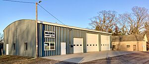
Town hall
|
|

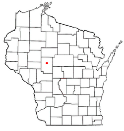
Location of Warner, Wisconsin
|
|
| Country | |
| State | |
| County | Clark |
| Area | |
| • Total | 35.0 sq mi (90.7 km2) |
| • Land | 34.9 sq mi (90.3 km2) |
| • Water | 0.1 sq mi (0.3 km2) |
| Elevation | 1,201 ft (366 m) |
| Population
(2000)
|
|
| • Total | 627 |
| • Density | 18.0/sq mi (6.9/km2) |
| Time zone | UTC-6 (Central (CST)) |
| • Summer (DST) | UTC-5 (CDT) |
| Area code(s) | 715 & 534 |
| FIPS code | 55-83350 |
| GNIS feature ID | 1584344 |
| PLSS township | T27N R2W |
| Website | https://townofwarner.com/ |
Warner is a small town located in Clark County, in the U.S. state of Wisconsin. In the year 2000, about 627 people lived here.
A place called Hemlock, which is now a ghost town (an abandoned town), used to be in Warner. It was a small town with a mill. It grew around a dam where the Black and Popple rivers met.
Contents
Exploring Warner's Geography
Warner covers about 35.0 square miles (90.6 square kilometers). Most of this area is land, about 34.9 square miles (90.3 square kilometers). Only a small part, 0.1 square miles (0.3 square kilometers), is water.
Warner's Past: A Look at Its History
Early Surveys and Land Descriptions
The area that is now Warner was first mapped in June 1847 by a U.S. government team. In November 1847, another team marked all the corners of the land sections. They walked through forests and swamps, using chains and compasses to measure.
After their work, the surveyor described the land. He said it was gently rolling with good soil. It had many trees like white pine, sugar maple, elm, and birch. There was also prickly ash and gooseberry bushes. The Black River flowed through the town from north to south. It had fast, rough water with many places for mills. The surveyor believed this area would soon have many people living there.
Roads and Early Settlements
An old map from 1873 showed just one road in Clark County. It stretched from Neillsville through Greenwood and Warner. It crossed the Popple River and went into what would become Longwood. This was a dirt road used by wagons. Today, Highway 73 follows a similar path.
The Rise of Hemlock Mill Town
In 1879, a company built a special dam on the Black River. This "flooding dam" could be opened to help logs float down the river. Frederick Limprecht and N.H. Withee used this dam to power a gristmill (a mill for grinding grain). Withee also built a sawmill. The next year, C.G. Reul added a shingle mill. Frederick Limprecht built the very first house in the small town that would become Hemlock.
By 1880, the Town of Warner was much larger than it is today. It stretched eighteen miles across. Maps from that time show seven buildings in Hemlock. There was also a school nearby and a "hotel" up the Popple River. Many large areas of land in Warner were owned by logging companies. Only a few roads had been built, mostly in the southeast. Farmers started settling along these roads, especially in the south. More schools appeared, and a "German church" was built.
Hemlock's Busy Years
In 1890, a pamphlet described Hemlock as a busy place. It had two large mills: one for flour and one for lumber, shingles, and lath. Hemlock was also the end point for a telephone line that went south to La Crosse. At that time, a stagecoach ran daily from Neillsville through Hemlock and Warner to Longwood.
By 1893, Warner was still very wide. Loggers and land buyers still owned much of the land. More wagon roads were added, and more settlers arrived. A sawmill was also shown on the map at Hemlock.
Changes and the End of Hemlock
Around 1906, the eastern part of Warner was separated to form the Town of Mead. This made Warner its current size. More roads were built, and many more settlers arrived. Farms of about 80 acres became common. Logging companies still owned large parts of the land. Another sawmill appeared on the Black River. A railroad, the Fairchild and Northeastern Railroad, also crossed the southeast corner of Warner.
In 1914, a big flood on the Black River destroyed Hemlock's dam and mill. A history book from 1919 described Hemlock as an "abandoned village." It said that nothing was left but the ruined dam and empty buildings.
By 1920, Warner's road system was almost complete. Most of the town was settled. Three cheese factories had also appeared. This showed that the area was changing from logging to farming.
Warner's Population: Who Lives Here?
In the year 2000, there were 627 people living in Warner. These people lived in 195 households, and 164 of those were families. On average, there were about 18 people per square mile.
Most of the people living in Warner were White (98.41%). A small number were Asian (1.28%) or from two or more races (0.32%). About 0.16% of the population was Hispanic or Latino.
Many households (47.2%) had children under 18 living with them. Most households (75.4%) were married couples. The average household had 3.16 people, and the average family had 3.44 people.
The population was spread out by age:
- 35.1% were under 18 years old.
- 5.7% were between 18 and 24.
- 26.3% were between 25 and 44.
- 22.2% were between 45 and 64.
- 10.7% were 65 years or older.
The average age in Warner was 35 years. For every 100 females, there were about 101.6 males.
See also
 In Spanish: Warner (Wisconsin) para niños

