Hemphill, Kentucky facts for kids
Quick facts for kids
Hemphill, Kentucky
|
|
|---|---|

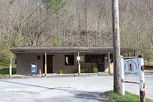
Jackhorn post office
|
|
| Country | United States |
| State | Kentucky |
| County | Letcher |
| Elevation | 1,378 ft (420 m) |
| Time zone | UTC-5 (Eastern (EST)) |
| • Summer (DST) | UTC-4 (EDT) |
| ZIP code |
41825
|
| Area code(s) | 606 |
| GNIS feature ID | 494020 |
Hemphill, also known as Jackhorn, is a small place in Letcher County, Kentucky, in the United States. It is called an unincorporated community. This means it's a group of homes and businesses that isn't officially a town or city with its own local government.
What is Hemphill?
Hemphill is located in the eastern part of Kentucky. It sits about 1.7 miles (2.7 kilometers) north of a place called Fleming-Neon. Even though it's not a city, Hemphill has its own post office.
The Jackhorn Post Office
The post office in Hemphill is an important part of the community. It uses the name Jackhorn and has a special code called a ZIP code, which is 41825. This ZIP code helps mail get to the right place. Post offices are where people send and receive letters and packages.
Unincorporated Communities Explained
An unincorporated community like Hemphill is a place where people live close together, but it doesn't have its own separate government. Instead, it's usually part of a larger county. This means the county government handles services like roads, police, and schools for the people living in Hemphill.
 | Chris Smalls |
 | Fred Hampton |
 | Ralph Abernathy |


