Tamalpais-Homestead Valley, California facts for kids
Quick facts for kids
Tamalpais-Homestead Valley
|
|
|---|---|

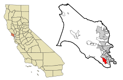
Location in Marin County and the state of California
|
|
| Country | |
| State | |
| County | Marin |
| Area | |
| • Total | 4.747 sq mi (12.29 km2) |
| • Land | 4.685 sq mi (12.13 km2) |
| • Water | 0.062 sq mi (0.16 km2) 1.31% |
| Population | |
| • Total | 11,492 |
| • Density | 2,452.93/sq mi (947.08/km2) |
| Time zone | UTC-8 (PST) |
| • Summer (DST) | UTC-7 (PDT) |
| ZIP code |
94941
|
| Area codes | 415/628 |
| FIPS code | 06-77805 |
Tamalpais-Homestead Valley is a special community in Marin County, California, United States. It is called a "census-designated place" (CDP). This means it is an area that the government counts for population. However, it is not an official city or town with its own local government. In 2020, about 11,492 people lived here.
Contents
Where is Tamalpais-Homestead Valley?
Tamalpais-Homestead Valley is located at 37°53′19″N 122°32′23″W / 37.888526°N 122.539609°W. It is next to Mill Valley on its north side. To the southeast, it borders Sausalito. The area is about a 10-minute drive north of San Francisco and the famous Golden Gate Bridge.
California State Route 1 runs through the Valley. This road is also known as Shoreline Highway or the Pacific Coast Highway. It is often used to reach the western parts of Marin County. Many cool places are nearby. These include the Golden Gate National Recreation Area and Mount Tamalpais State Park. You can also find Muir Woods National Monument, Tennessee Valley, and Muir Beach.
The total area of Tamalpais-Homestead Valley is about 4.7 square miles (12 km2). Only a small part of this area, about 0.06 square miles (0.16 km2), is water. This means most of the area is land.
People Living in Tamalpais-Homestead Valley
| Historical population | |||
|---|---|---|---|
| Census | Pop. | %± | |
| 2010 | 10,735 | — | |
| 2020 | 11,492 | 7.1% | |
| U.S. Decennial Census | |||
Population in 2010
In 2010, the population of Tamalpais-Homestead Valley was 10,735 people. Most of the people living here were White (88.0%). There were also people of Asian (5.5%), African American (0.8%), and Native American (0.2%) backgrounds. About 4.6% of the people were of Hispanic or Latino origin.
Most people lived in regular homes. About 23.9% of the population was under 18 years old. About 14.1% of the people were 65 years or older. The average age of people living here was about 45.5 years.
Most homes were owned by the people living in them (76.1%). About 23.9% of homes were rented.
Population in 2000
In 2000, there were 10,691 people living in the area. The racial makeup was similar to 2010. About 85.0% were White, and 5.5% were Asian. About 4.6% of people were of Hispanic or Latino origin.
About 20.1% of the people were under 18 years old. About 9.2% were 65 years or older. The average age was 42 years.
Education in the Valley
Most of Tamalpais-Homestead Valley is part of the Mill Valley Elementary School District. This district manages the local elementary schools. A smaller part of the area is in the Sausalito Marin City School District. All students in the area attend high school in the Tamalpais Union High School District.
See also
 In Spanish: Tamalpais-Homestead Valley para niños


