Hoosierville, Indiana facts for kids
Quick facts for kids
Hoosierville
|
|
|---|---|
| Country | United States |
| State | Indiana |
| County | Clay |
| Township | Jackson |
| Elevation | 653 ft (199 m) |
| ZIP code |
47834
|
| FIPS code | 18-34690 |
| GNIS feature ID | 436417 |
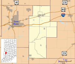
Hoosierville is a small, unincorporated community located in Jackson Township, Clay County, Indiana. This means it's a place where people live, but it doesn't have its own local government like a city or town. It is also part of the larger Terre Haute area.
History of Hoosierville
Hoosierville got its name from "Hoosier", which is a nickname for people from Indiana. A post office opened here in 1874. It helped people send and receive mail. However, the post office closed down in 1902. For a long time, the main job in Hoosierville was mining.
Where is Hoosierville?
Hoosierville is located in the state of Indiana. Its exact location can be found using special geographic coordinates: 39°28′30″N 87°06′30″W / 39.47500°N 87.10833°W. These numbers help pinpoint its spot on a map.
Black History Month on Kiddle
Famous African-American Inventors:
 | Shirley Ann Jackson |
 | Garett Morgan |
 | J. Ernest Wilkins Jr. |
 | Elijah McCoy |

All content from Kiddle encyclopedia articles (including the article images and facts) can be freely used under Attribution-ShareAlike license, unless stated otherwise. Cite this article:
Hoosierville, Indiana Facts for Kids. Kiddle Encyclopedia.

