Hooversville, Pennsylvania facts for kids
Quick facts for kids
Hooversville, Pennsylvania
|
|
|---|---|
|
Borough
|
|

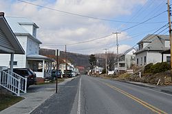
Houses on Barn Street
|
|

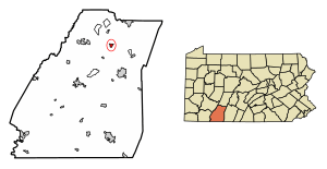
Location of Hooversville in Somerset County, Pennsylvania.
|
|
| Country | United States |
| State | Pennsylvania |
| County | Somerset |
| Settled | 1836 |
| Incorporated | 1896 |
| Government | |
| • Type | Borough Council |
| Area | |
| • Total | 0.61 sq mi (1.58 km2) |
| • Land | 0.61 sq mi (1.58 km2) |
| • Water | 0.00 sq mi (0.00 km2) |
| Population
(2020)
|
|
| • Total | 628 |
| • Density | 1,027.82/sq mi (397.12/km2) |
| Time zone | UTC-5 (Eastern (EST)) |
| • Summer (DST) | UTC-4 (EDT) |
| Zip code |
15936
|
| Area code(s) | 814 |
| FIPS code | 42-35608 |
Hooversville is a small town, called a borough, located in Somerset County, Pennsylvania, in the United States. It's part of the larger Johnstown, Pennsylvania area. In 2020, about 626 people lived there.
Contents
A Look at Hooversville's Past
Hooversville was started in 1836. The first people to claim land in this area were George Lohr, Michael Kocher, and Casper Ripple.
Jonas Hoover, who founded Hooversville, arrived in Quemahoning Township in 1834. He bought land from Casper Ripple's family. In 1836, he planned out the first streets, like Water and Main Streets.
Jonas Hoover was a farmer. He also ran a gristmill (for grinding grain) and a sawmill (for cutting wood) on Hoover Street in 1847. He helped establish the German Reformed Church in Hooversville.
Today, Hooversville is mostly a residential town. It has a few local businesses like a hardware store, a funeral home, and a service garage. There used to be gas stations, but they are now closed.
Where is Hooversville Located?
Hooversville is found at specific coordinates: 40.149267 degrees North and -78.914062 degrees West. It covers about 0.7 square miles (1.8 square kilometers) of land.
The town is on the eastern edge of Quemahoning Township. It borders Shade Township.
Pennsylvania Route 403 is the main road that goes through Hooversville. You can also reach U.S. Route 30 by driving about five miles south on Route 403.
Who Lives in Hooversville?
| Historical population | |||
|---|---|---|---|
| Census | Pop. | %± | |
| 1900 | 465 | — | |
| 1910 | 990 | 112.9% | |
| 1920 | 1,345 | 35.9% | |
| 1930 | 1,448 | 7.7% | |
| 1940 | 1,364 | −5.8% | |
| 1950 | 1,240 | −9.1% | |
| 1960 | 1,120 | −9.7% | |
| 1970 | 962 | −14.1% | |
| 1980 | 863 | −10.3% | |
| 1990 | 731 | −15.3% | |
| 2000 | 779 | 6.6% | |
| 2010 | 645 | −17.2% | |
| 2020 | 626 | −2.9% | |
| 2021 (est.) | 620 | −3.9% | |
| Sources: | |||
In 2000, there were 779 people living in Hooversville. These people lived in 335 households, and 213 of these were families.
Most people in Hooversville are White (98.84%). A small number are African American, Native American, or from two or more races.
About 25.7% of households had children under 18 living with them. Many households (48.4%) were married couples living together. About 17.9% of households had someone aged 65 or older living alone.
The average age of people in Hooversville in 2000 was 40 years old. About 23.1% of the population was under 18. Also, 19.4% of the people were 65 years or older.
See also
 In Spanish: Hooversville para niños
 | Calvin Brent |
 | Walter T. Bailey |
 | Martha Cassell Thompson |
 | Alberta Jeannette Cassell |


