
Somerset County, Pennsylvania facts for kids
Quick facts for kids
Somerset County
|
|||
|---|---|---|---|

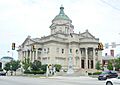
Somerset County Courthouse
|
|||
|
|||

Location within the U.S. state of Pennsylvania
|
|||
 Pennsylvania's location within the U.S. |
|||
| Country | |||
| State | |||
| Founded | April 17, 1795 | ||
| Named for | Somerset | ||
| Seat | Somerset | ||
| Largest borough | Somerset | ||
| Area | |||
| • Total | 1,081 sq mi (2,800 km2) | ||
| • Land | 1,074 sq mi (2,780 km2) | ||
| • Water | 6.6 sq mi (17 km2) 0.6%% | ||
| Population
(2020)
|
|||
| • Total | 74,129 | ||
| • Density | 69/sq mi (27/km2) | ||
| Time zone | UTC−5 (Eastern) | ||
| • Summer (DST) | UTC−4 (EDT) | ||
| Congressional district | 14th | ||


Somerset County is a special area in Pennsylvania, a state in the United States. It's like a big neighborhood with its own local government. In 2020, about 74,129 people lived here. The main town, or "county seat," where the government offices are, is called Somerset.
Somerset County was created a long time ago, on April 17, 1795. It was formed from a part of Bedford County. The county got its name from Somerset in England. It's located in the southwestern part of Pennsylvania.
This county is part of a larger area called the Somerset, PA micropolitan statistical area. This just means it's a smaller city area that is connected to the bigger Johnstown area.
Somerset County is well-known for a very important event. It was the crash site of United Airlines Flight 93 on September 11, 2001. This plane was one of four involved in the September 11 attacks. The passengers bravely fought against hijackers, stopping the plane from hitting a major building in Washington, D.C.
The Amish community in Somerset County is also very old. It started in 1772 and is the second oldest Amish community that still exists today. You can find it in the southern part of the county, near towns like Meyersdale and Springs.
Contents
- History of Somerset County
- Geography and Climate
- Major Roads
- Neighboring Counties
- Special Protected Areas
- Geology: The Rocks and Rivers of Somerset County
- Population and People
- Education in Somerset County
- Culture and Arts
- Communities in Somerset County
- Famous People from Somerset County
- Images for kids
- See also
History of Somerset County
How Somerset County Was Formed

Long ago, southwestern Pennsylvania was a huge area called Cumberland County. As more people moved in, this large area was divided into smaller counties. Bedford County was created from Cumberland in 1771. It was so big that people called it "Old Bedford County."
Over time, Old Bedford County was split into many smaller counties. In 1773, Westmoreland County was formed. Then, in 1787, Bedford County was split in half, creating Huntingdon County to the north.
Somerset County was officially created on April 17, 1795. It was made from the western part of Bedford County. The name "Somerset" came from a county in England. A few years later, in 1804, the northern part of Somerset County became Cambria County. Since then, Somerset County has stayed the same size.
Early Days and Important Roads
Before the French and Indian War, George Washington explored the Somerset County area in 1753. A few years later, the Forbes Road was built through the county. This was a very important 200-mile road from Carlisle to what is now Pittsburgh.
British General John Forbes created this road in 1758. It helped the British bring supplies to capture the French Fort Duquesne. The Forbes Road was one of the main paths for pioneers traveling west to the Ohio Country.
The first people to live permanently in what is now Somerset County were fur trappers and hunters. Around 1770, families from New Jersey moved to a region called Turkeyfoot.
United Airlines Flight 93: A Story of Courage
Somerset County became known worldwide in 2001 because of United Airlines Flight 93. This hijacked plane crashed in Stonycreek Township, near Shanksville. This was part of the terrible September 11 attacks.
The plane's voice recorder showed that the passengers and crew fought the hijackers. They learned that other planes had crashed into buildings that morning. When the hijackers realized they might lose control, they crashed the plane on purpose.
The brave actions of those on Flight 93 saved many lives. The crash site is now a special place called the Flight 93 National Memorial. It is cared for by the National Park System. A U.S. Navy ship, the USS Somerset, was named to remember this tragedy.
In July 2002, Somerset County was in the news again. Nine coal miners were trapped deep underground in the Quecreek mine. After a difficult multi-day effort, all nine miners were safely rescued.
Geography and Climate
Somerset County covers about 1,081 square miles. Most of this area is land, with a small amount of water. It's located in the southern part of Pennsylvania, right along the border with Maryland.
The county shares borders with Garrett County and Allegany County in Maryland. In Pennsylvania, it borders Fayette County, Westmoreland County, Cambria County, and Bedford County.
Weather in Somerset County
Somerset County gets a lot of snow, especially in its higher areas. It's one of the snowiest places where people live in the United States. Some parts get over 150 inches of snow each winter! This is because of its elevation and its location near both the Great Lakes and the Atlantic Ocean. Snow can fall from late October through early April. It has even snowed in every month except July.
Mount Davis, the highest point in Pennsylvania, is in the southern part of Somerset County. It stands at 3,213 feet high.
Major Roads


 I-70 / I-76 / Penna Turnpike
 US 30
US 30 US 40
US 40 US 219


US 219 Bus. PA 31
PA 31 PA 56
PA 56 PA 160
 PA 271
 PA 281
 PA 403
 PA 523
 PA 601
 PA 653
 PA 669
 PA 985
Neighboring Counties
- Cambria County (north)
- Bedford County (east)
- Allegany County, Maryland (southeast)
- Garrett County, Maryland (southwest)
- Fayette County (west)
- Westmoreland County (northwest)
Special Protected Areas
- Flight 93 National Memorial
- Kooser State Park
- Laurel Hill State Park
- Laurel Mountain State Park
- Laurel Ridge State Park
Geology: The Rocks and Rivers of Somerset County
Somerset County is located where the Allegheny Plateau meets the Ridge and Valley mountains. This means the area has gently folded layers of rock that are very old. These rocks are mostly made of sand, mud, and pebbles. There are no volcanic rocks or rocks changed by heat and pressure here.
The mountains in the county include Laurel Hill, Negro Mountain, Meadow Mountain, Savage Mountain, and Allegheny Mountain. Mount Davis, the highest point in Pennsylvania, is part of Negro Mountain.
During the Ice Age, Somerset County was not covered by glaciers. However, the cold weather made the area look like a tundra, a treeless plain. You can still see signs of this old landscape at Mount Davis.
Many rivers and streams flow through Somerset County. In the southwest, the Casselman River and Laurel Hill Creek flow into the Youghiogheny River. In the northwest, the Stonycreek River, Shade Creek, and Quemahoning Creek flow into the Conemaugh River. All these rivers eventually lead to the Mississippi River.
In the southeast, Wills Creek flows into the Potomac River. The Raystown Branch of the Juniata River also starts here. Both the Potomac and Juniata rivers flow into the Chesapeake Bay.
Somerset County has many coal deposits, especially a type called bituminous coal. Much of this coal has been mined. Unfortunately, many old mines cause a problem called acid mine drainage. This polluted water can harm streams and make them unable to support fish.
Population and People
| Historical population | |||
|---|---|---|---|
| Census | Pop. | %± | |
| 1800 | 10,188 | — | |
| 1810 | 11,284 | 10.8% | |
| 1820 | 13,974 | 23.8% | |
| 1830 | 17,762 | 27.1% | |
| 1840 | 19,650 | 10.6% | |
| 1850 | 24,416 | 24.3% | |
| 1860 | 26,778 | 9.7% | |
| 1870 | 28,226 | 5.4% | |
| 1880 | 33,110 | 17.3% | |
| 1890 | 37,317 | 12.7% | |
| 1900 | 49,461 | 32.5% | |
| 1910 | 67,717 | 36.9% | |
| 1920 | 82,112 | 21.3% | |
| 1930 | 80,764 | −1.6% | |
| 1940 | 84,957 | 5.2% | |
| 1950 | 81,813 | −3.7% | |
| 1960 | 77,450 | −5.3% | |
| 1970 | 76,037 | −1.8% | |
| 1980 | 81,243 | 6.8% | |
| 1990 | 78,218 | −3.7% | |
| 2000 | 80,023 | 2.3% | |
| 2010 | 77,742 | −2.9% | |
| 2020 | 74,129 | −4.6% | |
| U.S. Decennial Census 1790–1960 1900–1990 1990–2000 2010–2017 2010-2020 |
|||
In 2000, there were about 80,023 people living in Somerset County. Most people (about 97%) were White. About 1.5% were Black or African American. A small number of people were Native American, Asian, or from other backgrounds. About 0.66% of the population was Hispanic or Latino.
Many families in the county had children under 18 living at home. The average age of people in the county was 40 years old.
Population in 2020
| Race | Num. | Perc. |
|---|---|---|
| White (NH) | 69,044 | 93.1% |
| Black or African American (NH) | 1,860 | 2.51% |
| Native American (NH) | 50 | 0.1% |
| Asian (NH) | 194 | 0.26% |
| Pacific Islander (NH) | 7 | 0.01% |
| Other/Mixed (NH) | 1,934 | 2.61% |
| Hispanic or Latino | 1,037 | 1.4% |
Education in Somerset County
Public Schools

Here are the public school districts in Somerset County:
- Berlin Brothersvalley School District
- Conemaugh Township Area School District
- Meyersdale Area School District
- North Star School District
- Rockwood Area School District
- Salisbury-Elk Lick School District
- Shade-Central City School District
- Shanksville-Stonycreek School District
- Somerset Area School District
- Turkeyfoot Valley Area School District
- Windber Area School District (also in Cambria County)
Culture and Arts
Somerset County has a lively arts scene. The Mountain Playhouse in Jennerstown, Pennsylvania, is one of the oldest "summer-stock" theaters in the country. It has been putting on live plays from May through October for over sixty years.
Laurel Arts is an important arts center in rural Pennsylvania. It offers art classes, music lessons, and dance classes. It also hosts art shows by local artists.
The Rockwood Opera House in Rockwood, Pennsylvania, is a historic building. It was restored to look like it did in 1890. Since reopening in 2000, it has hosted dinner theater shows. These include tribute artists and community plays.
Communities in Somerset County

In Pennsylvania, there are different types of towns and areas. These include cities, boroughs, and townships. Here are the boroughs and townships in Somerset County:
Boroughs (Towns)
- Addison
- Benson
- Berlin
- Boswell
- Callimont
- Casselman
- Central City
- Confluence
- Garrett
- Hooversville
- Indian Lake
- Jennerstown
- Meyersdale
- New Baltimore
- New Centerville
- Paint
- Rockwood
- Salisbury
- Seven Springs (partly in Fayette County)
- Shanksville
- Somerset (county seat)
- Stoystown
- Ursina
- Wellersburg
- Windber
Townships (Larger Rural Areas)
- Addison
- Allegheny
- Black
- Brothersvalley
- Conemaugh
- Elk Lick
- Fairhope
- Greenville
- Jefferson
- Jenner
- Larimer
- Lincoln
- Lower Turkeyfoot
- Middlecreek
- Milford
- Northampton
- Ogle
- Paint
- Quemahoning
- Shade
- Somerset
- Southampton
- Stonycreek
- Summit
- Upper Turkeyfoot
Census-Designated Places (CDPs)
These are areas the U.S. Census Bureau uses for collecting data. They are not official towns or cities.
Other Small Communities
Largest Communities by Population (2010 Census)
† county seat
| Rank | City/Town/etc. | Municipal type | Population (2010 Census) |
|---|---|---|---|
| 1 | Somerset | Township | 12,122 |
| 2 | Conemaugh | Township | 7,452 |
| 3 | † Somerset | Borough | 6,277 |
| 4 | Windber | Borough | 4,683 |
| 5 | Brothersvalley | Township | 4,184 |
| 6 | Jenner | Township | 4,054 |
| 7 | Paint | Township | 3,300 |
| 8 | Shade | Township | 2,886 |
| 9 | Summit | Township | 2,368 |
| 10 | Elk Lick | Township | 2,293 |
| 11 | Stonycreek | Township | 2,237 |
| 12 | Meyersdale | Borough | 2,184 |
| 13 | Quemahoning | Township | 2,180 |
| 14 | Berlin | Borough | 2,104 |
| 15 | Lincoln | Township | 1,669 |
| 16 | Milford Twp | Township | 1,561 |
| 17 | Friedens | CDP | 1,523 |
| 18 | Jefferson | Township | 1,375 |
| 19 | Boswell | Borough | 1,277 |
| 20 | Lower Turkeyfoot | Township | 1,232 |
| 21 | Davidsville | CDP | 1,130 |
| 22 | Central City | Borough | 1,124 |
| 23 | Paint | Borough | 1,023 |
| 24 | Addison | Township | 1,019 |
| 25 | Jerome | CDP | 1,017 |
| 26 | Black | Township | 980 |
| 27 | Rockwood | Borough | 890 |
| 28 | Middlecreek | Township | 797 |
| 29 | Confluence | Borough | 780 |
| 30 | Salisbury | Borough | 727 |
| 31 | Greenville | Township | 718 |
| 32 | Jennerstown | Borough | 695 |
| 33 | Lower Turkeyfoot | Township | 672 |
| 34 | Southampton | Township | 655 |
| 35 | Allegheny | Township | 654 |
| 36 | Hooversville | Borough | 645 |
| 37 | Larimer | Township | 590 |
| 38 | Ogle | Township | 588 |
| 39 | Cairnbrook | CDP | 520 |
| 40 | Garrett | Borough | 456 |
| 41 | Indian Lake | Borough | 394 |
| 42 | Northampton | Township | 366 |
| 43 | Stoystown | Borough | 355 |
| 44 | Shanksville | Borough | 237 |
| 45 | Ursina | Borough | 225 |
| 46 | Addison | Borough | 207 |
| 47 | Benson | Borough | 191 |
| 48 | Wellersburg | Borough | 181 |
| 49 | New Baltimore | Borough | 180 |
| 50 | Fairhope | Township | 137 |
| 51 | New Centerville | Borough | 133 |
| 52 | Casselman | Borough | 94 |
| 53 | Edie | CDP | 83 |
| 54 | Callimont | Borough | 41 |
| 55 | Seven Springs (partially in Fayette County) | Borough | 26 |
Famous People from Somerset County
- Jeremiah S. Black: He was a very important lawyer who worked for the U.S. government in the 1850s and 1860s. He was the Attorney General and Secretary of State for President James Buchanan.
- George Chorpenning: A pioneer in transportation.
- Alexander Hamilton Coffroth: A U.S. Representative in the 1800s. He was also the last person to die who had been a pallbearer at Abraham Lincoln's funeral.
- Larry Critchfield: An NFL football player.
- Joseph Darby: A former U.S. Army sergeant. He was the first soldier to report the mistreatment of prisoners at Abu Ghraib.
- Joseph F. Loy: A lawyer and state senator in Wisconsin.
- Howard Shultz Miller: A U.S. Representative from Kansas.
- Keith Malley: A comedian and co-host of the "Keith and The Girl" podcast.
- Edwin S. Porter: A silent movie director, famous for The Great Train Robbery.
- Joseph C. Pringey: A U.S. Representative from Oklahoma.
- Rip Engle: A successful college football coach for Brown University and Penn State University.
Images for kids
-
Somerset County Courthouse
See also
 In Spanish: Condado de Somerset (Pensilvania) para niños
