
Rockwood, Pennsylvania facts for kids
Quick facts for kids
Rockwood, Pennsylvania
previously Mineral Point (c. 1857)
|
|
|---|---|
|
Borough
|
|

View down Bridge St.
|
|

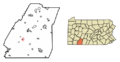
Location of Rockwood in Somerset County, Pennsylvania.
|
|

Rockwood, Pennsylvania
Location in Pennsylvania
|
|
| Country | United States |
| State | Pennsylvania |
| County | Somerset |
| Settled | 1857 |
| Incorporated | 1885 |
| Government | |
| • Type | Borough Council |
| Area | |
| • Total | 0.33 sq mi (0.87 km2) |
| • Land | 0.33 sq mi (0.87 km2) |
| • Water | 0.00 sq mi (0.00 km2) |
| Elevation | 1,837 ft (560 m) |
| Population
(2020)
|
|
| • Total | 843 |
| • Density | 2,523.95/sq mi (974.27/km2) |
| Time zone | UTC-5 (Eastern (EST)) |
| • Summer (DST) | UTC-4 (EDT) |
| Zip code |
15557
|
| Area code(s) | 814 |
| FIPS code | 42-65736 |
Rockwood is a small town, called a borough, located in Somerset County, Pennsylvania, United States. In 2020, about 850 people lived there. Rockwood is part of the Johnstown, Pennsylvania area. It is found just north of Mount Davis, which is Pennsylvania's highest point. This mountain makes it tricky to travel south from Rockwood by land.
Contents
History of Rockwood
Rockwood has a rich history, starting as a small settlement and growing into the community it is today.
How Rockwood Started

Rockwood was first known by other names like Shaff's Bridge and Mineral Point. In 1856, Philip Wolfersberger built the first house in the area. He then planned out the town in 1857 with the help of Martin Meyers.
Over the next few years, more buildings and services appeared. A hotel was built in 1860 by John Poister. A post office opened in 1868, making it easier to send and receive mail. Henry Werner built a tannery in 1869, which processed animal hides. A railroad station was added in 1871, connecting the town to the wider world.
Businesses also began to thrive. J.D. Miller and E.D. Miller opened a store called Miller & Bro. In 1874, they partnered with Samuel A. Haines, forming Miller Bros. & Haines.
The Name Rockwood and Railroads
Philip Stauffer Wolfersberger, Philip Wolfersberger's son, worked for the Baltimore & Ohio Railroad (B&O). He played a big part in changing the town's name to Rockwood. The B&O Railroad was very important for travel and trade across the Appalachian Mountains.
The B&O line still runs through Rockwood today. It is now owned by CSX. You can also see Amtrak trains pass through, traveling between Pittsburgh and Cumberland, MD. Rockwood was an important stop for people moving west after the American Revolution.
Notable Events and Growth

Over the years, Rockwood saw some interesting events. In 1907, President Theodore Roosevelt made a quick stop in Rockwood. He was on his way to a funeral in Ohio.
The town also grew as a community of faith. By 1914, there were at least five different church groups in Rockwood. These included Lutheran, Methodist, Reformed, United Brethren, and United Evangelical churches.
A historic building, the Penrose Wolf Building, was added to the National Register of Historic Places in 2002. This means it is recognized as an important historical site.
Geography of Rockwood
Rockwood is located at coordinates 39°54′58″N 79°9′21″W / 39.91611°N 79.15583°W. It sits near the western side of the Eastern Continental Divide. This divide separates river systems that flow to the Potomac and Mississippi.
The town is on the north bank of the Casselman River. This river starts in nearby Western Maryland. Rockwood is also just west of where the Casselman River meets Coxes Creek.
The United States Census Bureau states that Rockwood covers about 0.3 square miles (0.87 square kilometers) of land. There is no water area within the borough.
Population and People
Rockwood has seen its population change over the years.
| Historical population | |||
|---|---|---|---|
| Census | Pop. | %± | |
| 1880 | 331 | — | |
| 1890 | 553 | 67.1% | |
| 1900 | 685 | 23.9% | |
| 1910 | 1,300 | 89.8% | |
| 1920 | 1,362 | 4.8% | |
| 1930 | 1,176 | −13.7% | |
| 1940 | 1,375 | 16.9% | |
| 1950 | 1,237 | −10.0% | |
| 1960 | 1,101 | −11.0% | |
| 1970 | 1,051 | −4.5% | |
| 1980 | 1,058 | 0.7% | |
| 1990 | 1,014 | −4.2% | |
| 2000 | 954 | −5.9% | |
| 2010 | 890 | −6.7% | |
| 2020 | 850 | −4.5% | |
| 2021 (est.) | 842 | −5.4% | |
| Sources: | |||
Who Lives in Rockwood?
According to the 2000 census, there were 954 people living in Rockwood. These people made up 406 households and 272 families. The population density was about 3,053 people per square mile.
Most residents were White (99.58%). A small number were Native American or Asian, or from two or more races.
Households and Families
About 29.8% of households had children under 18 living with them. Many households (51.2%) were married couples living together. About 11.6% had a female head of household without a husband present.
The average household had 2.28 people. The average family had 2.79 people.
Age and Income
The population in Rockwood was spread out by age. About 22.0% were under 18. About 18.1% were 65 or older. The average age was 39 years old.
The median income for a household was $25,139. For a family, it was $31,023. The average income per person was $13,687. About 15.1% of the population lived below the poverty line.
Schools in Rockwood
The children of Rockwood attend schools in the Rockwood Area School District.
Local Schools
The district includes Rockwood Area Elementary School and Rockwood Area Junior/Senior High School. Both schools are located near the edge of Rockwood, next to Milford Township.
Another elementary school in the district, Kingwood Elementary School, is now closed. The building was sold to the Kingwood Church of God.
Typically, between 65 and 80 students graduate from Rockwood Area High School each year.
Transportation in Rockwood
Rockwood is connected to other areas by roads and has a history with railroads.
Roads and Highways
Pennsylvania Route 653 runs through Rockwood. It enters the town as Bridge Street and then turns onto Main Street. This route connects Rockwood to places like New Centerville.
The closest major highway is the Pennsylvania Turnpike. You can access it at Somerset (Exit 110), which is about 10 miles (16 km) north of Rockwood.
Railroad Connections
Historically, Rockwood was a stop for passenger trains on the Baltimore & Ohio line until 1971.
Since 1981, Amtrak's Capitol Limited train passes through Rockwood. However, it does not stop there. Local officials have been trying to get Rockwood added as a stop since 1990. In 2009, a study estimated that a new station would cost about $2.2 million. Supporters believe a train stop could help local resorts like Seven Springs and Hidden Valley by bringing more tourists to the area.
Images for kids
-
Location of Rockwood in Somerset County, Pennsylvania.
See also
 In Spanish: Rockwood (Pensilvania) para niños
