
Westmoreland County, Pennsylvania facts for kids
Quick facts for kids
Westmoreland County
|
|||
|---|---|---|---|

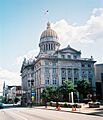
Westmoreland County Courthouse
|
|||
|
|||

Location within the U.S. state of Pennsylvania
|
|||
 Pennsylvania's location within the U.S. |
|||
| Country | |||
| State | |||
| Founded | February 26, 1773 | ||
| Named for | Westmorland | ||
| Seat | Greensburg | ||
| Largest city | Hempfield Township | ||
| Area | |||
| • Total | 1,036 sq mi (2,680 km2) | ||
| • Land | 1,028 sq mi (2,660 km2) | ||
| • Water | 8.5 sq mi (22 km2) 0.8% | ||
| Population
(2020)
|
|||
| • Total | 354,663 | ||
| • Density | 345/sq mi (133/km2) | ||
| Time zone | UTC−5 (Eastern) | ||
| • Summer (DST) | UTC−4 (EDT) | ||
| Congressional districts | 13th, 14th | ||


Westmoreland County is a county in Pennsylvania, United States. It is part of the Pittsburgh area. In 2020, about 354,663 people lived here.
The main town, or county seat, is Greensburg. The largest community is Hempfield Township. The county is named after Westmorland, a historic county in England. Westmoreland County is in the Southwest Pennsylvania region.
It was formed on February 26, 1773. It was the first county in Pennsylvania located entirely west of the Allegheny Mountains. Westmoreland County used to be much larger. It included parts of many other counties we know today. These included Fayette, Washington, and Greene. It also included parts of Beaver, Allegheny, Indiana, and Armstrong counties.
Contents
History of Westmoreland County
Westmoreland County was created on February 26, 1773. It was formed from parts of Lancaster, Northumberland, and Bedford counties. This made it the first county in Pennsylvania fully west of the Allegheny Mountains.
The county was originally much bigger. It included areas that are now Fayette, Washington, and Greene counties. It also covered parts of Beaver, Allegheny, Indiana, and Armstrong counties. The county gets its name from Westmorland, a historic county in England.
Geography and Climate
Westmoreland County covers about 1,036 square miles. Most of this area, 1,028 square miles, is land. About 8.5 square miles, or 0.8%, is water. The county is part of the Appalachian region.
Weather in Westmoreland County
Westmoreland County has a humid continental climate. This means it has warm summers and cold winters. Average temperatures in Greensburg range from 28.7°F in January to 71.8°F in July. Other towns like Murrysville, Latrobe, and Ligonier have similar temperatures.
Neighboring Counties
Westmoreland County shares borders with several other counties:
- Armstrong County (north)
- Indiana County (north)
- Cambria County (east)
- Somerset County (southeast)
- Fayette County (south)
- Washington County (west)
- Allegheny County (west)
- Butler County (northwest)
Main Roads and Highways
Many important roads pass through Westmoreland County. These highways help people travel and transport goods.
 I-70
I-70
 I-76 / Penna Turnpike
 US 30
US 30 US 22
US 22 US 119
 PA 31
PA 31 PA 51
PA 51 PA 56
PA 56
PA 56 Truck
 PA 66 / Toll PA 66
PA 66 Bus.
PA 66 Alt. PA 130
 PA 136
 PA 201
 PA 217
 PA 259
 PA 271
 PA 286
 PA 356
 PA 366
 PA 380
 PA 381
 PA 711
 PA 780
 PA 819
 PA 906
 PA 981
 PA 982
 PA 993
People of Westmoreland County
| Historical population | |||
|---|---|---|---|
| Census | Pop. | %± | |
| 1790 | 16,019 | — | |
| 1800 | 22,726 | 41.9% | |
| 1810 | 26,392 | 16.1% | |
| 1820 | 30,540 | 15.7% | |
| 1830 | 38,400 | 25.7% | |
| 1840 | 42,699 | 11.2% | |
| 1850 | 51,726 | 21.1% | |
| 1860 | 53,736 | 3.9% | |
| 1870 | 58,719 | 9.3% | |
| 1880 | 78,036 | 32.9% | |
| 1890 | 112,819 | 44.6% | |
| 1900 | 160,175 | 42.0% | |
| 1910 | 231,304 | 44.4% | |
| 1920 | 273,568 | 18.3% | |
| 1930 | 294,995 | 7.8% | |
| 1940 | 303,411 | 2.9% | |
| 1950 | 313,179 | 3.2% | |
| 1960 | 352,629 | 12.6% | |
| 1970 | 376,935 | 6.9% | |
| 1980 | 392,294 | 4.1% | |
| 1990 | 370,321 | −5.6% | |
| 2000 | 369,993 | −0.1% | |
| 2010 | 365,169 | −1.3% | |
| 2020 | 354,663 | −2.9% | |
| U.S. Decennial Census 1790-1960 1900-1990 1990-2000 2010-2019 2010-2020 |
|||
In 2010, there were 365,169 people living in Westmoreland County. There were 153,650 households. The population density was about 355 people per square mile.
Most people in the county were White (95.3%). About 2.3% were Black or African American. Other groups like Native American and Asian people also lived there. About 0.9% of the population was Hispanic or Latino.
In 2010, about 24.5% of households had children under 18. The average household had 2.32 people. The average family had 2.86 people. The median age in the county was 45.1 years old.
2020 Census Information
The 2020 census showed the following racial makeup for Westmoreland County:
| Race | Num. | Perc. |
|---|---|---|
| White (Non-Hispanic) | 323,114 | 91.1% |
| Black or African American (Non-Hispanic) | 8,985 | 2.53% |
| Native American (Non-Hispanic) | 295 | 0.1% |
| Asian (Non-Hispanic) | 3,301 | 1% |
| Pacific Islander (Non-Hispanic) | 36 | 0.01% |
| Other/Mixed (Non-Hispanic) | 13,702 | 3.86% |
| Hispanic or Latino | 5,230 | 1.47% |
Education in Westmoreland County
Westmoreland County has many schools and colleges.
Public School Districts

Here are the public school districts in the county:
- Belle Vernon Area School District (also in Fayette County)
- Blairsville-Saltsburg School District (also in Indiana County)
- Burrell School District
- Derry Area School District
- Franklin Regional School District
- Greater Latrobe School District
- Greensburg-Salem School District
- Hempfield Area School District
- Jeannette City School District
- Kiski Area School District (also in Armstrong County)
- Leechburg Area School District (also in Armstrong County)
- Ligonier Valley School District
- Monessen City School District
- Mount Pleasant Area School District
- New Kensington–Arnold School District
- Norwin School District
- Penn-Trafford School District (also in Allegheny County)
- Southmoreland School District (also in Fayette County)
- Yough School District
Public Charter Schools
- Dr. Robert Ketterer Charter School in Latrobe serves grades 7 through 12. It opened in 2008.
Private High Schools
- Greensburg Central Catholic High School
Colleges and Universities
Students can attend several colleges and universities in the county:
- Penn State New Kensington
- Seton Hill University
- Saint Vincent College
- Westmoreland County Community College
- University of Pittsburgh at Greensburg
- Carlow University at Youngwood
- Triangle Tech
Other Educational Centers
- Central Westmoreland Career and Technology Center
- Northern Westmoreland Career and Technology Center
- Eastern Westmoreland Career and Technology Center
- Valley School of Ligonier
Economy and Jobs
After the Civil War, coal mining became a big industry in Westmoreland County. Then, iron, steel, and glass factories grew. Many towns were built just for miners. These were called "coal patches." A large coal miners' strike happened in 1910–1911. Sixteen people died during this strike.
In 2020, the main jobs in the county were in health care and social services (16.3%). Manufacturing was also important (13.8%), as was retail trade (13.7%). Mining now makes up less than 1% of jobs. Over 100 old, unused mines are thought to be in the county.
The Volkswagen car plant was near New Stanton. It was the first foreign-owned car factory in the U.S. It made cars from 1978 to 1988.
Fun and Recreation

Westmoreland County has four Pennsylvania state parks. These parks offer places for outdoor activities.
Communities in Westmoreland County

Pennsylvania law has four types of towns: cities, boroughs, townships, and sometimes towns. Westmoreland County has cities, boroughs, and townships.
Cities
- Arnold
- Greensburg (county seat)
- Jeannette
- Latrobe
- Lower Burrell
- Monessen
- New Kensington
Boroughs
- Adamsburg
- Arona
- Avonmore
- Bolivar
- Delmont
- Derry
- Donegal
- East Vandergrift
- Export
- Hunker
- Hyde Park
- Irwin
- Laurel Mountain
- Ligonier
- Madison
- Manor
- Mount Pleasant
- Murrysville
- New Alexandria
- New Florence
- New Stanton
- North Belle Vernon
- North Irwin
- Oklahoma
- Penn
- Scottdale
- Seward
- Smithton
- South Greensburg
- Southwest Greensburg
- Sutersville
- Trafford (partly in Allegheny County)
- Vandergrift
- West Leechburg
- West Newton
- Youngstown
- Youngwood
Townships
- Allegheny
- Bell
- Cook
- Derry
- Donegal
- East Huntingdon
- Fairfield
- Hempfield
- Ligonier
- Loyalhanna
- Mount Pleasant
- North Huntingdon
- Penn
- Rostraver
- St. Clair
- Salem
- Sewickley
- South Huntingdon
- Unity
- Upper Burrell
- Washington
Census-Designated Places (CDPs)
CDPs are areas the U.S. Census Bureau uses for data. They are not official towns.
Other Unincorporated Communities
These are smaller communities not officially part of a city, borough, or township.
- Acme
- Alverton
- Ardara
- Armbrust
- Baggaley
- Bessemer
- Blackstone
- Boquet
- Bovard
- Brenizer
- Carbon
- Claridge
- Forbes Road
- Greenwald
- Hannastown
- Hopewell
- Hutchinson
- Jacobs Creek
- Jones Mills
- Kecksburg
- Larimer
- Laughlintown
- Lloydsville
- Lowber
- Luxor
- Marguerite
- Morewood
- Moween
- New Derry
- Pandora
- Peanut
- Pleasant Unity
- Reagantown
- Rector
- Reduction
- Ruffs Dale
- Salina
- Scab Hill
- Seger
- Southwest
- Stahlstown
- Standard Shaft
- Tarrs
- Torrance
- Trauger
- Turkeytown
- United
- Wendel
- Westmoreland City
- Whitney
- Yohoghany
Former Communities
- Cokeville / Coketown
- Franklin Township - now known as Murrysville, Pennsylvania
Largest Communities by Population
This table shows the largest communities in Westmoreland County based on the 2010 census. † county seat
| Rank | City/Town/etc. | Municipal type | Population (2010 Census) |
|---|---|---|---|
| 1 | Murrysville | Municipality | 20,079 |
| 2 | † Greensburg | City | 14,892 |
| 3 | New Kensington | City | 13,116 |
| 4 | Lower Burrell | City | 11,761 |
| 5 | Jeannette | City | 9,654 |
| 6 | Latrobe | City | 8,338 |
| 7 | Monessen | City | 7,720 |
| 8 | Vandergrift | Borough | 5,205 |
| 9 | Arnold | City | 5,157 |
| 10 | Mount Pleasant | Borough | 4,454 |
| 11 | Scottdale | Borough | 4,384 |
| 12 | Level Green | CDP | 4,020 |
| 13 | Irwin | Borough | 3,973 |
| 14 | Loyalhanna | CDP | 3,428 |
| 15 | Manor | Borough | 3,239 |
| 16 | Trafford (partially in Allegheny County) | Borough | 3,174 |
| 17 | Youngwood | Borough | 3,050 |
| 18 | Derry | Borough | 2,688 |
| 19 | Delmont | Borough | 2,686 |
| 20 | West Newton | Borough | 2,633 |
| 21 | Lawson Heights | CDP | 2,194 |
| 22 | New Stanton | Borough | 2,173 |
| 23 | Southwest Greensburg | Borough | 2,155 |
| 24 | South Greensburg | Borough | 2,117 |
| 25 | Lynnwood-Pricedale | CDP | 2,031 |
| 26 | North Belle Vernon | Borough | 1,971 |
| 27 | Ligonier | Borough | 1,573 |
| 28 | St. Vincent College | CDP | 1,357 |
| 29 | West Leechburg | Borough | 1,294 |
| 30 | Calumet | CDP | 1,241 |
| 31 | Fellsburg | CDP | 1,180 |
| 32 | Collinsburg | CDP | 1,125 |
| 33 | Avonmore | Borough | 1,011 |
| 34 | Norvelt | CDP | 948 |
| 35 | Export | Borough | 917 |
| 36 | North Irwin | Borough | 846 |
| 37 | Oklahoma | Borough | 809 |
| 38 | Herminie | CDP | 789 |
| 39 | Hostetter | CDP | 740 |
| 40 | New Florence | Borough | 689 |
| 41 | Yukon | CDP | 677 |
| 42 | East Vandergrift | Borough | 674 |
| 43 | Sutersville | Borough | 605 |
| 44 | Millwood | CDP | 566 |
| 45 | New Alexandria | Borough | 560 |
| 46 | Bradenville | CDP | 545 |
| 47 | Grapeville | CDP | 538 |
| 48 | Mammoth | CDP | 525 |
| 49 | Hyde Park | Borough | 500 |
| 50 | Seward | Borough | 495 |
| 51 | Wyano | CDP | 484 |
| 52 | Penn | Borough | 475 |
| 53 | Bolivar | Borough | 465 |
| 54 | Smithton | Borough | 399 |
| 55 | Madison | Borough | 397 |
| 56 | Slickville | CDP | 388 |
| 57 | Arona | Borough | 370 |
| 58 | Youngstown | Borough | 326 |
| 59 | Hunker | Borough | 291 |
| 60 | Crabtree | CDP | 277 |
| 61 | Webster | CDP | 255 |
| 62 | Adamsburg | Borough | 172 |
| 63 | Laurel Mountain | Borough | 167 |
| 64 | Harrison City | CDP | 134 |
| 65 | Donegal | Borough | 120 |
Famous People from Westmoreland County
Many well-known people have connections to Westmoreland County.
- David Alter, an inventor, was born here.
- Pete Babando, a former NHL hockey player, was born in Lower Burrell. He won the Stanley Cup in 1950.
- George Blanda, a Hall of Fame football player, was born in Youngwood.
- D.J. Coffman, a comic book artist, was born in Mt. Pleasant.
- Johnny Costa, a jazz pianist, grew up in Arnold.
- Jesse Root Grant, the father of President Ulysses S. Grant, was born in Greensburg.
- Shirley Jones, an Academy Award-winning actress and singer, grew up in Smithton.
- Sheila Kelley, an actress, was born and raised in Greensburg.
- Stephanie Kwolek, the chemist who invented Kevlar, was born in New Kensington.
- Bill Mazeroski, a Hall of Fame baseball player.
- Michael Moorer, a boxer.
- Arnold Palmer, a famous golfer, was born and grew up in Latrobe.
- Terrelle Pryor, an NFL quarterback, went to Jeannette High School.
- Fred Rogers, the beloved television personality (Mr. Rogers), was born and lived in Latrobe. He is buried nearby.
- Arthur St. Clair, a Major General in the American Revolution, is buried in Greensburg.
- Willie Thrower, a football player, was born and raised in New Kensington.
- Jim White, a radio talk show host, grew up in Greensburg.
- Jacob Zimmerman, a newspaper editor and politician, was born in 1831.
Images for kids
-
Westmoreland County Courthouse
See also
 In Spanish: Condado de Westmoreland (Pensilvania) para niños
