Youngstown, Pennsylvania facts for kids
Quick facts for kids
Youngstown, Pennsylvania
|
|
|---|---|
|
Borough
|
|
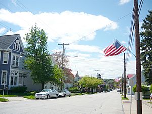
Main Street
|
|
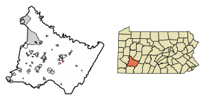
Location of Youngstown in Westmoreland County, Pennsylvania.
|
|
| Country | |
| State | |
| County | Westmoreland |
| Settled | 1764 |
| Incorporated | April 2, 1831 |
| Government | |
| • Type | Borough Council |
| Area | |
| • Total | 0.11 sq mi (0.29 km2) |
| • Land | 0.11 sq mi (0.29 km2) |
| • Water | 0.00 sq mi (0.00 km2) |
| Elevation | 1,076 ft (328 m) |
| Population
(2010)
|
|
| • Total | 326 |
| • Estimate
(2019)
|
305 |
| • Density | 2,747.75/sq mi (1,057.67/km2) |
| Time zone | UTC-5 (Eastern (EST)) |
| • Summer (DST) | UTC-4 (EDT) |
| Zip code |
15696
|
| Area code(s) | 724 |
| FIPS code | 42-87208 |
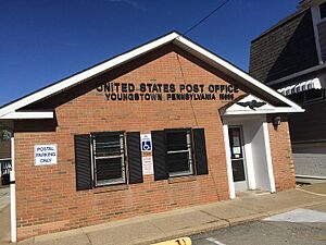
Youngstown is a small town, called a borough, in Westmoreland County, Pennsylvania, United States. It officially became a borough on April 2, 1831. In 2010, about 326 people lived there. Youngstown has its own post office, which opened on April 1, 1813. Its zip code is 15696.
Contents
Youngstown's Early History
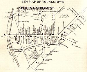
The town was named after Alexander Young. His first land record was made on November 25, 1815. There was a debate about whether to call the town Martinsburg or Youngstown. They chose Youngstown because another town named Martinsburg already existed in Pennsylvania. James Keenan's land plan from April 3, 1816, officially called the town Youngstown Borough.
Becoming an Official Borough
As more people moved to Youngstown, they wanted to form their own local government. The residents asked the state government in Harrisburg to make Youngstown a borough. Governor George Wolf approved this request on April 2, 1831. This act set the town's boundaries and allowed residents to elect their own leaders, like a mayor (called a burgess back then).
Later, the residents felt the 1830 law was too old-fashioned. They asked to follow a newer law from April 3, 1851, which offered a more modern way to run a borough. It took a while, but the Borough Council finally approved this change on July 25, 1905.
First Settlers and Important Roads
In 1769, the Pennsylvania Government Land Office opened in the area. This allowed pioneers, many from Germany and Scotland-Ireland, to settle in the Loyalhannah Valley. Christopher Saxman in 1764 and Frederick Pershing in 1769 were among the first recorded settlers near what is now Youngstown.
As the community grew, it was often called Martinsburg, named after Martin West, another landowner nearby. Youngstown was located along the Forbes road, a military road built in 1758 by Brigadier General John Forbes. This road connected Philadelphia to Pittsburgh, making Youngstown an important stop for travelers. In 1794, soldiers even stayed at the town's Barrett Hotel while on their way to stop the Whiskey Insurrection.
Land Ownership and Growth
Before 1796, people settled in Youngstown without official land claims. The first official land deal happened on March 31, 1796. Robert Dickey received a permit for a 250-acre piece of land called "Hermitage." This land was later sold to Joseph Baldridge in 1797.
Joseph Baldridge started selling smaller lots of land in 1800. Alexander Young recorded these sales in 1815. After the name debate, the town officially became Youngstown on April 3, 1816.
General Arthur St. Clair, a famous military leader who had retired near Youngstown, passed away near his home, "Hermitage," in 1818.
In 1819, the Greensburg-Stoystown Turnpike was built along the old Forbes Road. This brought more people and business to Youngstown. The town became a busy market place with hotels, blacksmiths, wagon makers, and a post office. The community continued to grow, and on April 2, 1831, Youngstown officially became a borough. J. G. Karns was the first burgess (mayor) of Youngstown.
Changes Over Time
In 1852, the Pennsylvania Railroad started train service through nearby Latrobe. This caused Youngstown to become less busy, as merchants moved closer to the railway. The Greensburg-Stoystown Turnpike was used less often.
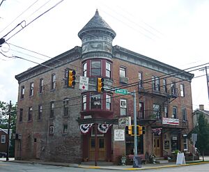
Later, when cars became popular, the old turnpike became the Lincoln Highway, bringing traffic back through Youngstown. However, in the 1930s, U.S. Route 30 was built, which bypassed Youngstown. This made Youngstown a quieter place, mostly for people to live. The Kingston House, an old hotel and trading center from 1800, was added to the National Register of Historical Places on June 30, 1983.
Youngstown Timeline
Here are some important dates in Youngstown's history:
- 1758: The Forbes Road was finished.
- 1769: The Pennsylvania Government Land Office opened.
- 1794: During the Whiskey Insurrection, soldiers stayed at the Barrett Hotel.
- 1799-1800: Youngstown Borough was planned out.
- 1819: The Greensburgh-Stoystown Turnpike was completed.
- 1831: Youngstown officially became a borough.
- 1852: The Pennsylvania Railroad started service through Latrobe.
- 1861: Youngstown was a place where people signed up for the Civil War.
- November 9, 1909: The town council voted to get four streetlights for Main Street.
- October 1916: The council ordered the town's weigh scales to be removed from Main Street.
- March 6, 1918: The council approved a plan with the State Highway Department to pave streets.
- August 1818: General Arthur St. Clair, a hero from the American Revolution and a former president of the United States in Congress, passed away near Youngstown. He lived in a home called "Hermitage" on Laurel Ridge. His parlor from that home was moved and is now part of the Ligonier Museum.
Youngstown's Geography
Youngstown is located at 40°16′51″N 79°21′56″W / 40.28083°N 79.36556°W.
The United States Census Bureau says the borough covers about 0.1 square miles (0.29 square kilometers) of land. There is no water area within the borough limits.
Close to Youngstown, you can find Solomon's Temple Ridge and Sugarbush Ridge. These are sometimes called Youngstown Ridge.
The famous Latrobe Country Club, where golf legend Arnold Palmer played, is just outside Youngstown's southwestern edge.
People of Youngstown
| Historical population | |||
|---|---|---|---|
| Census | Pop. | %± | |
| 1850 | 454 | — | |
| 1860 | 360 | −20.7% | |
| 1870 | 301 | −16.4% | |
| 1880 | 294 | −2.3% | |
| 1890 | 486 | 65.3% | |
| 1900 | 318 | −34.6% | |
| 1910 | 323 | 1.6% | |
| 1920 | 426 | 31.9% | |
| 1930 | 482 | 13.1% | |
| 1940 | 547 | 13.5% | |
| 1950 | 577 | 5.5% | |
| 1960 | 590 | 2.3% | |
| 1970 | 478 | −19.0% | |
| 1980 | 470 | −1.7% | |
| 1990 | 370 | −21.3% | |
| 2000 | 400 | 8.1% | |
| 2010 | 326 | −18.5% | |
| 2019 (est.) | 305 | −6.4% | |
| Sources: | |||
Based on the census from 2000, there were 400 people living in Youngstown. These people lived in 177 households, and 98 of those were families. The population density was about 3,910 people per square mile (1,510 people per square kilometer).
Most of the people in Youngstown (99.50%) were White, and 0.50% were Native American. About 0.25% of the population was Hispanic or Latino.
In 2000, about 24.3% of households had children under 18 living with them. About 40.7% were married couples. The average household had 2.24 people, and the average family had 3.04 people.
The population's age groups were:
- 21.5% were under 18 years old.
- 6.3% were from 18 to 24 years old.
- 30.0% were from 25 to 44 years old.
- 26.5% were from 45 to 64 years old.
- 15.8% were 65 years or older.
The average age was 41 years.
The average income for a household in Youngstown was $31,029. For families, the average income was $34,167. About 16.1% of families and 20.4% of the total population lived below the poverty line.
Many residents have ancestors from different countries, including:
- German (26.2%)
- Italian (19.0%)
- Polish (16.0%)
- Slovak (9.6%)
- English (8.7%)
- Hungarian (6.4%)
See also
 In Spanish: Youngstown (Pensilvania) para niños
 | Selma Burke |
 | Pauline Powell Burns |
 | Frederick J. Brown |
 | Robert Blackburn |


