
Garrett, Pennsylvania facts for kids
Quick facts for kids
Garrett, Pennsylvania
|
|
|---|---|
|
Borough
|
|

Garrett looking east on PA 653 (Jackson Street) in 2014
|
|
| Motto(s):
The Town that goes on and on
|
|

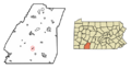
Location of Garrett in Somerset County, Pennsylvania
|
|

Garrett, Pennsylvania
Location in Pennsylvania
|
|
| Country | United States |
| State | Pennsylvania |
| County | Somerset |
| Settled | 1869 |
| Incorporated | 1900 |
| Government | |
| • Type | Borough Council |
| Area | |
| • Total | 0.51 sq mi (1.31 km2) |
| • Land | 0.51 sq mi (1.31 km2) |
| • Water | 0.00 sq mi (0.00 km2) |
| Population
(2020)
|
|
| • Total | 415 |
| • Density | 820.16/sq mi (316.88/km2) |
| Time zone | UTC-5 (Eastern (EST)) |
| • Summer (DST) | UTC-4 (EDT) |
| Zip Code |
15542
|
| Area code(s) | 814 |
| FIPS code | 42-28520 |
Garrett is a small town, called a borough, located in Somerset County, Pennsylvania, United States. It is part of the Johnstown, Pennsylvania, Metropolitan Statistical Area. In 2020, about 416 people lived in Garrett.
Contents
History of Garrett: How It Started
Garrett was first settled by people in 1869. It officially became a borough in 1900. The town is named after a very important person: John Work Garrett. He was the president of the Baltimore and Ohio Railroad for many years, from 1858 to 1884.
Railroads and Garrett's Growth
Garrett was a busy place because of the Baltimore and Ohio Railroad. It was where the main Pittsburgh line connected with the Berlin branch. The Berlin Branch Railroad was built in 1871. It was about 8.5 miles long and linked the town of Berlin to the main B&O line that passed through Garrett. The B&O railroad took over this branch in 1880.
There were seven train stations along the Berlin branch: Garrett, Burkholder, Buchle, Bitner, Pine Hill, Hanger's, and Berlin. A picture of Garrett was even included in a book of photographs from along the B&O lines published in 1872!
The Western Maryland Railroad and the Great Allegheny Passage
Another important railroad, the Western Maryland Railroad, also ran through Garrett. Today, the path where this railroad used to be is now the Great Allegheny Passage. This is a 150-mile long trail perfect for biking and hiking. It connects Cumberland, Maryland to Pittsburgh. The Western Maryland Railroad's Connellsville Extension was built between 1906 and 1912.
Over the years, different railroad companies took over the Western Maryland Railway. In 1964, the Chesapeake and Ohio Railway (C&O) and the Baltimore and Ohio Railroad (B&O) worked together to gain control of it. Eventually, in 1987, it became part of CSX Transportation.
Geography of Garrett: Where It Is
Garrett is located at coordinates 39°51′49″N 79°3′40″W / 39.86361°N 79.06111°W. It covers an area of about 0.51 square miles (1.31 square kilometers), and all of it is land. Garrett is situated right on the border between Summit Township and Brothersvalley Township.
The town is also where two waterways meet: the Buffalo Creek and the Casselman River. The Casselman River might have been named after a place in Germany called Hesse-Kassel.
Transportation in Garrett
Pennsylvania Route 653 starts in Garrett, at the Mason Dixon Highway. From there, this route goes northwest towards Rockwood.
Population of Garrett: Who Lives There
| Historical population | |||
|---|---|---|---|
| Census | Pop. | %± | |
| 1880 | 253 | — | |
| 1900 | 488 | — | |
| 1910 | 848 | 73.8% | |
| 1920 | 850 | 0.2% | |
| 1930 | 878 | 3.3% | |
| 1940 | 872 | −0.7% | |
| 1950 | 761 | −12.7% | |
| 1960 | 617 | −18.9% | |
| 1970 | 616 | −0.2% | |
| 1980 | 563 | −8.6% | |
| 1990 | 520 | −7.6% | |
| 2000 | 449 | −13.7% | |
| 2010 | 456 | 1.6% | |
| 2020 | 416 | −8.8% | |
| 2021 (est.) | 413 | −9.4% | |
| Sources: | |||
In 2000, there were 449 people living in Garrett. There were 168 households, and 128 of them were families. Most people living in Garrett were White (99.55%).
About 33.3% of the households had children under 18 living with them. Many households (61.3%) were married couples. About 21.4% of all households were people living alone. The average household had 2.67 people.
The population was spread out by age. About 26.9% were under 18, and 16.5% were 65 or older. The average age was 34 years old.
The median income for a household in Garrett was $24,609. This means half of the households earned more than this, and half earned less. About 15.8% of the people in Garrett lived below the poverty line.
Interesting Facts About Garrett
One cool thing about Garrett is that it has a 10 MW wind farm. This was the first large-scale wind power facility built in the eastern United States! It uses wind to create electricity.
Images for kids
-
Location of Garrett in Somerset County, Pennsylvania
See also
 In Spanish: Garrett (Pensilvania) para niños
