Conemaugh River facts for kids
Quick facts for kids Conemaugh River |
|
|---|---|

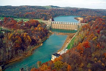
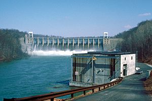
Conemaugh River Lake Dam at low water
|
|
| Country | United States |
| Physical characteristics | |
| Main source | 40°19′54″N 78°55′30″W / 40.3317406°N 78.9250255°W |
| River mouth | 827 ft (252 m) 40°29′08″N 79°27′14″W / 40.4856220°N 79.4539299°W |
| Basin features | |
| River system | Allegheny River |
The Conemaugh River is a 70-mile (110 km) long river in Pennsylvania. It flows through Westmoreland, Indiana, and Cambria counties. A river like the Conemaugh that flows into a larger river is called a tributary. The Conemaugh River flows into the Kiskiminetas River.
The name "Conemaugh" comes from an old Native American language called Unami-Lenape. In this language, kwənəmuxkw means 'otter'. So, the river's name means 'Otter Creek'.
Where the Conemaugh River Flows
The Conemaugh River starts in Johnstown. Johnstown is famous for the Johnstown Flood, a big flood that happened there a long time ago. The Conemaugh River forms when two smaller rivers, the Little Conemaugh and Stonycreek rivers, join together.
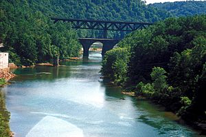
From Johnstown, the Conemaugh River flows mostly west and northwest. It winds its way through the mountains, passing along the edges of Laurel Hill and Chestnut Ridge.
Further along its path, another stream called Blacklick Creek joins the Conemaugh River near Blairsville. Finally, at a town called Saltsburg, the Loyalhanna Creek flows into the Conemaugh. When these two rivers meet, they form the Kiskiminetas River. For much of its lower part, the Conemaugh River creates a natural border between Westmoreland and Indiana counties.
The Conemaugh River Area
The area around the Kiskiminetas-Conemaugh rivers is very scenic. It has many mountains and is known for its history of coal mining in western Pennsylvania. Before a large dam was built, a town called Livermore was an important stop. It was a key place for both the old canal system and the railroad between Blairsville and Saltsburg.
Over the years, the river's health was affected by past mining activities. Water from old mines sometimes caused pollution. Because of this, many state and private groups have been working hard to help the river recover. This effort to improve the river's ecology (the study of how living things interact with their environment) is an important ongoing project.
 | Charles R. Drew |
 | Benjamin Banneker |
 | Jane C. Wright |
 | Roger Arliner Young |


