Hudson Mountains facts for kids
Quick facts for kids Hudson Mountains |
|
|---|---|

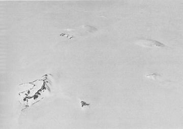
Aerial view of the southern Hudson Mountains.
|
|
| Highest point | |
| Peak | Mount Moses |
| Elevation | 750 m (2,460 ft) |
| Geography | |
| Geology | |
| Mountain type | Stratovolcanoes |
| Last eruption | 210 BCE |
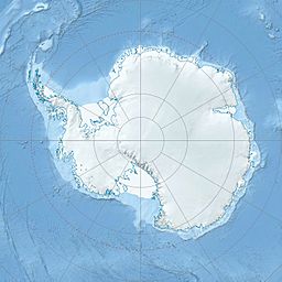
The Hudson Mountains are a group of mountains in western Ellsworth Land, a part of Antarctica. They are located near Cranton Bay and Pine Island Bay, which is part of the Amundsen Sea. These mountains are actually volcanoes! They are mostly low, scattered peaks and nunataks, which are mountain tops that stick out from under the thick West Antarctic Ice Sheet. To the north, the Hudson Mountains are next to the Cosgrove Ice Shelf, and to the south, they are bordered by the Pine Island Glacier.
Contents
What are the Hudson Mountains Made Of?
The Hudson Mountains are home to several stratovolcanoes. These are cone-shaped volcanoes built up by many layers of hardened lava, ash, and rocks. Some of these volcanoes, like Mount Manthe, Teeters Nunatak, and Mount Moses, are very old and have been worn down over time.
Scientists think the Hudson Mountains might still be active volcanoes. In 1974, people reported seeing steam, and in 1985, a satellite might have even detected an eruption. This suggests that these volcanoes could erupt again!
Most of the lava from the Hudson Mountains' eruptions has flowed on land. However, some eruptions have happened under the ice or water, creating special types of rock called tuffs. Scientists found a layer of volcanic ash from an eruption that happened under the ice around 200 BCE. This was found by studying the ice thickness.
How Were the Hudson Mountains Discovered?
The Hudson Mountains were first seen by members of the United States Antarctic Service (USAS). They flew over the area in February 1940 from a ship called the USS Bear. Later, in December 1946, more details were added using air photos taken during a US Navy mission called Operation Highjump.
The full shape and size of the mountains were finally mapped in 1966. This was done by the United States Geological Survey (USGS) using more air photos from the United States Navy. The mountains were named by the US-SCAN group. They chose the name to honor Captain William L. Hudson. He was the commander of a ship called the USS Peacock during a big exploration trip called the United States Exploring Expedition from 1838 to 1842. Captain Hudson's ship, along with another ship called the USS Flying Fish, sailed near this area in March 1839.
A Huge Eruption Under the Ice
In January 2008, scientists from the British Antarctic Survey made an exciting discovery. Led by Hugh Corr and David Vaughan, they reported in a science journal called Nature Geoscience that a huge volcano had erupted under the Antarctic ice sheet about 2,200 years ago.
They found this out by using radar images from an airplane. This eruption was described as the biggest one in Antarctica in the last 10,000 years! The volcanic ash from this massive event was found on the ice surface under the Hudson Mountains, very close to the Pine Island Glacier.
See also
 In Spanish: Montañas Hudson para niños
 | Janet Taylor Pickett |
 | Synthia Saint James |
 | Howardena Pindell |
 | Faith Ringgold |


