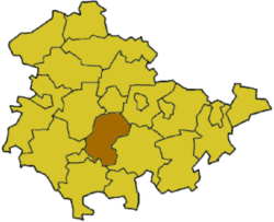
Ilm-Kreis Rural District facts for kids
Quick facts for kids
Ilm-Kreis
|
|
|---|---|
 |
|
| Country | |
| State | Thuringia |
| Capital | Arnstadt |
| Area | |
| • Total | 843 km2 (325 sq mi) |
| Population | |
| • Total | 117,418 |
| • Density | 139.29/km2 (360.75/sq mi) |
| Time zone | UTC+1 (CET) |
| • Summer (DST) | UTC+2 (CEST) |
| Vehicle registration | IK |
| Website | http://www.ilm-kreis.de |
Ilm-Kreis is a cool district located in the state of Thuringia, Germany. It's a place with a rich history and beautiful landscapes.
Contents
A Look Back in Time
Long, long ago, in the Middle Ages, the land that is now Ilm-Kreis was controlled by powerful families. These families were like local rulers. Two important ones were the counts of Henneberg and the princes of Schwarzburg. They were two important families in the area.
For example, the town of Ilmenau was ruled by the Henneberg family. The town of Arnstadt belonged to the Schwarzburg family.
In 1583, the Henneberg family no longer had any rulers. So, Ilmenau became part of Saxony. The Schwarzburg family's land was divided among different family members. This created several smaller states. One of these states, called Schwarzburg-Arnstadt, was based in Arnstadt. It started in 1574 and lasted until 1716. Then, it became part of another state called Schwarzburg-Sondershausen.
Later, in 1920, all these smaller states in the region came together. They formed a new state called the Freestate of Thuringia. This is how Ilm-Kreis became part of modern Thuringia.
How the District Was Formed
The district itself was first created in 1920. Back then, it was simply called Arnstadt. In 1952, it was split into two smaller districts: Arnstadt and Ilmenau. But don't worry, they didn't stay separate for long! In 1994, the two parts joined back together. This formed the Ilm-Kreis district we know today.
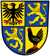
Understanding the Coat of Arms
A coat of arms is like a special symbol or logo for a place. It tells a story about its history. The coat of arms for Ilm-Kreis has three important symbols:
Towns and Communities
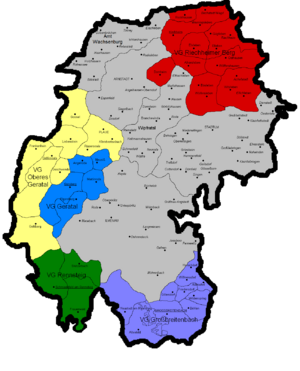
Ilm-Kreis is made up of many different towns and smaller communities. Some of these are independent. Others work together in groups called Verwaltungsgemeinschaften. This is a German word for an administrative union. It means several smaller towns or villages share some government services.
Independent Towns and Communities
These towns and communities manage their own affairs without being part of a larger administrative union:
| Verwaltungsgemeinschaft-free towns | and communities |
|---|---|
|
|
Administrative Unions (Verwaltungsgemeinschaften)
Here are the groups of communities that work together:
| Verwaltungsgemeinschaften | ||
|---|---|---|
|
1. Geratal
2. Großbreitenbach
|
3. Langer Berg
4. Oberes Geratal
|
5. Rennsteig
6. Riechheimer Berg
|
| 1seat of the Verwaltungsgemeinschaft (where the main office is);2town | ||
 | Jessica Watkins |
 | Robert Henry Lawrence Jr. |
 | Mae Jemison |
 | Sian Proctor |
 | Guion Bluford |


