
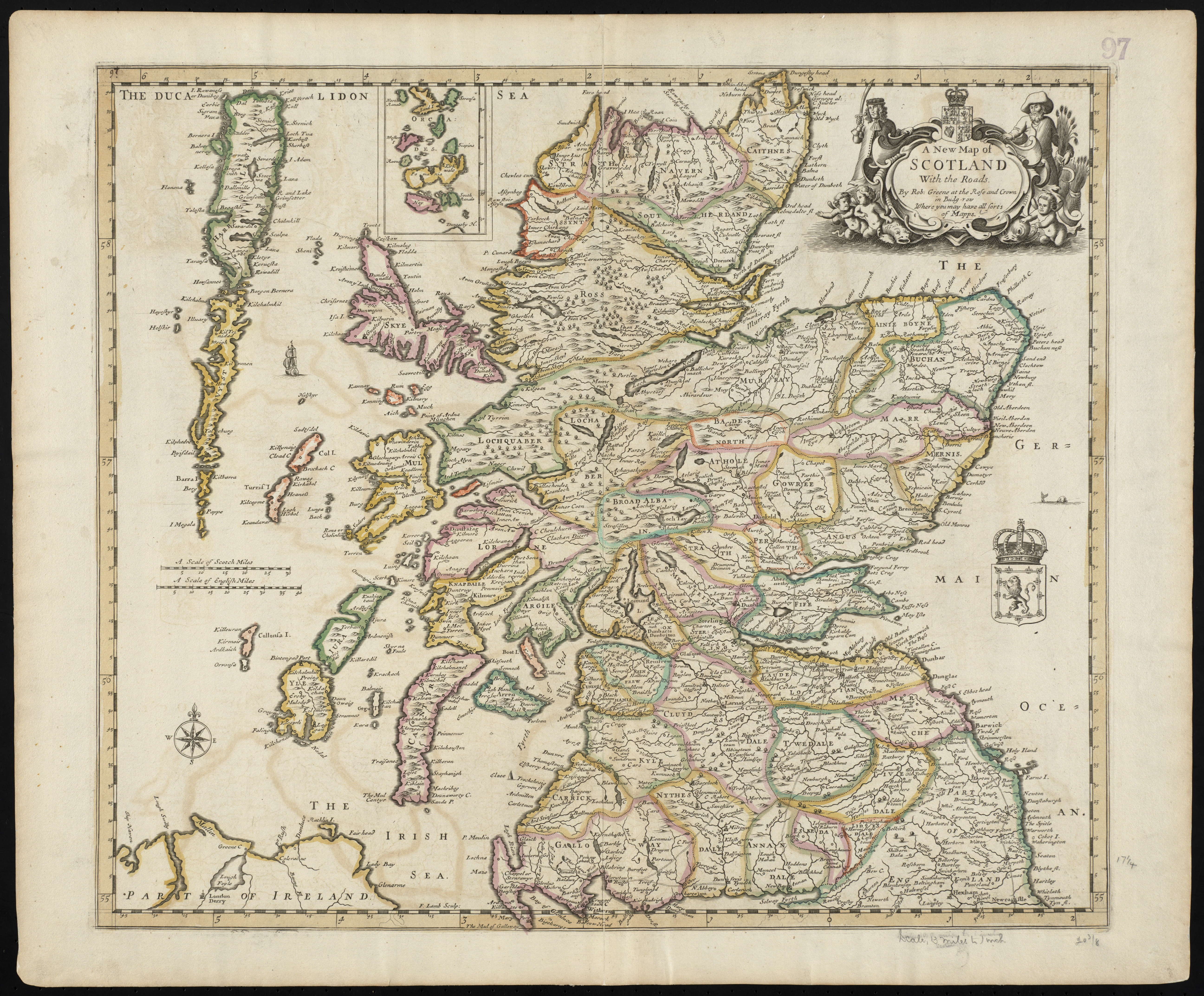
Image: A new map of Scotland with the roads (8643653080)
Size of this preview: 725 × 600 pixels. Other resolutions: 290 × 240 pixels | 5,187 × 4,291 pixels.
Original image (5,187 × 4,291 pixels, file size: 21.34 MB, MIME type: image/jpeg)
Description: Zoom into this map at maps.bpl.org. Author: Greene, Robert Publisher: Greene, Robert Date: 1689 Location: Scotland Dimensions: 46 x 52 cm. Scale: [ca. 1:847,500] Call Number: G1015 .C651 1630
Title: A new map of Scotland with the roads (8643653080)
Credit: A new map of Scotland with the roads
Author: http://maps.bpl.org
Usage Terms: Creative Commons Attribution 2.0
License: CC BY 2.0
License Link: https://creativecommons.org/licenses/by/2.0
Attribution Required?: Yes
Image usage
The following 7 pages link to this image:

All content from Kiddle encyclopedia articles (including the article images and facts) can be freely used under Attribution-ShareAlike license, unless stated otherwise.
.jpg)