The Rough Bounds facts for kids
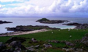
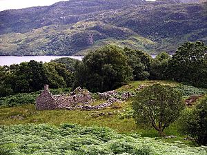
The Rough Bounds (called Na Garbh Chriochan in Scottish Gaelic) is a special part of the Scottish Highlands. It's located in West Inverness-shire and is surrounded by three large lakes: Loch Hourn, Loch Shiel, and Loch Moidart. This area includes the districts of Knoydart, North Morar, Arisaig, and Moidart.
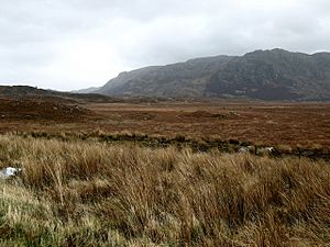
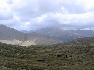
The Rough Bounds is known for being wild and hard to reach, even today. Not many people live there. Back in 1750, someone wrote that these areas were "the most Rough Mountainous and impassible parts in all the Highlands of Scotland." They were even called "the highlands of the Highlands" by people living nearby.
Contents
Ancient Times
When a 6-kilometer part of the A830 road in Arisaig was rebuilt in 2000-2001, archaeologists from the University of Edinburgh and Headland Archaeology Ltd explored the area. They found some amazing things from the Bronze Age, which was thousands of years ago!
They discovered an ancient stone circle called a kerb cairn, along with old turf buildings and shieling huts. Shieling huts were simple shelters used by people who moved their animals to high pastures in summer. These huts were used again and again during the medieval period (Middle Ages) and later, but they were built on top of even older Bronze Age remains.
Scientists also studied peat (a type of soil made from decayed plants) from the area. This showed that the forests in the Rough Bounds slowly became smaller over a very long time, starting around 3200 BC and continuing until now.
History of the Rough Bounds
Early Days
After attacks by Vikings, the Rough Bounds became part of the Kingdom of the Isles. This kingdom was controlled by Norway. However, in the late 1000s, Malcolm III of Scotland, the Scottish king, made a deal with Magnus Barelegs, the Norwegian king. They moved the border to the coast, which meant the Rough Bounds became part of Scotland.
In the early 1100s, a powerful leader named Somerled took control of the Rough Bounds and another area called Lorn. We don't have clear records of how this happened, but by the 1140s, King David I of Scotland no longer had much control over the region. In the middle of the century, Somerled took over the Kingdom of the Isles, joining it with his other lands to create a single, independent state.
After Somerled died, Norway took back control of the areas he had ruled. But the kingdom was split up. The part that included the Rough Bounds, Uist, and the islands in between (Eigg and Rhum) became known as Garmoran. It was ruled by the MacRory family, who were part of Somerled's descendants.
The Lordship of Garmoran
After a peace treaty in 1266 called the Treaty of Perth, Garmoran became a dependency of the Scottish Crown. This meant it was controlled by the Scottish king and was known as the Lordship of Garmoran. Around the year 1200, King William I had created a new job: the Sheriff of Inverness. This person was in charge of the Scottish Highlands, which now included Garmoran. Most of the rest of the Kingdom of the Isles became the Lordship of the Isles, ruled by the MacDonalds, another family descended from Somerled.
The Lordship of Garmoran continued to be ruled by the MacRory family and their relatives, the Siol Gorrie and Clan Ranald. However, there were many fights between these two groups. In 1427, King James I had the leader of the Siol Gorrie executed and took away the Lordship of Garmoran. This violence almost wiped out the Siol Gorrie, and they didn't play a big part in the region's history after that.
Land Ownership Changes
In 1469, King James III (James I's grandson) gave the mainland parts of Garmoran and North Uist to John of Islay, Earl of Ross, who was the Lord of the Isles. John then gave these lands to his own half-brother, Hugh of Sleat. The king confirmed this gift to Hugh in 1493. However, the Clan Ranald family disagreed with this and fought against it.
After Hugh of Sleat died in 1498, his son, John of Sleat, immediately gave all the land back to the king. It's not clear why he did this. By this time, John of Ross had lost the Lordship of the Isles because he had been involved in plots against the king. But in 1501, his heir, Black Donald, started a rebellion to try and get it back.
Ranald Bane, the leader of Clan Ranald, was one of the few MacDonald-related clan leaders who refused to support Donald. So, in 1505 (just before Donald was defeated), Ranald Bane was rewarded with the lands of Arisaig and Eigg.
In 1520, Ranald Bane's son, Dougall, was known for being very cruel. This led to him being killed, and Ranald Bane's family was no longer allowed to lead Clan Ranald. Instead, Ranald Bane's brother, Alexander, took over. In 1532, the king officially made Alexander's son, John Moidartach, the owner of Arisaig and Eigg, and also gave him Moidart.
However, in 1539, the king gave the area of Morar to the MacDonells of Glengarry, not to the leaders of Clan Ranald. The MacDonells of Glengarry were a related branch of Clan Ranald.
Around the same time, the king claimed the right to take control of Knoydart. He said that the feudal duties (like loyalty and service) for the land hadn't been kept for 70 years. It's still a bit unclear why he said this if the land had been controlled by the king since 1498. In 1537, the king gave Knoydart to Ewen Cameron, the leader of Clan Cameron.
73 years later, in 1611, Allan Cameron, the new leader of Clan Cameron, gave Knoydart to the MacDonells of Glengarry. This split Garmoran into a north part (controlled by MacDonells of Glengarry) and a south part (controlled by Clan Ranald). In 1613, the MacDonells received official confirmation of their ownership from the king.
Law and Order in the Highlands
In 1509, Alexander, the Earl of Huntly, was made sheriff of Inverness. This gave him power in Garmoran, and this job was passed down in his family. In 1540, King James V put John Moidartach in prison. The king tried to give the leadership of Clan Ranald to Ranald Gallda, who was John Moidartachs uncle. When John was released in 1542, Ranald Gallda ran away. This led to small battles between Clan Ranald (led by John Moidartach) and Ranald Galldas supporters. These fights only stopped when the Earl of Huntly stepped in. This then led to a bigger battle called the Battle of the Shirts.
John Moidartach and Clan Cameron won the Battle of the Shirts against the Earl of Huntly and Ranald Gallda. After this, the Earl of Huntly mostly left the Rough Bounds alone and only tried to enforce the king's rules in areas around it. However, when Mary of Guise became the regent (someone who rules for a child king or queen, in this case, her daughter Mary), in 1554, she ordered an attack on the Rough Bounds. The Campbells attacked Castle Tioram from the sea, but the Earl of Huntly didn't want to bring his troops into the Rough Bounds, so the attack failed.
During the 1500s, there were many violent clashes between the MacDonells of Glengarry and the MacKenzies. This was due to a disagreement over who should inherit lands from the MacDonalds of Lochalsh. In 1592, the leader of the MacDonells of Glengarry made a deal with the Earl of Huntly to help each other. The MacKenzies then tried to complain about the MacDonells in court, but the MacDonell leaders wouldn't show up. So, in 1602, the MacKenzies attacked Morar, leading to the Battle of Morar. After this, peace agreements helped reduce the fighting between local clans, and people started focusing on national issues.
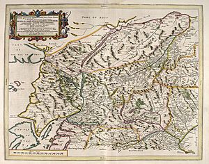
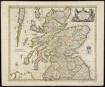
Around this time, the name Garmoran seemed to disappear. The Earls of Huntly had been given the nearby Lordship of Lochaber in 1500, and people started to think of Garmoran as being connected to it. Yet, a map from 1669 called the Rough Bounds Loquaber, but clearly showed it outside the borders of Lochaber. The lands that were once Garmoran remained separate from Moray and Lochaber even into the 1700s. On Moll's map from before 1732, the area is clearly different from its neighbors but has no name itself, only the description the territory west from Lochaber. This unnamed separation was also seen on Blaeu's 1654 map, where the lands were simply those that lay west from Lochaber.

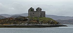
In 1609, the Statutes of Iona tried to bring the Scottish reformation (a change in religion) to the Highlands. But the people of the Rough Bounds strongly remained Roman Catholic. They supported the Royalists during the Civil War. In the next century, the area became a strong supporter of the Jacobite cause, which wanted to bring the old royal family back to the throne. They even burned down Tioram Castle themselves to stop it from falling into the hands of their enemies. After the Jacobite rising of 1745 failed, the Rough Bounds was the last place in Scotland where Bonnie Prince Charlie found safety. He left for exile in France from here on September 20, 1746.
Recent History
Over time, some leaders of the clans in the Rough Bounds were not very successful. This led to the land eventually being sold or passed into the hands of other families.
The Rough Bounds remained hard to reach even into the 1900s. For example, Moidart only got a proper road connection (the A861) in 1966. Before that, people had to travel by foot or by ferry. This remoteness made it a perfect place for practicing secret operations during World War II for missions in Occupied Europe. The Special Operations Executive (SOE), a British secret service, set up its Scottish headquarters just outside Arisaig. They built training bases for soldiers and spies throughout the region. In Moidart, a base called HMS Dorlin was created to train people for beach signals and communications.
Because the area was so remote, many people continued to speak Scottish Gaelic until the mid-1900s. In the 1881 census, about 90% of the people could speak Gaelic, and more than a third couldn't speak English at all. By 2001, the number of Gaelic speakers had dropped to less than 15% of the people living there regularly.
 | May Edward Chinn |
 | Rebecca Cole |
 | Alexa Canady |
 | Dorothy Lavinia Brown |


