Lorne, Scotland facts for kids
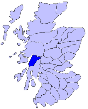
Lorne (also spelled Lorn) is an old region in the west of Scotland. Today, it's a district within the Argyll and Bute council area. Lorne also gives its name to the Lynn of Lorn National Scenic Area. This is one of 40 special areas in Scotland known for their amazing natural beauty. These areas are protected to make sure they stay beautiful and aren't harmed by new buildings. The Lynn of Lorn area covers a huge space, including the island of Lismore and nearby places like Benderloch and Port Appin.
Some people think the name Lorne might even be linked to the traditional Scottish breakfast food, Lorne sausage!
Contents
Exploring Lorne's Geography
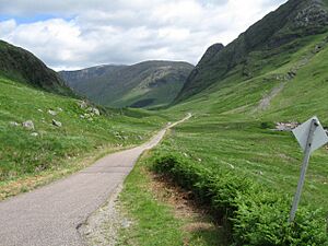
Lorne has natural borders all around it. To the west, the Firth of Lorne separates it from the Isle of Mull. In the north, Glen Coe and Rannoch Moor divide it from Lochaber. To the east, the Bridge of Orchy hills and Glen Orchy separate it from Breadalbane. Finally, Loch Awe runs along the southeastern border, separating Lorne from Knapdale and other parts of Argyll.
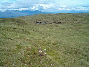
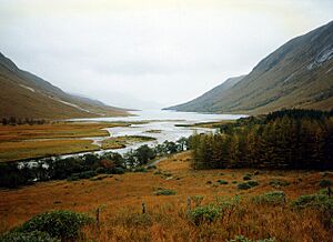
The northern part of Lorne is mostly covered by Glen Etive and its tall mountains. The southern part is quite different, with rolling, wet moorland, dotted with small lochs (lakes) and winding burns (streams). The Pass of Brander acts as a natural divide between these two areas and is a main route through Lorne.
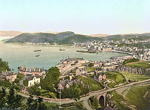
Although it's only been around since the 1800s, Oban is the biggest town in Lorne today. It's considered the modern capital of the district. Oban was once called the "Charing Cross of the Highlands" because so many boats connected it to the islands and the coast. It's still a very busy port for ferries, cruise ships, fishing boats, and pleasure boats.
Lorne's Rich History
Ancient Times in Lorne
During the Iron Age, people living in Lorne built many hillforts. These were strongholds on hills, like Dun Ormidale near Oban. We're not sure if these early inhabitants were Picts, another ancient Scottish group.
Around the year 500 AD, people from Ireland crossed the sea and settled in Lorne and the nearby islands. They created the Gaelic kingdom of Dál Riata. One of their kings was Loarn mac Eirc, who was a brother of Fergus Mór. Loarn's family group, the Cenél Loairn, controlled Mull and what is now Lorne. This is how the region got its name!
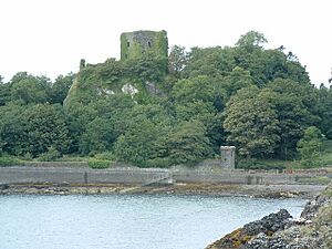
The Cenél Loairn built their main stronghold, Dun Ollaigh, a few miles north of Dun Ormidale. Old Irish records mention attacks on Dun Ollaigh, even by the king of Dál Riata, but the reasons aren't always clear. Dun Ollaigh remained an important fort throughout Dál Riata's existence.
Viking Influence and Norwegian Rule
In the 800s, Viking invaders arrived, leading to the end of Dál Riata. The Vikings created the Kingdom of the Isles, which later became part of Norway. This island kingdom was much larger than Dál Riata, including the Outer Hebrides and Skye. The Norwegians called it Suðreyjar, meaning southern isles. The old lands of Dál Riata became known as Argyle (now Argyll), meaning the Gaelic coast.
In the late 1000s, the Norwegian king, Magnus Barefoot, launched a military campaign. In 1098, the Scottish king agreed that Norway had control over the Kingdom of the Isles. Later, in the mid-1100s, a man named Somerled took control of the kingdom. After he died in 1164, his descendants kept half of the kingdom. Lorne seems to have gone to his son, Dubgall, whose family became known as the MacDougalls.
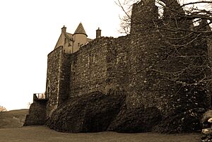
In the 1200s, the MacDougalls built two castles, Aros (on Mull) and Ardtornish (on the mainland). These castles helped them control the Sound of Mull. Later, they built Dunstaffnage Castle, a more comfortable headquarters north of Dun Ollaigh.
During the early 1200s, Scottish kings like Alexander II tried to expand their kingdom into the Isles. This caused a lot of tension between Norway and Scotland. In 1266, after the Battle of Largs, Norway's king gave up his claim to the Isles to the Scottish king, Alexander III, in exchange for a large sum of money. The Isles then became Scottish territories, but still had a lot of independence.
Scottish Lords of Lorne
Towards the end of the 1200s, there was a big argument over who should be the King of Scotland: John Balliol or Robert the Bruce. The MacDougalls supported John Balliol, while other powerful families, the MacDonalds and MacRory, supported Robert the Bruce. When Robert the Bruce won, he took the MacDougalls' lands and gave Lorne to the MacRory family.
The Campbells, based at Innis Chonnell Castle in southern Lorne, helped Robert the Bruce against the MacDougalls. Neil Campbell was rewarded by marrying Robert's sister, Mary. Robert first put Lorne under the control of the sheriff of Perth, but in 1326, he made Lorne a separate area and gave its authority to Neil's son, Dougall Campbell. This position became known as the sheriff of Argyll.
In 1346, John MacDonald married the heir of the MacRory family. This brought together the remaining parts of Somerled's old kingdom, forming the powerful Lordship of the Isles. In 1357, King David II, King of Scotland (Robert the Bruce's son) gave Lorne back to the MacDougalls. However, Mull then became part of the Lordship of the Isles.
John MacDougall had two daughters but no sons who lived. He did have a son named Alan, who was born outside of marriage. In Gaelic law, such a son could inherit. So, when John died, Alan became the leader of the MacDougalls. However, the title of Lord of Lorne was left without a clear owner.
John MacDougall's legitimate daughter, Isabel, married Sir John Stewart. Their son, Robert Stewart, was then recognized as the Lord of Lorne according to Scottish law. This led to some rivalry between Alan MacDougall's supporters and John Stewart's son, also named John Stewart. Sadly, John Stewart was fatally stabbed by an Alan MacDougall supporter on his way to get married at Dunstaffnage Castle. He managed to finish the wedding ceremony before he died.
When John Stewart died, his younger brother, William Stewart, inherited the Lordship of Lorne. However, King James III later convinced William Stewart to give up the title of Lord of Lorne.
The Campbells and Lorne
Sir Colin Campbell was a loyal supporter of King James I and James II. He was rewarded with the new title of Earl of Argyll. The Campbell family's main lands were in the center of mainland Argyll.
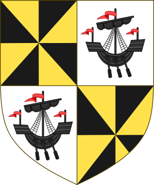
Sir Colin wanted to add more power to his title, so he married Isabel Stewart, the daughter of John MacDougall. In 1468, Sir Colin was recognized as the Lord of Lorne, and this became a secondary title of the Earldom of Argyll. The traditional symbol for Lorne was a lymphad (an old type of ship). So, the coat of arms for the Lordship of Lorne became a black lymphad on a silver background, combined with the Campbell family's own arms.
After John Stewart's death, the MacDougalls took over Dunstaffnage Castle, but King James III's army eventually forced them out. In 1470, the King appointed Sir Colin and his family as captains of the castle, meaning they looked after it for the King, not as their own property.
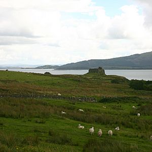
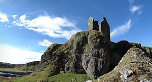
In 1582, the MacDougalls built Gylen Castle on an island near their old capital. However, during the civil war in the next century, Archibald Campbell was a leader of the Covenanters (a group supporting the Scottish church), while the MacDougalls were Royalists (supporters of the King). A Covenanter army burned down Gylen Castle and Dunollie. But Archibald's son later supported the King, so the Campbells kept their important position.
In 1746, after some rebellions, a new law called the Heritable Jurisdictions Act removed the Campbells' official power over Lorne and the Argyll sheriffdom. From then on, the Campbells could only use their influence as landlords.
Lorne in Modern Times
For a long time, Lorne was a very rural area with small villages. People mostly fished, traded, built boats, or quarried stone. But in 1794, the Oban Distillery was founded. This greatly improved the economy in western Lorne, and soon the town of Oban grew into the only large settlement in the area. In the late 1800s, the Callander and Oban Railway was built, bringing even more economic growth and helping other parts of Lorne.
In 1889, Scotland formally created counties, and Lorne became part of the new County of Argyll.
Lorne briefly became important on the world stage twice in the mid-1900s. During World War II, Oban was a key base for Royal Navy ships in the Battle of the Atlantic. Later, during the Cold War, the first Transatlantic Telephone Cable (TAT-1) came ashore here. This cable carried the famous Hot Line used by the presidents of the US and the USSR.
After some changes in the late 1900s, Lorne is now part of the larger Argyll and Bute council area.
 | Kyle Baker |
 | Joseph Yoakum |
 | Laura Wheeler Waring |
 | Henry Ossawa Tanner |


