
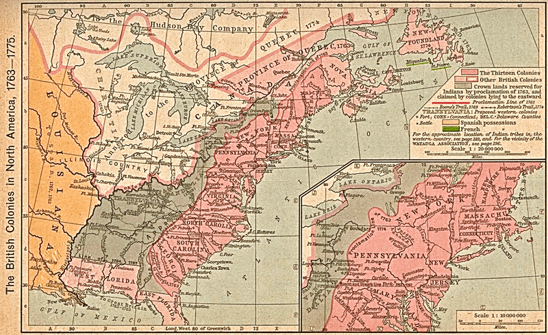
Image: British colonies 1763-76 shepherd1923

Description: Map of the British colonies in North America, 1763 to 1775. This was first published in: Shepherd, William Robert (1911) "The British Colonies in North America, 1763–1765" in Historical Atlas, New York, United States: Henry Holt and Company, pp. p. 194 Retrieved on 27 October 2010.
Title: British colonies 1763-76 shepherd1923
Credit: Scan from Historical Atlas by William R. Shepherd, New York, Henry Holt and Company, 1923; the map is unchanged from the 1911 original version. Original image at the Perry-Castañeda Library Map Collection at the University of Texas at Austin.
Author: William Robert Shepherd
Permission: This work is in the public domain in the United States because it was published (or registered with the U.S. Copyright Office) before January 1, 1923. Public domain works must be out of copyright in both the United States and in the source country of the work in order to be hosted on the Commons. If the work is not a U.S. work, the file must have an additional copyright tag indicating the copyright status in the source country. PD-1923 Public domain in the United States //commons.wikimedia.org/wiki/File:British_colonies_1763-76_shepherd1923.PNG
Usage Terms: Public domain
License: Public domain
Attribution Required?: No
Image usage
The following 13 pages link to this image:
