
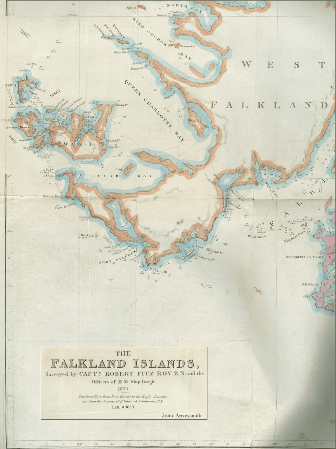
Image: Falkland-Islands-Map-1841-Fragment
Size of this preview: 449 × 599 pixels. Other resolutions: 180 × 240 pixels | 1,171 × 1,562 pixels.
Original image (1,171 × 1,562 pixels, file size: 2.08 MB, MIME type: image/png)
Description: 1841 Falkland Islands map by John Arrowsmith, fragment showing Swan Island (present Weddell Island)
Title: Falkland-Islands-Map-1841-Fragment
Credit: The Falkland Islands: Surveyed by Capt. Fitz Roy R.N. and the Officers of H.M. Ship Beagle, 1834. The Inner Bays from Port Harriet to the Eagle Passage are from the Surveys of Lt. Sulivan and W. Robinson R.N., 1838 & 1839. Scale ca. 1:404000 map. London: John Arrowsmith, 1841 (following p. 38)
Author: John Arrowsmith (1790–1873)
Usage Terms: Public domain
License: Public domain
Attribution Required?: No
Image usage
The following 3 pages link to this image:

All content from Kiddle encyclopedia articles (including the article images and facts) can be freely used under Attribution-ShareAlike license, unless stated otherwise.