
Image: KKH
Size of this preview: 419 × 599 pixels. Other resolutions: 168 × 240 pixels | 595 × 851 pixels.
Original image (595 × 851 pixels, file size: 1.46 MB, MIME type: image/png)
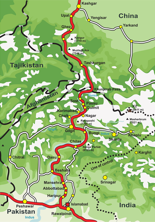
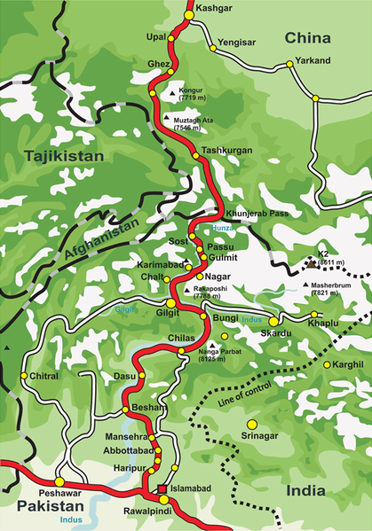
Description: This is a map of Karakoram Highway, the road that links the Northern Areas of Pakistan to the Xinjiang province of China, connecting it to the old Silk Road.
Title: KKH
Credit: Own work by the original uploader
Author: de:Benutzer:Grag, User:Tevatron~commonswiki, User:Lexicon
Usage Terms: Creative Commons Attribution-Share Alike 3.0
License: CC-BY-SA-3.0
License Link: http://creativecommons.org/licenses/by-sa/3.0/
Attribution Required?: Yes
Image usage
The following 3 pages link to this image:

All content from Kiddle encyclopedia articles (including the article images and facts) can be freely used under Attribution-ShareAlike license, unless stated otherwise.