
Image: Katrina-noaaGOES12

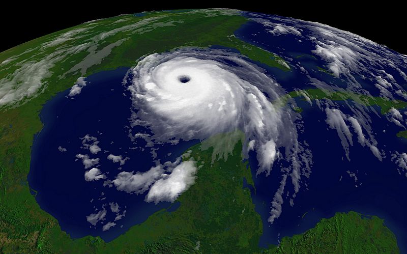
Description: Camera location 26° 13′ 59″ N, 88° 08′ 03″ W View this and other nearby images on: OpenStreetMap - Google Earth 26.233056; -88.134167 Year 2005 Storm Events Hurricane Katrina regional imagery, 2005.08.28 at 1515Z. Centerpoint Latitude: 26:13:59N Longitude: 88:08:03W. Observation Device: GOES-12 4 km infrared imagery. Visualization Date: August 28, 2005 12:03:14 Description from en.wiki: Katrina from NOAA/GOES 12. Courtesy NOAA/NESDIS: http://www.nnvl.noaa.gov/ 2005/08/28T1515Z
Title: Katrina-noaaGOES12
Credit: http://www.nnvl.noaa.gov/hurseas2005/Katrina1515z-050828-4kg12.jpg as linked by http://www.nnvl.noaa.gov/cgi-bin/index.cgi?page=items&ser=109660&large=1
Author: NOAA
Usage Terms: Public domain
License: Public domain
Attribution Required?: No
Image usage
