
Image: Last Glacial Maximum Vegetation Map

Size of this PNG preview of this SVG file: 800 × 533 pixels. Other resolution: 320 × 213 pixels.
Original image (SVG file, nominally 1,200 × 800 pixels, file size: 316 KB)
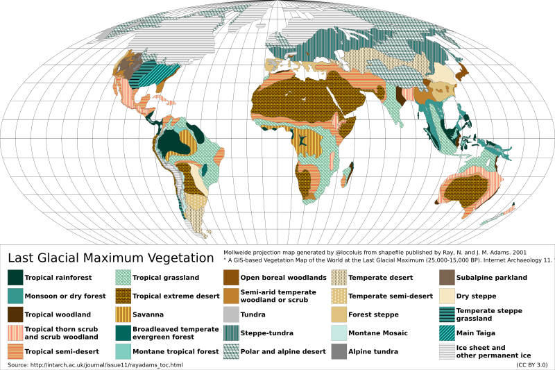
Description: Reconstructed vegetation cover at the Last Glacial Maximum period ~18,000 years ago, describing the type of vegetation cover present, based on fossil pollen samples recovered from lake and bog sediments.
Title: Last Glacial Maximum Vegetation Map
Credit: Map generated from shapefile published by Ray, N. and J. M. Adams. 2001, “ A GIS-based Vegetation Map of the World at the Last Glacial Maximum (25,000-15,000 BP). Internet Archaeology 11. ” Source: http://intarch.ac.uk/journal/issue11/rayadams_toc.html
Author: Locoluis
Usage Terms: Creative Commons Attribution 3.0
License: CC BY 3.0
License Link: https://creativecommons.org/licenses/by/3.0
Attribution Required?: Yes
Image usage
The following 3 pages link to this image:

All content from Kiddle encyclopedia articles (including the article images and facts) can be freely used under Attribution-ShareAlike license, unless stated otherwise.