
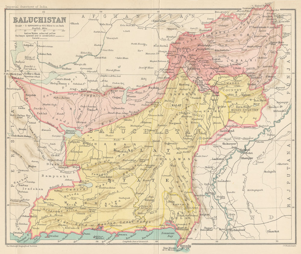
Image: Map of Baluchistan from The Imperial Gazetteer of India (1907-1909)
Size of this preview: 710 × 599 pixels. Other resolutions: 284 × 240 pixels | 1,000 × 844 pixels.
Original image (1,000 × 844 pixels, file size: 254 KB, MIME type: image/jpeg)
Description: Map of Baluchistan from The Imperial Gazetteer of India Volume 6, opposite page 336.. New edition, published under the authority of His Majesty's Secretary of State for India in Council. Oxford: Clarendon Press, 1907-1909. Scale: 1:6,000,000. 1 in. to 94.6 miles. Native States colored yellow.
Title: Map of Baluchistan from The Imperial Gazetteer of India (1907-1909)
Credit: http://dsal.uchicago.edu/maps/gazetteer/index.html
Author: John G. Bartholomew
Usage Terms: Public domain
License: Public domain
Attribution Required?: No
Image usage
The following 5 pages link to this image:

All content from Kiddle encyclopedia articles (including the article images and facts) can be freely used under Attribution-ShareAlike license, unless stated otherwise.
.jpg)