
Kharan (princely state) facts for kids
Quick facts for kids Kharan |
|
|---|---|
| Princely state of Pakistan | |
| 1697–14 October 1955 | |
 Flag
|
|
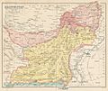
 Map of Pakistan with Kharan highlighted |
|
| Capital | Kharan |
| Area | |
|
•
|
48,051 km2 (18,553 sq mi) |
| History | |
|
• Established
|
1697 |
|
• Disestablished
|
14 October 1955 |
| Today part of | Balochistan, Pakistan |
The State of Kharan was a special kind of independent area in what is now Pakistan. It was like a small country with its own ruler. For a long time, it worked with British India, which was when the British ruled parts of Asia.
After the British left in 1947, Kharan became fully independent. But in 1948, its ruler decided to join Pakistan. Kharan kept some of its own power to govern itself. Then, in 1955, Kharan became a full part of Pakistan. Today, the land that was once Kharan is part of the Balochistan province in southwest Pakistan.
History of Kharan

The State of Kharan started around the year 1697. For many years, it was connected to another state called Kalat. However, in 1940, Kharan became completely independent from Kalat.
On March 17, 1948, Kharan officially joined Pakistan. Later, on October 3, 1952, it became part of a group called the Baluchistan States Union. The rulers of Kharan were quite strong. They managed to keep a lot of independence, not just from Kalat, but also from bigger powers like Kabul and Tehran.
Most of the people living in Kharan were from the Baloch tribes. There were also some Brahui people living in different parts of the area.
The State of Kharan ended on October 14, 1955. This happened when many areas in the western part of Pakistan joined together to form a new province called West Pakistan. When West Pakistan was later broken up in 1970, the land that used to be Kharan became known as the Kharan District. This district is now part of the Balochistan province.
Images for kids
-
Map of the Baluchistan Agency from the early 1900s.
.jpg)
See also
 In Spanish: Principado de Jarán para niños
