
Tehran facts for kids
Quick facts for kids
Tehran
تهران
|
||
|---|---|---|
.jpg) _(cropped).jpg) .jpg)   .jpg)  Clockwise from top:
Azadi Tower, Tabiat Bridge with Alborz mountains, National Garden, National Museum, City Theater, Golestan Palace and Milad Tower. |
||
|
||

Tehran
Location in Iran

Tehran
Location in Asia
|
||
| Country | Iran | |
| Province | Tehran | |
| County | Tehran Rey Shemiranat |
|
| District | Central | |
| Area | ||
| • Urban | 615 km2 (237 sq mi) | |
| • Metro | 2,235 km2 (863 sq mi) | |
| Elevation | 900 to 1,830 m (2,952 to 6,003 ft) | |
| Population | ||
| • Estimate
(2018)
|
9,400,000 | |
| • Density | 11,800/km2 (31,000/sq mi) | |
| • Urban | 9,039,000 | |
| • Metro | 15,800,000 | |
| • Population rank in Iran | 1st | |
| Demonym(s) | Tehrani (en) | |
| Time zone | UTC+03:30 (Iran Time) | |
| • Summer (DST) | (Not Observed) | |
| Area code(s) | +98 21 | |
| Climate | BSk | |
| Website | tehran.ir | |

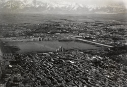
Tehran (/tɛəˈræn, -ˈrɑːn, ˌteɪ-/; Persian: تهران Tehrân [tehˈɾɒːn]) is the capital and largest city of Iran. It is also the main city of Tehran Province. About 9.4 million people live in the city itself. The larger metropolitan area has around 16.8 million people. This makes Tehran the most populated city in Iran and Western Asia. It is also the second-largest metropolitan area in the Middle East after Cairo.
Long ago, part of Tehran was home to an important city called Rhages (now Ray). This city was destroyed during invasions by Arabs, Turks, and Mongols. Modern Ray is now part of Greater Tehran.
Tehran became the capital of Iran in 1786. This decision was made by Agha Mohammad Khan Qajar of the Qajar dynasty. He chose Tehran because it was close to Iran's lands in the Caucasus. This helped him avoid conflicts with other powerful families. Tehran has been the capital many times throughout history. It became the 32nd capital of Persia. Big building projects started in the 1920s. Since then, many people have moved to Tehran from all over Iran.
Tehran has many historic places. These include royal palaces like Golestan Palace, Sa'dabad Complex, and Niavaran Complex. These were once home to Iran's last two royal families. Famous landmarks in Tehran include the Azadi Tower, built in 1971. It marked 2,500 years of the Persian Empire. The Milad Tower was finished in 2007. It is the world's sixth-tallest self-supporting tower. The Tabiat Bridge, completed in 2014, is also a well-known landmark.
Most people in Tehran are Persian. About 99% of them speak the Persian language. Other groups live in the city too. Over time, many of them have also started speaking Persian.
Tehran has two airports: Imam Khomeini International Airport for international flights and Mehrabad Airport for domestic flights. It also has a main railway station, a subway system called the Tehran Metro, a bus rapid transit system, and a large network of highways.
There have been talks about moving the capital from Tehran. This is because of air pollution and the risk of earthquakes. However, these plans have not been approved yet. In 2016, Tehran City Council declared October 6 as Tehran Day. This day celebrates when the city officially became the capital of Iran in 1907.
Contents
What's in a Name?
People have different ideas about where the name Tehran comes from.
One idea from a linguist named Ahmad Kasravi is that "Tehran" means "the warm place." He also thought "Shemiran" means "the cool place." He found other cities with similar names. He believed that "Tehran" and "Kehran" meant the same thing in different old Iranian languages. He also showed that "Shemiran" cities were colder than "Tehran" or "Kehran" cities.
Another idea is that "Tehran" comes from "Tiran" or "Tirgan." This means "the home of Tir," a god in the Zoroastrian religion. An old town called Tiran was near a village called Mehran. Mehran meant "home of Mehr," another Zoroastrian angel. Both were small villages near the big city of Ray. Today, Mehran is a part of Greater Tehran.
The official City of Tehran website says "Tehran" comes from two Persian words. "Tah" means "end" or "bottom." "Ran" means "mountain slope." So, "Tehran" literally means "the bottom of the mountain." This refers to the city's location at the foot of the Alborz mountains.
How to Spell It
In English, you might also see "Teheran." Both spellings have been used for a long time. "Teheran" was more common after World War II until just before the Islamic Revolution.
Tehran's Past
Old findings from the city of Ray show that people lived in the Tehran area over 6,000 years ago.
Ancient Times
Tehran is in the historic Media region of northwestern Iran. During the time of the Median Empire, part of what is now Tehran was a suburb of a major city called Rhages. Ancient texts mention Rhages as a sacred place. Later, in the Achaemenid Empire, Rhages was a province. Some old texts say the prophet Zoroaster was born in Rhages.
Mount Damavand, Iran's highest peak, is near Tehran. It is important in the Iranian epic poem Šāhnāme. This poem is based on old Iranian legends.
Medieval Period
In 641, during the Sasanian Empire, the last Sasanian king, Yazdegerd III, made his final plea to the nation from Rhages. He then fled to Khorasan. Rhages was controlled by the Parthian House of Mihran. They fought against the Muslim invasion in the seventh century. Because of this, when the Arabs took Rhages, they destroyed it. It was then rebuilt by a local leader.
By the ninth century, Tehran was a known village. However, it was not as famous as the nearby city of Rhages. Rhages was described in detail by Muslim geographers in the tenth century. Most people in Rhages were Iranians.
The Oghuz Turks attacked Rhages in 1035 and again in 1042. But the city recovered under the Seljuks. Before the Mongol invasion, Rhages had about 500,000 people. In the 13th century, the Mongols invaded Rhages. They destroyed the city and killed many people. Others escaped to Tehran.
In 1404, a Spanish ambassador named Ruy González de Clavijo visited Tehran. He was on his way to Samarkand, the capital of the ruler Timur. The ambassador described Tehran as a place without walls.
Early Modern Era
In 1618, an Italian traveler named Pietro della Valle passed through Tehran. He called the city Taheran in his writings. An English traveler, Thomas Herbert, visited Tehran in 1627. He called it Tyroan and said it had about 3,000 houses.

In the early 1700s, Karim Khan Zand of the Zand dynasty ordered a palace and government office built in Tehran. He might have planned to make it his capital. But he later moved his government to Shiraz. Finally, in 1786, Qajar king Agha Mohammad Khan Qajar chose Tehran as Iran's capital.
Agha Mohammad Khan wanted to control both northern and southern Iran. He knew that people in older capitals like Isfahan and Shiraz were loyal to previous rulers. He also worried about powerful local leaders in those cities. Tehran was smaller and less developed. This meant less chance of people resisting his rule. Also, he needed to be close to Azerbaijan and Iran's lands in the Caucasus. These lands were later lost to the Russian Empire.

After 50 years of Qajar rule, Tehran still had only about 80,000 people. Until the 1870s, Tehran had a walled fort, a covered market called a bazaar, and three main neighborhoods.
During the long rule of Naser al-Din Shah Qajar (1848-1896), Tehran saw many firsts for Iran. These included the first university, bank, railway line, and museum. The city grew quickly with new plans. The first plan in 1855 kept the old city layout. The second plan in 1878 added new city walls. These walls were shaped like a perfect octagon, covering 19 square kilometers. This was similar to European cities of the time. Tehran grew more than four times in size.
Recent History

People's desire for more rights led to the Persian Constitutional Revolution and Iran's first constitution in 1906. In 1907, a law was passed about local government. It explained how city councils would work. However, the Qajar monarch Mohammad Ali Shah Qajar ended the constitution. He attacked the parliament in 1908 with help from Russian forces. Revolutionary forces then captured the city in 1909. The monarch was sent away, and his son Ahmad Shah Qajar took his place. The parliament was also brought back.
World War I
During World War I, Russian troops entered Iran. They marched near Qazvin and got close to Tehran. This caused problems and the parliament was dissolved. Ahmad Shah Qajar and his group decided to leave Tehran. They planned to move the capital to another city. This made people in other cities worried about rebellions.
Iranian forces fought the Russians in the Battle of Robat Karim. They stopped the Russians from taking Tehran. This allowed the government to move to Qom and then to Isfahan. The monarchy stayed in Tehran.
Pahlavi Rule
After World War I, Reza Shah of the Pahlavi dynasty became the new monarch. He changed the local government laws. He replaced city councils with a more central system.
From the 1920s to the 1930s, Reza Shah largely rebuilt Tehran. Many old buildings were replaced with modern ones. These new buildings were inspired by old Iranian architecture. Examples include the National Bank and the police headquarters.
The city's layout changed a lot. In 1933, a law made streets wider. The Grand Bazaar was cut in half. Many historic buildings were torn down. They were replaced by wide, straight roads. The old city structure was changed to a grid of crossing streets.
In 1937, the old fort and city walls were removed. Wide streets were built in their place. The new city map of Tehran in 1937 used modern city planning ideas.
During World War II, Soviet and British troops entered the city. In 1943, Tehran hosted the Tehran Conference. U.S. President Franklin D. Roosevelt, Soviet Premier Joseph Stalin, and British Prime Minister Winston Churchill attended this important meeting.
In 1948, Iran started its first plan for social and economic development. These plans did not stop Tehran's fast growth. In fact, land reforms in 1962, called the White Revolution, made Tehran's growth even more chaotic.
Throughout the 1960s and 1970s, Tehran grew quickly under Mohammad Reza Shah. Modern buildings changed the city's look. Big projects were planned for the future. To help with social problems, a city plan was approved in 1968. This plan aimed to fix issues like crowded suburbs, pollution, and unemployment. However, the plan was put aside after the 1979 Revolution and the Iran–Iraq War.
.jpg)
Tehran's most famous landmark, the Azadi Tower, was built in 1971. It was designed by Hossein Amanat. His design mixed old Sasanian architecture with newer Iranian styles. It was first called the Shahyad Tower. It was built to celebrate the 2,500th anniversary of the Imperial State of Iran.
Islamic Republic
During the Iran–Iraq War from 1980 to 1988, Tehran was attacked many times. It was hit by airstrikes and missiles.
The 435-meter-high Milad Tower was a project planned before the revolution. It was finished in 2007. It is now a famous landmark in Tehran. The Tabiat Bridge, a 270-meter pedestrian bridge, was designed by Leila Araghian. It was completed in 2014.
People of Tehran
.png)

Population Growth
| title = Tehran's Population History | percentages = pagr | 1,000 | 3,000 | 15,000 | 50,000 | 60,000 | 80,000 | 147,256 | 250,000 | 540,087 | 1,560,934 | 2,719,730 | 4,530,223 | 6,058,207 | 6,497,238 | 6,758,845 | 7,711,230 | 8,244,759 | 8,737,510 |
In 2006, Tehran had about 7.7 million people. By 2011, the population grew to about 8.1 million. The 2016 census showed the city's population was about 8.7 million people.
Languages and Groups
Tehran is a diverse city with many different ethnic and language groups. Most people in Tehran are Persians. They speak the Persian language, especially the Tehrani variety. However, the original language of the Tehran-Ray area was different from Persian.
Iranian Azeris are the second-largest group. They make up about 10-15% of the population. Mazanderanis are the third-largest group, about 5%. Other groups include Kurds, Armenians, Georgians, and Arabs.
A 2010 study found that 63% of Tehran residents were born in the city. 98% knew Persian. 75% identified as ethnic Persian. 13% could speak some European language.
After the 1979 Revolution, many people, especially Tehranis, left Iran. Most went to countries like the United States, Germany, and Canada.
During the Iran–Iraq War (1980–1988), more people fled the city. This was especially true during Iraqi air attacks. Many refugees from Afghanistan and Iraq also came to Tehran. They helped the city recover by working for lower wages. Some refugees have returned home. But many Afghan and Iraqi refugees still live in Tehran.
Religions
Most people in Tehran are Twelver Shia Muslims. This has been the official religion since the 16th century. Other religious groups in the city include Sunni Muslims, Christians, Judaism, Zoroastrianism, and the Baháʼí Faith.
Tehran has many religious places. These include mosques, churches, synagogues, and Zoroastrian fire temples. There is also a small Sikh community with a local gurdwara.
City Layout
Areas and Districts
.svg)
Tehran is divided into 22 city districts. Each district has its own administrative center. Most districts are in Tehran County. Districts 1 and 20 are in Shemiranat County and Ray County, respectively.
| Regions and municipal districts of Tehran | |||||
|---|---|---|---|---|---|
|
| Municipal districts of Tehran | |||||||||||||||||||||||||||||||||||||||||||||||||||||||||||||||||||||||||||||||||||||||||||||||||||||||||||||||||||||||||||||||||||||||||||||||||||||||||||||||||||||||||||||||||||||||||
|---|---|---|---|---|---|---|---|---|---|---|---|---|---|---|---|---|---|---|---|---|---|---|---|---|---|---|---|---|---|---|---|---|---|---|---|---|---|---|---|---|---|---|---|---|---|---|---|---|---|---|---|---|---|---|---|---|---|---|---|---|---|---|---|---|---|---|---|---|---|---|---|---|---|---|---|---|---|---|---|---|---|---|---|---|---|---|---|---|---|---|---|---|---|---|---|---|---|---|---|---|---|---|---|---|---|---|---|---|---|---|---|---|---|---|---|---|---|---|---|---|---|---|---|---|---|---|---|---|---|---|---|---|---|---|---|---|---|---|---|---|---|---|---|---|---|---|---|---|---|---|---|---|---|---|---|---|---|---|---|---|---|---|---|---|---|---|---|---|---|---|---|---|---|---|---|---|---|---|---|---|---|---|---|---|---|
|


Northern Tehran is the richest part of the city. It includes areas like Zafaraniyeh, Jordan, and Elahiyeh. Government offices are in the city center. But many shopping areas are further north.
Tehran's Climate

Most of Tehran has a semi-arid climate. This means it has hot, dry summers. Winters are cool and rainy. The climate is shaped by the tall Alborz mountains to the north. To the south is the country's central desert.
Because the city is large and has different elevations, the weather changes. The hilly north is often cooler than the flat south. For example, Valiasr Street runs from an elevation of 1117 meters in the south. It goes up to 1712.6 meters in the north. Some northern areas can be as high as 2000 meters. The air in the northern areas is often 2 to 3 degrees Celsius cooler. This is due to fewer buildings and more green spaces.
The main wind in Tehran blows from northwest to southeast. Other winds also affect the city.
- Tochal breeze: At night, Mount Tochal cools quickly. This creates a cold wind that blows down into the city from the north.
- Southern and southeastern winds: These winds come from the desert in hot months.
- Western winds: These winds affect Tehran throughout the year. They bring fresh air to the west of the city. However, they can also carry pollution from industrial areas.
Winds greatly affect Tehran's weather. Strong western winds can help clear polluted air from the city.
Most of Tehran's rain falls from late autumn to mid-spring. March is the rainiest month. Summer is the driest season. September has the least rain. The amount of rain can be very different between the north and south of the city. Tehran usually has 205 to 213 clear or partly cloudy days.
One of the heaviest rains in Tehran happened on April 21, 1962. It rained for 10 hours. Meteorologists said the amount of rain that day was equal to six years of rainfall.
Summer is hot and dry with little rain. But the air is not very humid, so the heat is easier to handle. High temperatures are usually between 31°C and 38°C in summer. They can sometimes reach 40°C during heat waves. Low temperatures in summer are between 18°C and 25°C. In the mountainous north, it can drop below 14°C at night.
Winter is cold and sometimes snowy. Central Tehran gets snow about 12.3 days a year. Northern Tehran gets snow more than 23.7 days a year. In winter, high temperatures are between 3°C and 11°C. Low temperatures are between -5°C and 1°C. It can sometimes drop below -10°C during cold spells.
The most rain happens from late autumn to mid-spring. March is the wettest month, with about 39.6 mm of rain. July is the hottest month. Its average low is 24°C and average high is 36.7°C. January is the coldest. Its average low is -0.4°C and average high is 7.9°C.
The highest temperature ever recorded was 43°C on July 3, 1958. The lowest was -15°C on January 8, 1969.
| Climate data for Tehran Mehrabad, altitude: 1191 m (1991-2020 normals, extremes 1951-present) | |||||||||||||
|---|---|---|---|---|---|---|---|---|---|---|---|---|---|
| Month | Jan | Feb | Mar | Apr | May | Jun | Jul | Aug | Sep | Oct | Nov | Dec | Year |
| Record high °C (°F) | 19.6 (67.3) |
24.4 (75.9) |
30.3 (86.5) |
33.4 (92.1) |
37.0 (98.6) |
42.2 (108.0) |
43.0 (109.4) |
42.4 (108.3) |
38.4 (101.1) |
33.4 (92.1) |
26.4 (79.5) |
21.0 (69.8) |
43.0 (109.4) |
| Mean daily maximum °C (°F) | 8.5 (47.3) |
11.1 (52.0) |
16.2 (61.2) |
22.3 (72.1) |
28.2 (82.8) |
34.3 (93.7) |
36.9 (98.4) |
35.8 (96.4) |
31.6 (88.9) |
24.6 (76.3) |
15.7 (60.3) |
10.2 (50.4) |
23.0 (73.3) |
| Daily mean °C (°F) | 4.7 (40.5) |
7.0 (44.6) |
11.8 (53.2) |
17.6 (63.7) |
23.2 (73.8) |
28.8 (83.8) |
31.4 (88.5) |
30.5 (86.9) |
26.3 (79.3) |
19.6 (67.3) |
11.6 (52.9) |
6.5 (43.7) |
18.3 (64.9) |
| Mean daily minimum °C (°F) | 1.3 (34.3) |
3.0 (37.4) |
7.2 (45.0) |
12.6 (54.7) |
17.6 (63.7) |
22.5 (72.5) |
25.2 (77.4) |
24.6 (76.3) |
20.7 (69.3) |
14.8 (58.6) |
7.8 (46.0) |
3.2 (37.8) |
13.4 (56.1) |
| Record low °C (°F) | −15.0 (5.0) |
−13.0 (8.6) |
−8.0 (17.6) |
−4.0 (24.8) |
2.4 (36.3) |
5.0 (41.0) |
14.0 (57.2) |
13.0 (55.4) |
9.0 (48.2) |
2.8 (37.0) |
−7.2 (19.0) |
−13.0 (8.6) |
−15.0 (5.0) |
| Average precipitation mm (inches) | 31.7 (1.25) |
32.9 (1.30) |
42.5 (1.67) |
34.8 (1.37) |
14.0 (0.55) |
2.3 (0.09) |
2.3 (0.09) |
1.4 (0.06) |
0.9 (0.04) |
13.6 (0.54) |
30.9 (1.22) |
31.8 (1.25) |
239.1 (9.43) |
| Average snowfall cm (inches) | 24.0 (9.4) |
11.6 (4.6) |
1.7 (0.7) |
0.1 (0.0) |
0.0 (0.0) |
0.0 (0.0) |
0.0 (0.0) |
0.0 (0.0) |
0.0 (0.0) |
0.0 (0.0) |
0.0 (0.0) |
7.3 (2.9) |
44.7 (17.6) |
| Average precipitation days (≥ 1.0 mm) | 4.8 | 5.4 | 5.9 | 5.2 | 3.7 | 0.8 | 0.5 | 0.3 | 0.2 | 2.5 | 4.9 | 5.3 | 39.5 |
| Average rainy days | 6 | 7.1 | 10.3 | 9.8 | 6.9 | 2 | 1.6 | 0.9 | 0.7 | 5.3 | 8.6 | 7.8 | 67 |
| Average snowy days | 5.1 | 2.9 | 1.1 | 0.1 | 0.0 | 0.0 | 0.0 | 0.0 | 0.0 | 0.0 | 0.4 | 2.7 | 12.3 |
| Average relative humidity (%) | 57 | 51 | 43 | 39 | 31 | 25 | 25 | 26 | 28 | 36 | 50 | 58 | 39 |
| Mean monthly sunshine hours | 176.0 | 178.0 | 208.0 | 232.0 | 284.0 | 339.0 | 344.0 | 344.0 | 305.0 | 254.0 | 181.0 | 164.0 | 3,009 |
| Average ultraviolet index | 2 | 3 | 3 | 5 | 6 | 7 | 7 | 7 | 5 | 4 | 3 | 2 | 5 |
| Source 1: NOAA NCEI (snowfall 1981-2010) | |||||||||||||
| Source 2: Iran Meteorological Organization (records), (snow/sleet days 1951-2005), Weather Atlas (UV) | |||||||||||||
| Climate data for Tehran-Shomal (north of Tehran), altitude: 1549.1 m (1988–2010, temperature normals, precipitation, and snow days 1988-2020, records 1988-present) | |||||||||||||
|---|---|---|---|---|---|---|---|---|---|---|---|---|---|
| Month | Jan | Feb | Mar | Apr | May | Jun | Jul | Aug | Sep | Oct | Nov | Dec | Year |
| Record high °C (°F) | 17.2 (63.0) |
23.5 (74.3) |
29.0 (84.2) |
32.4 (90.3) |
34.6 (94.3) |
40.4 (104.7) |
41.8 (107.2) |
42.0 (107.6) |
36.9 (98.4) |
31.2 (88.2) |
23.6 (74.5) |
19.6 (67.3) |
42.0 (107.6) |
| Mean daily maximum °C (°F) | 6.9 (44.4) |
9.1 (48.4) |
14.3 (57.7) |
20.2 (68.4) |
26.1 (79.0) |
32.2 (90.0) |
34.9 (94.8) |
33.9 (93.0) |
29.8 (85.6) |
22.9 (73.2) |
14.3 (57.7) |
9.0 (48.2) |
21.1 (70.0) |
| Daily mean °C (°F) | 3.0 (37.4) |
4.8 (40.6) |
9.6 (49.3) |
15.0 (59.0) |
20.3 (68.5) |
26.1 (79.0) |
28.9 (84.0) |
27.8 (82.0) |
23.7 (74.7) |
17.3 (63.1) |
9.8 (49.6) |
5.0 (41.0) |
15.9 (60.7) |
| Mean daily minimum °C (°F) | −1.0 (30.2) |
0.5 (32.9) |
4.8 (40.6) |
9.8 (49.6) |
14.5 (58.1) |
19.9 (67.8) |
22.9 (73.2) |
21.6 (70.9) |
17.5 (63.5) |
11.6 (52.9) |
5.2 (41.4) |
1.0 (33.8) |
10.7 (51.2) |
| Record low °C (°F) | −13.0 (8.6) |
−11.0 (12.2) |
−8.0 (17.6) |
−2.4 (27.7) |
0.0 (32.0) |
12.0 (53.6) |
15.4 (59.7) |
10.6 (51.1) |
8.8 (47.8) |
2.6 (36.7) |
−8.3 (17.1) |
−9.6 (14.7) |
−13.0 (8.6) |
| Average precipitation mm (inches) | 56.6 (2.23) |
64.2 (2.53) |
70.1 (2.76) |
54.9 (2.16) |
25.6 (1.01) |
3.9 (0.15) |
5.0 (0.20) |
3.9 (0.15) |
3.7 (0.15) |
24.5 (0.96) |
53.8 (2.12) |
61.1 (2.41) |
427.3 (16.83) |
| Average precipitation days | 12.3 | 10.9 | 12.3 | 10.0 | 8.9 | 3.3 | 3.4 | 1.6 | 1.3 | 5.8 | 8.6 | 10.7 | 89.1 |
| Average snowy days | 7.3 | 5.6 | 2.3 | 0.1 | 0.1 | 0 | 0 | 0 | 0 | 0 | 1.0 | 4.0 | 20.4 |
| Average relative humidity (%) | 67 | 59 | 53 | 44 | 39 | 30 | 31 | 31 | 33 | 44 | 57 | 66 | 46 |
| Mean monthly sunshine hours | 135.8 | 146.4 | 185.1 | 215.0 | 274.6 | 322.8 | 331.8 | 327.5 | 292.6 | 245.5 | 171.5 | 135.8 | 2,784.4 |
| Climate data for Tehran Geophysic, altitude: 1418.6 m (1991–2010, temperature normals and precipitation 1991-2020, records 1991-2022) | |||||||||||||
|---|---|---|---|---|---|---|---|---|---|---|---|---|---|
| Month | Jan | Feb | Mar | Apr | May | Jun | Jul | Aug | Sep | Oct | Nov | Dec | Year |
| Record high °C (°F) | 17.0 (62.6) |
22.7 (72.9) |
28.4 (83.1) |
32.0 (89.6) |
36.0 (96.8) |
40.6 (105.1) |
41.6 (106.9) |
40.9 (105.6) |
37.3 (99.1) |
32.0 (89.6) |
24.0 (75.2) |
19.6 (67.3) |
41.6 (106.9) |
| Mean daily maximum °C (°F) | 7.4 (45.3) |
9.7 (49.5) |
14.8 (58.6) |
20.7 (69.3) |
26.5 (79.7) |
32.6 (90.7) |
35.3 (95.5) |
34.2 (93.6) |
30.1 (86.2) |
23.3 (73.9) |
14.6 (58.3) |
9.1 (48.4) |
21.5 (70.7) |
| Daily mean °C (°F) | 4.2 (39.6) |
6.2 (43.2) |
10.7 (51.3) |
16.3 (61.3) |
21.9 (71.4) |
27.8 (82.0) |
30.5 (86.9) |
29.5 (85.1) |
25.4 (77.7) |
18.8 (65.8) |
10.8 (51.4) |
6.0 (42.8) |
17.3 (63.2) |
| Mean daily minimum °C (°F) | 0.8 (33.4) |
2.5 (36.5) |
6.6 (43.9) |
11.7 (53.1) |
16.5 (61.7) |
22.1 (71.8) |
25.1 (77.2) |
24.1 (75.4) |
20.2 (68.4) |
14.3 (57.7) |
7.3 (45.1) |
2.7 (36.9) |
12.8 (55.1) |
| Record low °C (°F) | −11.7 (10.9) |
−8.2 (17.2) |
−6.0 (21.2) |
−1.8 (28.8) |
4.5 (40.1) |
11.8 (53.2) |
15.4 (59.7) |
13.6 (56.5) |
10.0 (50.0) |
6.4 (43.5) |
−7.9 (17.8) |
−7.2 (19.0) |
−11.7 (10.9) |
| Average precipitation mm (inches) | 47.4 (1.87) |
38.7 (1.52) |
51.9 (2.04) |
40.5 (1.59) |
17.3 (0.68) |
3.6 (0.14) |
3.2 (0.13) |
2.5 (0.10) |
2.0 (0.08) |
17.2 (0.68) |
36.1 (1.42) |
39.5 (1.56) |
299.9 (11.81) |
| Average precipitation days | 10.0 | 9.1 | 11.2 | 9.3 | 8.5 | 2.7 | 1.6 | 0.9 | 1.2 | 4.1 | 8.4 | 10.1 | 77.1 |
| Average snowy days | 5.1 | 3.3 | 2.0 | 0.0 | 0.0 | 0.0 | 0.0 | 0.0 | 0.0 | 0.1 | 0.3 | 2.9 | 13.7 |
| Mean monthly sunshine hours | 157.3 | 172.3 | 198.1 | 213.8 | 279.1 | 342.4 | 345.2 | 346.7 | 308.4 | 257.1 | 180.1 | 146.8 | 2,947.3 |
| Source: Iran Meteorological Organization (records (temperatures), (precipitation), (humidity), (days with precipitation), (sunshine) | |||||||||||||
In February 2005, heavy snow covered Tehran. The snow was 15 cm deep in the south and 100 cm in the north. It was reported as the worst weather in 34 years. Thousands of workers helped clear the roads.
In January 2008, another heavy snowfall hit the city. It caused the government to declare a state of emergency. The capital was closed for two days.
On February 3, 2014, Tehran had very heavy snowfall, especially in the north. The snow was up to 2 meters deep. Roads became impassable in some areas. Temperatures dropped to between -8°C and -16°C.
On June 3, 2014, a strong thunderstorm caused a dust storm. It covered the city in sand and dust. Five people died and over 57 were injured. Many trees and power lines fell. The temperature dropped from 33°C to 19°C in an hour. Wind gusts reached almost 118 km/h.
Environmental Challenges

Moving the capital has been discussed many times. This is mainly because of environmental problems. Tehran is one of the most polluted cities in the world. It is also located near two major fault lines.
The city has serious air pollution. About 80% of it comes from cars. The other 20% is from factories. Some say motorcycles alone cause 30% of air pollution and 50% of noise pollution. Tehran also produces a lot of greenhouse gases.
In 2010, the government said it would move the capital. This was for security and administrative reasons. There are plans to move 163 state companies and several universities out of Tehran. This is to protect them from a possible earthquake.
Officials are working to reduce air pollution. They have encouraged taxis and buses to use compressed natural gas instead of petrol. The government has also set up a "Traffic Zone" in the city center. You need a special permit to drive in this zone during busy hours.
There are also efforts to make people more aware of pollution. Pollution Indicator Boards are installed around the city. They show the levels of different pollutants in the air.
Tehran's Economy

Tehran is Iran's main economic hub. About 30% of Iran's government workers are in Tehran. Also, 45% of its large factories are located here. Almost half of these workers are employed by the government. Other workers include factory workers, shopkeepers, and transport workers.
Few foreign companies operate in Tehran. This is due to Iran's complex international relations. But before the 1979 Revolution, many foreign companies were active. Today, Tehran's modern industries make cars, electronics, weapons, and textiles. It is also a major center for selling carpets and furniture. Oil companies like Pars Oil are based in Tehran.
Tehran relies heavily on private cars, buses, and taxis. It is one of the most car-dependent cities in the world. The Tehran Stock Exchange is a member of the World Federation of Exchanges. It has been one of the world's best-performing stock exchanges recently.
Fashion and Shopping
The fashion industry in Tehran has grown a lot. This includes design, making clothes, and selling them. Many models work in Tehran for fashion advertising. Clothing makers work closely with other fashion businesses. For example, women's boot and bodysuit makers have increased their sales to other countries.
Tehran has many shopping centers. There are over 60 modern shopping malls. Popular shopping areas include Valiasr and Davudie. The largest old markets are the Grand Bazaar and the Bazaar of Tajrish. Iran Mall is the biggest mall in the world by area.
Most international brand stores and expensive shops are in the northern and western parts of the city. Tehran's retail business is growing with many new malls.
Tehran is a main center for making women's clothing in Iran. Shoe companies, especially those making women's boots, can be found in the malls.
Visiting Tehran

Tehran is a popular place for tourists in Iran. It has many cultural attractions. The city is home to royal palaces like Golestan Palace, Sa'dabad Complex, and Niavaran Complex. These were built by Iran's last two royal families.
Tehran has several museums about history, art, and science. These include the National Museum and the Carpet Museum. The Museum of Contemporary Art has works by famous artists like Van Gogh and Pablo Picasso. The Iranian Crown Jewels, one of the world's largest jewel collections, are also on display.
Many cultural and trade shows happen in Tehran. The annual Tehran International Book Fair is a major event in Asia for publishing.
City Transportation
Roads and Highways

After the Islamic Revolution in 1979, the government changed. New leaders decided to rename streets and public places. For example, Shahyad Square became Azadi Square. Pahlavi Street became Valiasr Street.
Tehran has a large network of highways and road connections.
Cars and Taxis
Tehran was designed for about 300,000 cars. But today, more than five million cars are on its roads. The car industry has grown. However, international rules sometimes affect car production.
Local news says Tehran has over 200,000 taxis. They drive on the roads every day. There are different types of taxis. Airport taxis cost more than regular green and yellow taxis.
Buses and Trolleybuses
.jpg)
Buses have been used in Tehran since the 1920s. The city's transport system includes regular buses, trolleybuses, and bus rapid transit (BRT). Tehran has four main bus stations.
The trolleybus system started in 1992. It used 65 trolleybuses made in the Czech Republic. This was the first trolleybus system in Iran. In 2005, trolleybuses ran on five routes. Some routes used special bus lanes. The trolleybus system closed in 2013 but reopened in March 2016.
Tehran's bus rapid transit (BRT) opened in 2008. It has 10 lines and about 215 stations. By 2011, the BRT system was 100 km long. It carried 1.8 million passengers daily.
Trains and Subway

Tehran has a central railway station. It connects to many cities across the country. There is also a train line that goes to Europe.
Plans for Tehran's subway system began in the 1970s. The first two of eight planned metro lines opened in 2001.
| Line | Opening | Length | Stations | Type |
|---|---|---|---|---|
| 1 | 2001 | 70 km (43 mi) | 32 | Metro |
| 2 | 2000 | 26 km (16 mi) | 22 | Metro |
| 3 | 2012 | 37 km (23 mi) | 24 | Metro |
| 4 | 2008 | 22 km (14 mi) | 22 | Metro |
| 5 | 1999 | 43 km (27 mi) | 11 | Commuter rail |
| 6 | 2019 | 9 km (5.6 mi) | 3 | Metro |
| 7 | 2017 | 13.5 km (8.4 mi) | 8 | Metro |
| Metro Subtotal: | 177.5 km (110 mi) | 111 | ||
| Total: | 220.5 km (137 mi) | 122 | ||
Airports
Tehran has two international airports: Mehrabad and Imam Khomeini. Mehrabad Airport is older and in western Tehran. It is mainly used for domestic flights. Imam Khomeini Airport is 50 km south of the city. It handles most international flights.
Parks and Green Spaces
Tehran has over 2,100 parks. One of the oldest is Jamshidieh Park. It was first a private garden. The total green space in Tehran is over 12,600 hectares. This covers more than 20% of the city's area. The Parks and Green Spaces Organization of Tehran was created in 1960. It protects the city's natural areas.
Tehran's Birds Garden is the largest bird park in Iran. There is also a zoo on the Tehran–Karaj Expressway. It has over 290 animal species.
In 2009, the Ab-o-Atash Park ("Water and Fire park") was opened. It has a water fountain area, fire towers, and an amphitheater.
Energy and Water
Fresh water resources of Tehran Province in 2017 Groundwater (37%) Sewage treatment (63%)
Greater Tehran, with over 13 million people, gets its water from several sources. These include the Lar Dam on the Lar River and the Latyan Dam on the Jajrood River. Water also comes from the Karaj River and underground water sources.
Solar panels have been installed in Tehran's Pardisan Park. This helps produce clean electricity. The government plans to increase green energy. They want to promote clean technology.
Education in Tehran
.jpg)
Tehran is Iran's largest and most important education center. There are nearly 50 major colleges and universities in Greater Tehran.
Since the Dar ol Fonun was founded in the mid-19th century, Tehran has gained many higher education institutions. Some of these have played key roles in Iran's political history. Samuel M. Jordan, for whom Jordan Avenue was named, helped start the American College of Tehran. This was one of the first modern high schools in the Middle East.
Some of the most famous universities in Tehran are Amirkabir University of Technology, University of Tehran, and Sharif University of Technology. Other major universities include Tehran University of Art and Shahid Beheshti University. These universities are known for their engineering and science programs. Many of their graduates go on to study abroad.
Tehran also has Iran's largest military academy. It has several religious schools as well.
Tehran's Culture
The culture of Tehran includes its arts, music, museums, and festivals. Many Persian entertainments and sports activities take place here. Iranian festivals are held in Tehran. These include Nowruz, Chaharshanbe Suri, and Yaldā Night. Western festivals like Valentine's Day and Halloween have also become popular.
City Architecture
The oldest buildings still standing in Tehran are from the Qajar dynasty and Pahlavi dynasty times. In Greater Tehran, you can also find buildings from the Seljuk Empire, like the Tughrul Tower in Ray. Parts of Rashkan Castle from the ancient Parthian Empire are in the National Museum. The Bahram fire temple remains from the Sasanian Empire.
Tehran was a small city until the late 1700s. It became more important after it was chosen as the capital. Despite earthquakes, some historic buildings from the Qajar period still exist.
Tehran is Iran's main city. It has the most modern buildings and systems. However, some old neighborhoods are being changed. Buildings with cultural meaning are sometimes torn down. This has caused some concern.
-
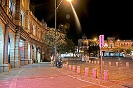
Hasanabad Square
-
A view of the building of the City Theater of Tehran
-
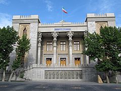
Police House,
the National Garden


Tehran used to have mostly low-rise buildings because of earthquakes. But in recent years, tall buildings have been built for the growing population. There have been no major earthquakes in Tehran since 1830.
The Tehran International Tower is the tallest skyscraper in Iran. It has 54 stories. It is in the northern part of the city.
The Azadi Tower has long been Tehran's most famous symbol. It was built to celebrate the 2,500th year of the Imperial State of Iran. It mixes old Achaemenid architecture and Sassanid architecture styles. The Milad Tower is the sixth tallest tower in the world. It is another famous landmark. Leila Araghian's Tabiat Bridge is the largest pedestrian bridge in Tehran. It was finished in 2014 and is also a landmark.
Fashion and Clothes
Tehran has many famous Iranian design houses and clothing companies. Fashion events are also held in the city. Many well-known Iranian models were born in Tehran.
After the 2000s, women in Tehran often wore over-the-knee and leather boots.
Theater and Arts

During the Qajar dynasty, Tehran had the royal theatre of Tekyeh Dowlat. It was used for traditional and religious shows. It was later torn down in 1947 and replaced by a bank.
Before the 1979 Revolution, Iran's national stage was famous for international artists. The Vahdat Hall, once called Rudaki Hall, was built for opera and ballet. It opened in 1967. It is home to the Tehran Symphony Orchestra.
The City Theater of Tehran is one of Iran's biggest theater complexes. It has several performance halls. It opened in 1972.
In old Tehran, Laleh-Zar Street was a center for cabarets. Famous Persian cabarets were active until 1979. They helped many local artists become known. Cabarets were sometimes called "home of dance."
The annual Fajr International Theater Festival and Tehran International Puppet Theatre Festival take place in Tehran.
Movies
The first movie theater in Tehran opened in 1904. By the early 1930s, Tehran Province had 15 theaters.
Today, most movie theaters in Tehran are downtown. Popular cinema complexes include Kourosh Cinema and Mellat Gallery and Cineplex.
Several film festivals are held in Tehran. These include the Fajr International Film Festival and the Children and Youth Film Festival.
Music and Dance
Tehran has many concert halls. The Roudaki Culture and Art Foundation has five venues. More than 500 concerts are held there each year. Vahdat Hall and Roudaki Hall are top venues. They host classical, pop, traditional, and rock concerts.
Sports and Recreation
Football and volleyball are the most popular sports in Tehran. Wrestling, basketball, and futsal are also important. Ice hockey and rugby are gaining popularity.
Iran has 12 ski resorts. The most famous are Tochal, Dizin, and Shemshak. All are one to three hours from Tehran.
Tochal's resort is the world's fifth-highest ski resort. It is over 3730 meters above sea level. It is also the closest ski resort to a capital city. The resort opened in 1976. It has an 8 km long gondola lift. From Tochal peak, you can see the Alborz mountains. This includes Mount Damavand, a dormant volcano.
Tehran is home to the national stadium of Azadi. It is the biggest stadium in West Asia. Many top football matches are held there. The stadium is part of the Azadi Sport Complex. It was built for the 1974 Asian Games. This was the first time the Asian Games were held in West Asia. Tehran hosted 3,010 athletes from 25 countries. The city also hosted the 1976 AFC Asian Cup and the first West Asian Games in 1997. Several FIVB Volleyball World League events have also been held in Tehran.
-
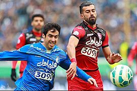
Tehran derby in Azadi Stadium. This match is one of the world's most intense derbies.
-
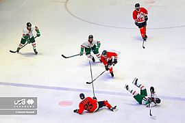
Iran men's ice hockey league in Tehran.
-
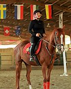
Horse riding in the west of the city.
-

One of the health clubs in the city.
-
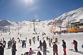
Dizin, Iran's largest ski resort, is located near Tehran.


_5.jpg)
.jpg)

Food and Dining
Tehran has many restaurants and cafes. They offer both Iranian and international foods. Pizzerias, sandwich bars, and kebab shops are very common.
Street Art
Many types of graffiti can be seen in Tehran. Some are political slogans painted by the government. Others are art by citizens showing their views. However, unauthorized street art is not allowed. Such works usually do not last long.
During the 2009 Iranian presidential election protests, many graffiti works supported the Green Movement. These were removed by forces like the Basij.
In recent years, Tehran Municipality has used graffiti to make the city look better. Several graffiti festivals have also taken place in Tehran. One was organized by the Tehran University of Art in October 2014.
Sister Cities
Tehran is connected with many cities around the world. These are called sister cities.
 Ankara, Turkey
 Baghdad, Iraq
 Beijing, China
 Bishkek, Kyrgyzstan
 Brasília, Brazil
 Budapest, Hungary
 Caracas, Venezuela
 Dushanbe, Tajikistan
 East Jerusalem, Palestine
 Havana, Cuba
 Kabul, Afghanistan
 Khartoum, Sudan
 London, England, United Kingdom
 Los Angeles, United States
- New York City, United States
 Manila, Philippines
 Minsk, Belarus
 Moscow, Russia
 Pretoria, South Africa
 Sanaa, Yemen
 Sarajevo, Bosnia and Herzegovina
 Tbilisi, Georgia
 Yerevan, Armenia
Cooperation Agreements
Tehran also works with these cities:
See also
 In Spanish: Teherán para niños
