
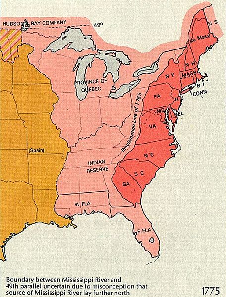
Image: Map of territorial growth 1775

Description: Eastern North America in 1775: The British Province of Quebec, the British thirteen colonies on the Atlantic coast and the Indian Reserve (as of the Royal Proclamation of 1763).
Title: Map of territorial growth 1775
Credit: National Atlas of the United States via en.wikipedia
Author: see below
Permission: This map was obtained from an edition of the National Atlas of the United States. Like almost all works of the U.S. federal government, works from the National Atlas are in the public domain in the United States. Online access: NationalAtlas.gov | 1970 print edition: Library of Congress, Perry-Castañeda Library čeština | Deutsch | English | français | Bahasa Indonesia | italiano | македонски | മലയാളം | 中文 | 中文(简体) | 中文(繁體) | +/−
Usage Terms: Public domain
License: Public domain
Attribution Required?: No
Image usage
The following 9 pages link to this image:
