
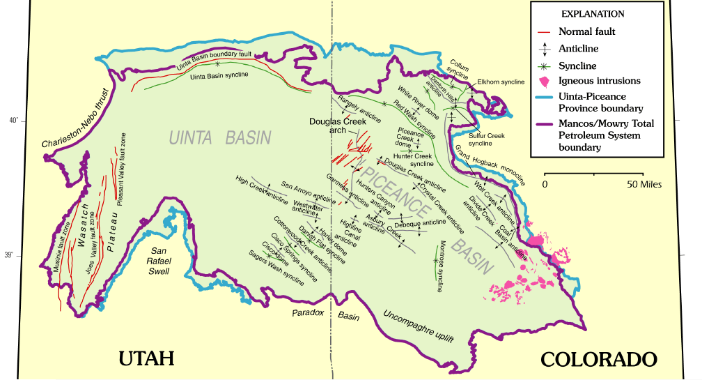
Image: Uinta Piceance Basins geologic map
Size of this preview: 800 × 433 pixels. Other resolutions: 320 × 173 pixels | 1,008 × 545 pixels.
Original image (1,008 × 545 pixels, file size: 185 KB, MIME type: image/png)
Description: Uinta Piceance Basins geologic map
Title: Uinta Piceance Basins geologic map
Credit: The Uinta-Piceance Province - Introduction to a geologic assessment of undiscovered oil and gas resources, USGS Digital Data Series DDS-69-B
Author: USGS Uinta-Piceance Assessment Team
Usage Terms: Public domain
License: Public domain
Attribution Required?: No
Image usage
The following 3 pages link to this image:

All content from Kiddle encyclopedia articles (including the article images and facts) can be freely used under Attribution-ShareAlike license, unless stated otherwise.