
Image: United States 1836-03-1836-06
Size of this preview: 800 × 542 pixels. Other resolutions: 320 × 217 pixels | 1,000 × 677 pixels.
Original image (1,000 × 677 pixels, file size: 49 KB, MIME type: image/png)
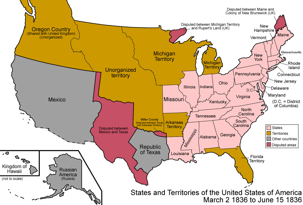
Description: Map of the states and territories of the United States as it was from March 1836 to June 1836. On March 2 1836, the Republic of Texas achieved independence from Mexico, though large portions remained disputed. On June 15 1836, Arkansas Territory was admitted as the state of Arkansas.
Title: United States 1836-03-1836-06
Credit: Own work
Author: Made by User:Golbez.
Permission: Own work, attribution required (Multi-license with GFDL and Creative Commons CC-BY 2.5)
Usage Terms: Creative Commons Attribution 2.5
License: CC BY 2.5
License Link: https://creativecommons.org/licenses/by/2.5
Attribution Required?: Yes
Image usage
The following 3 pages link to this image:

All content from Kiddle encyclopedia articles (including the article images and facts) can be freely used under Attribution-ShareAlike license, unless stated otherwise.