Jeromesville, Ohio facts for kids
Quick facts for kids
Jeromesville, Ohio
|
|
|---|---|
|
Village
|
|

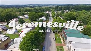
The Village of Jeromesville
|
|

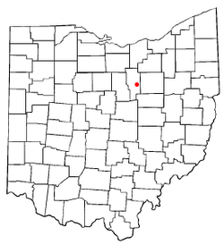
Location of Jeromesville, Ohio
|
|

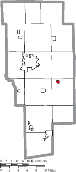
Location of Jeromesville in Ashland County
|
|
| Country | United States |
| State | Ohio |
| County | Ashland |
| Incorporated | February 14, 1815 |
| Area | |
| • Total | 0.35 sq mi (0.90 km2) |
| • Land | 0.34 sq mi (0.89 km2) |
| • Water | 0.00 sq mi (0.00 km2) |
| Elevation | 997 ft (304 m) |
| Population
(2020)
|
|
| • Total | 531 |
| • Density | 1,539.13/sq mi (594.04/km2) |
| Time zone | UTC-5 (Eastern (EST)) |
| • Summer (DST) | UTC-4 (EDT) |
| ZIP code |
44840
|
| Area code(s) | 419 |
| FIPS code | 39-39060 |
| GNIS feature ID | 2398299 |
| Website | https://jeromesville.nationbuilder.com/ |
Jeromesville is a small village located in Ashland County, Ohio, United States. In 2020, about 531 people lived there.
Contents
History of Jeromesville
Jeromesville was officially planned and laid out in 1815. It was built near where an old Native American village called "Jerometown" used to be. The village is named after Jean/John Baptiste Jerome. He was a fur trader and one of the first settlers from French Canada.
Christian Deardorf and William Vaughn bought land from Jean Jerome. They then started this new pioneer village. At first, its name was spelled "Jeromeville." A post office has been open in Jeromesville since 1816, helping people send and receive mail.
Jeromesville Junior Council
In 2018, the mayor of Jeromesville, Randy Spade, started something special. He created the Jeromesville Junior Council. This group is made up of students from 5th to 8th grade. They all attend schools in the Hillsdale Local School District.
The Junior Council acts as an advisory group. This means they give advice and ideas to the village leaders. Jeromesville was the first place in Ohio to make a Junior Village Council part of its official laws.
Geography of Jeromesville
Jeromesville is a small village. It covers an area of about 0.36 square miles (0.90 square kilometers). All of this area is land, meaning there are no large lakes or rivers within the village limits.
Population of Jeromesville
| Historical population | |||
|---|---|---|---|
| Census | Pop. | %± | |
| 1870 | 328 | — | |
| 1880 | 314 | −4.3% | |
| 1890 | 301 | −4.1% | |
| 1900 | 308 | 2.3% | |
| 1910 | 314 | 1.9% | |
| 1920 | 408 | 29.9% | |
| 1930 | 403 | −1.2% | |
| 1940 | 474 | 17.6% | |
| 1950 | 513 | 8.2% | |
| 1960 | 540 | 5.3% | |
| 1970 | 559 | 3.5% | |
| 1980 | 582 | 4.1% | |
| 1990 | 582 | 0.0% | |
| 2000 | 478 | −17.9% | |
| 2010 | 562 | 17.6% | |
| 2020 | 531 | −5.5% | |
| U.S. Decennial Census | |||
How Many People Live Here?
The number of people living in Jeromesville changes over time. In 2020, the census counted 531 people living in the village. There were 232 homes or housing units available for people to live in.
Jeromesville in 2010
In 2010, the census showed that 562 people lived in Jeromesville. There were 208 households, which are groups of people living together in one home. About 154 of these households were families.
The village had about 1561 people per square mile. This is called the population density. Most people living in Jeromesville were White (99.1%). A small number were Native American (0.9%). About 1.1% of the population was Hispanic or Latino.
Many households (41.3%) had children under 18 living with them. About half (51.9%) were married couples. The average household had 2.70 people. The average family had 3.14 people.
The average age of people in Jeromesville was 33.3 years old. About 32.4% of residents were under 18. Also, 10.7% were 65 years old or older. The village had a nearly even number of males (49.6%) and females (50.4%).
Education in Jeromesville
The public schools in Jeromesville are part of the Hillsdale Local School District. This school district has three main schools. There is one elementary school for younger students. There is also one middle school and one high school. Students from Jeromesville attend Hillsdale High School.
See also
 In Spanish: Jeromesville (Ohio) para niños
 | Dorothy Vaughan |
 | Charles Henry Turner |
 | Hildrus Poindexter |
 | Henry Cecil McBay |

