Jilotepec, Veracruz facts for kids
Quick facts for kids
Jilotepec
|
|
|---|---|

Panoramic view of Jilotepec
|
|

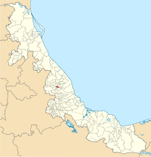
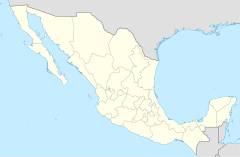
Location in Veracruz
|
|
| Country | |
| State | Veracruz |
| Region | Capital Region |
| Municipal seat and largest town | Jilotepec |
| Area | |
| • Total | 56.2 km2 (21.7 sq mi) |
| Elevation
(of seat)
|
1,368 m (4,488 ft) |
| Population
(2020)
|
|
| • Total | 16,585 |
| • Density | 295.2/km2 (765/sq mi) |
| • Seat | 4,309 |
| Time zone | UTC-6 (Central) |
| • Summer (DST) | UTC-5 (Central) |
| Postal codes |
91380–91396
|
| Area code | 228 |
| Website | Official website: http://www.jilotepec.gob.mx/ |
Jilotepec is a municipality in the Mexican state of Veracruz. Its name comes from the Nahuatl language and means "on the hill of jilotes." A jilote is a young corn cob. Jilotepec is located about 11 kilometers (7 miles) northwest of Xalapa, the capital city of Veracruz.
Contents
Geography of Jilotepec
Jilotepec is located in the central part of Veracruz. It sits at an elevation between 860 and 1900 meters (2,820 and 6,230 feet) above sea level. The municipality shares its borders with several other areas. These include Coacoatzintla to the north and Naolinco to the northeast. It also borders Xalapa to the southeast, Banderilla to the south, Rafael Lucio to the southwest, and Tlacolulan to the northwest.
Land and Rivers
The total area of Jilotepec is about 56.4 square kilometers (21.8 square miles). This makes up a small part, about 0.1%, of the entire state of Veracruz. The area gets its water from small rivers that flow into the Actopan River. The Naolinco River, which flows all year, forms part of the border between Jilotepec and the municipality of Naolinco.
Climate in Jilotepec
Jilotepec generally has a humid climate. This means it gets rain throughout the entire year. The average temperatures in the municipality usually stay between 16 and 22 degrees Celsius (61 and 72 degrees Fahrenheit). On average, the area receives between 1400 and 1600 millimeters (55 and 63 inches) of rain each year.
| Climate data for La Concepción weather station at 19°36′17″N 96°54′00″W / 19.60472°N 96.90000°W, 1000 m above sea level (1981–2010 averages, 1951–2010 extremes) | |||||||||||||
|---|---|---|---|---|---|---|---|---|---|---|---|---|---|
| Month | Jan | Feb | Mar | Apr | May | Jun | Jul | Aug | Sep | Oct | Nov | Dec | Year |
| Record high °C (°F) | 33.0 (91.4) |
32.5 (90.5) |
36.0 (96.8) |
40.0 (104.0) |
40.0 (104.0) |
42.0 (107.6) |
40.0 (104.0) |
36.0 (96.8) |
36.0 (96.8) |
39.0 (102.2) |
35.0 (95.0) |
32.5 (90.5) |
42.0 (107.6) |
| Mean daily maximum °C (°F) | 20.0 (68.0) |
21.3 (70.3) |
23.4 (74.1) |
26.1 (79.0) |
27.4 (81.3) |
26.7 (80.1) |
25.9 (78.6) |
26.0 (78.8) |
25.3 (77.5) |
24.2 (75.6) |
22.5 (72.5) |
20.9 (69.6) |
24.1 (75.4) |
| Daily mean °C (°F) | 15.6 (60.1) |
16.6 (61.9) |
18.4 (65.1) |
20.9 (69.6) |
22.2 (72.0) |
21.9 (71.4) |
21.1 (70.0) |
21.2 (70.2) |
20.9 (69.6) |
19.7 (67.5) |
18.0 (64.4) |
16.4 (61.5) |
19.4 (66.9) |
| Mean daily minimum °C (°F) | 11.2 (52.2) |
11.9 (53.4) |
13.5 (56.3) |
15.7 (60.3) |
17.1 (62.8) |
17.1 (62.8) |
16.3 (61.3) |
16.4 (61.5) |
16.4 (61.5) |
15.1 (59.2) |
13.5 (56.3) |
12.0 (53.6) |
14.7 (58.5) |
| Record low °C (°F) | 3.0 (37.4) |
3.0 (37.4) |
4.5 (40.1) |
6.5 (43.7) |
10.5 (50.9) |
11.0 (51.8) |
9.0 (48.2) |
11.0 (51.8) |
11.0 (51.8) |
8.0 (46.4) |
6.5 (43.7) |
2.0 (35.6) |
2.0 (35.6) |
| Average precipitation mm (inches) | 67.9 (2.67) |
59.7 (2.35) |
63.0 (2.48) |
73.0 (2.87) |
125.2 (4.93) |
285.5 (11.24) |
239.2 (9.42) |
203.7 (8.02) |
260.0 (10.24) |
146.4 (5.76) |
59.6 (2.35) |
56.8 (2.24) |
1,640 (64.57) |
| Average precipitation days (≥ 0.1 mm) | 9.4 | 8.3 | 7.9 | 8.0 | 9.8 | 16.0 | 14.7 | 14.4 | 16.0 | 12.1 | 8.8 | 9.3 | 134.7 |
| Source: Servicio Meteorológico Nacional | |||||||||||||
History of Jilotepec
Jilotepec has a long and interesting history. It was first settled by the Totonac people in the year 980. At that time, it was part of a group of towns called the confederation of Tlacolulan.
Changes in Control
Later, from 1380 to 1489, a group called the Teochichimecas took control of Jilotepec. After that, in 1489, Jilotepec decided to join the powerful Aztec Empire. Towards the end of the 1500s, a large farm or estate, known as a hacienda, was built in a place called La Concepción. In 1811, the local church, or parish, of Jilotepec officially opened.
Becoming a Municipality
Jilotepec became an official municipality on March 28, 1831. It was part of the Xalapa area within the state of Veracruz. On January 15, 1918, it gained more independence and became a free municipality.
People Moving Away
From 1995 into the early 2000s, many people from central Veracruz, including Jilotepec, moved to the United States. Many of them chose to go to New York City to find new opportunities.
How Jilotepec is Governed
The local government of Jilotepec is made up of a few important people. These include:
- A president, who is like the mayor.
- A councillor, also known as a síndico.
- A trustee, called a regidor.
The current president of the municipality is Sergio Fernández Lara.
Population of Jilotepec
| Historical population | ||
|---|---|---|
| Year | Pop. | ±% |
| 1995 | 12,743 | — |
| 2000 | 13,025 | +2.2% |
| 2005 | 13,653 | +4.8% |
| 2010 | 15,313 | +12.2% |
| 2015 | 16,682 | +8.9% |
| 2020 | 16,585 | −0.6% |
According to the Mexican Census in 2020, the municipality of Jilotepec had a population of 16,585 people. These people lived in 3,474 different small communities or localities. A survey in 2015 estimated that 3.97% of the people in Jilotepec said they had African roots.
Main Towns and Communities
There are 34 communities in the municipality. Two of these are considered urban, meaning they are more like towns or cities:
- The main town, also called Jilotepec, had 4,309 residents in 2020.
- La Concepción, which is about 6 kilometers (4 miles) east of the main town, had 3,707 residents in 2020.
Other important communities include Vista Hermosa (with 1,649 people), Paso de San Juan (1,214 people), and El Pueblito (1,198 people).
Economy of Jilotepec
The main way people in Jilotepec make a living is through agriculture. This means they grow crops and raise animals.
Farming and Livestock
Farmers in Jilotepec mostly grow:
- Coffee
- Sugarcane
- Corn
- Beans
They also raise animals like cattle and pigs.
See also
 In Spanish: Municipio de Jilotepec (Veracruz) para niños


