Jima Abajo facts for kids
Quick facts for kids
Jima Abajo
|
|
|---|---|
| Country | |
| Province | La Vega |
| Area | |
| • Total | 132.72 km2 (51.24 sq mi) |
| Elevation | 100 m (300 ft) |
| Population
(2012)
|
|
| • Total | 29,685 |
| • Density | 223.666/km2 (579.293/sq mi) |
| • Urban | 27,796 |
| Municipal Districts | 1 |
| Climate | Af |
Jima Abajo is a lively town located in the La Vega province of the Dominican Republic. It's a place where many people live and work, contributing to the rich culture of the country.
Contents
What is Jima Abajo?
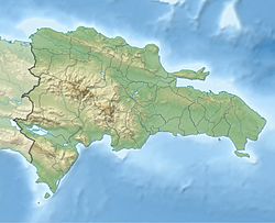
Jima Abajo is a community in the central part of the Dominican Republic. It's known as a municipal district, which is a type of local government area. This means it has its own local leaders who help manage the town.
Where is Jima Abajo located?
This town is found in the La Vega province. This province is in the heart of the Dominican Republic. Jima Abajo is about 100 meters (or 328 feet) above sea level. This elevation can affect its climate and the types of plants that grow there.
How big is Jima Abajo?
Jima Abajo covers an area of about 132.72 square kilometers. That's roughly 51 square miles! In 2012, almost 30,000 people lived in Jima Abajo. Most of these people, about 27,796, lived in the urban or town areas.
What is the climate like?
Jima Abajo has a tropical rainforest climate. This type of climate is often called "Af" in the Köppen climate classification system. It means the area usually gets a lot of rain all year round. It also means the temperatures are warm and consistent, without big changes between seasons.
See also

- For more information in Spanish, you can visit: Jima Abajo para niños


